|
|
| Dodge County Airport |
| IATA: UNU – ICAO: KUNU – FAA LID: UNU |
| Summary |
| Airport type |
Public |
| Owner/Operator |
Dodge County, Wisconsin |
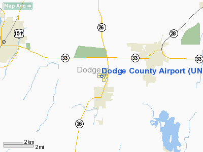
| Location |
Juneau, Wisconsin |
| Elevation AMSL |
934 ft / 284.7 m |
| Coordinates |
43°25.59′N 088°42.23′W / 43.4265°N 88.70383°W / 43.4265; -88.70383Coordinates: 43°25.59′N 088°42.23′W / 43.4265°N 88.70383°W / 43.4265; -88.70383 |
| Runways |
| Direction |
Length |
Surface |
| ft |
m |
| 8/26 |
5,060 |
1,542 |
Asphalt |
| 2/20 |
4,029 |
1,228 |
Asphalt |
| Statistics (2006) |
| Operations |
24,000 |
| Stats for 12 months ending July 14, 2006 |
Dodge County Airport (IATA: UNU, ICAO: KUNU, FAA LID: UNU) is a public airport located north of Juneau, Wisconsin.
Facilities
- Runway 8/26 5,060 x 100 ft. (1,542 x 30 m), asphalt, LOC/DME equipped
- Runway 2/20 4,029 x 75 ft. (1,228 x 23 m), asphalt
- JUNEAU (UNU) Non-directional beacon, 344 kHz is located on field
- Wisconsin Aviation - Dodge County is the Fixed base operator for the airport
- Recently named FBO of the Week by Avweb, Dodge County Airport is a great place for all types of aircraft and people. If your just looking for a place to stop or a bite to eat, UNU has it all.
The above content comes from Wikipedia and is published under free licenses – click here to read more.
 |
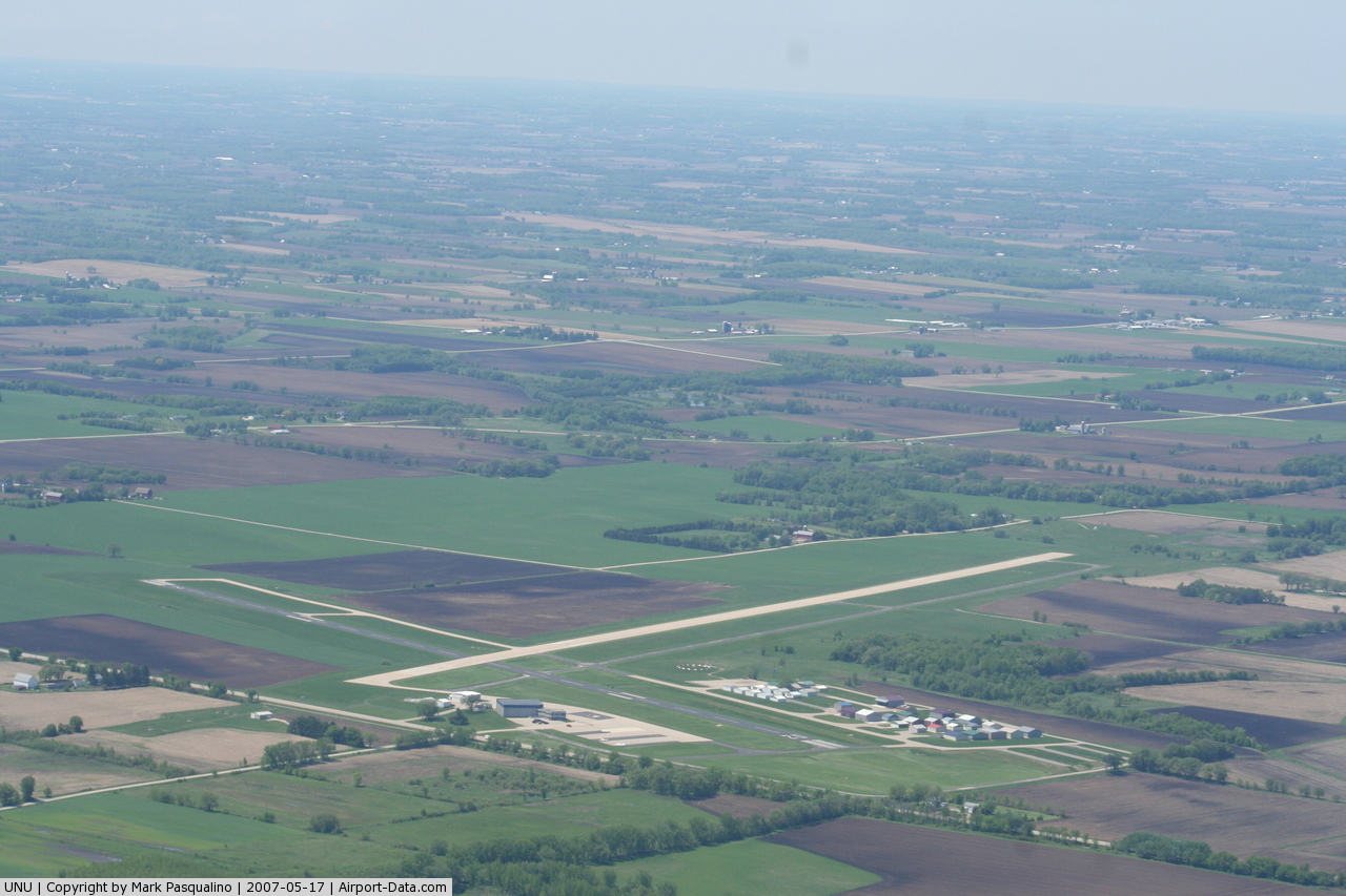
(Click on the photo to enlarge) |
 |
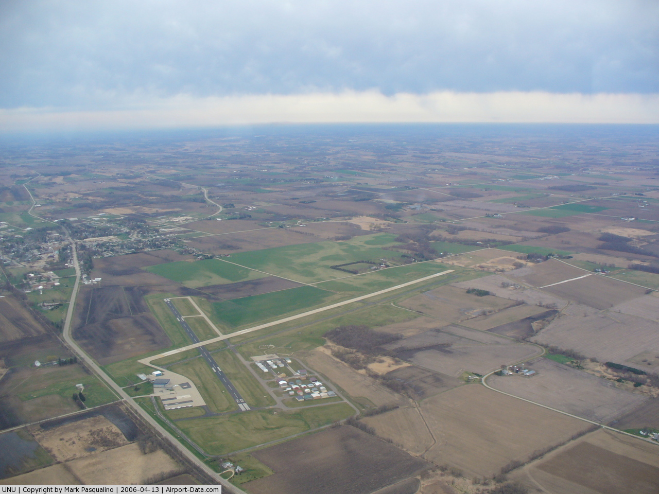
(Click on the photo to enlarge) |
Location & QuickFacts
| FAA Information Effective: | 2008-09-25 |
| Airport Identifier: | UNU |
| Airport Status: | Operational |
| Longitude/Latitude: | 088-42-13.8000W/43-25-35.4000N
-88.703833/43.426500 (Estimated) |
| Elevation: | 934 ft / 284.68 m (Surveyed) |
| Land: | 449 acres |
| From nearest city: | 2 nautical miles N of Juneau, WI |
| Location: | Dodge County, WI |
| Magnetic Variation: | 01W (1995) |
Owner & Manager
| Ownership: | Publicly owned |
| Owner: | Dodge County |
| Address: | Dodge Co Hwy Dept
Juneau, WI 53039 |
| Phone number: | 920-386-3650 |
| Manager: | Tim Bentheimer |
| Address: | W6491 State Highway 26
Juneau, WI 53039 |
| Phone number: | 920-386-2402 |
Airport Operations and Facilities
| Airport Use: | Open to public |
| Wind indicator: | Yes |
| Segmented Circle: | Yes |
| Control Tower: | No |
| Lighting Schedule: | DUSK-DAWN
MIRL RY 08/26 PRESET ON LOW INTST; TO INCR INTST ACTVT - CTAF. ACTVT MIRL RY 02/20; REIL RYS 02 & 20 - CTAF. |
| Beacon Color: | Clear-Green (lighted land airport) |
| Landing fee charge: | No |
| Sectional chart: | Chicago |
| Region: | AGL - Great Lakes |
| Boundary ARTCC: | ZAU - Chicago |
| Tie-in FSS: | GRB - Green Bay |
| FSS on Airport: | No |
| FSS Toll Free: | 1-800-WX-BRIEF |
| NOTAMs Facility: | UNU (NOTAM-d service avaliable) |
| Federal Agreements: | N |
Airport Communications
| CTAF: | 122.700 |
| Unicom: | 122.700 |
Airport Services
| Fuel available: | 100LLA |
| Airframe Repair: | MAJOR |
| Power Plant Repair: | MAJOR |
| Bottled Oxygen: | NONE |
| Bulk Oxygen: | NONE |
Runway Information
Runway 02/20
| Dimension: | 4029 x 75 ft / 1228.0 x 22.9 m |
| Surface: | ASPH, Good Condition |
| Weight Limit: | Single wheel: 12500 lbs. |
| Edge Lights: | Medium |
| |
Runway 02 |
Runway 20 |
| Longitude: | 088-42-06.7435W | 088-41-50.5938W |
| Latitude: | 43-25-17.7612N | 43-25-55.7668N |
| Elevation: | 930.00 ft | 932.00 ft |
| Alignment: | 17 | 127 |
| Traffic Pattern: | Left | Left |
| Markings: | Non-precision instrument, Fair Condition | Non-precision instrument, Fair Condition |
| Crossing Height: | 0.00 ft | 26.00 ft |
| VASI: | | 2-light PAPI on left side |
| Visual Glide Angle: | 0.00° | 3.00° |
| Runway End Identifier: | Yes | Yes |
| Obstruction: | 42 ft pline, 2220.0 ft from runway, 350 ft right of centerline, 48:1 slope to clear | 26 ft tree, 780.0 ft from runway, 290 ft left of centerline, 22:1 slope to clear |
|
Runway 08/26
| Dimension: | 5060 x 100 ft / 1542.3 x 30.5 m |
| Surface: | ASPH, Good Condition |
| Edge Lights: | Medium |
| |
Runway 08 |
Runway 26 |
| Longitude: | 088-42-59.5877W | 088-41-52.1260W |
| Latitude: | 43-25-29.7605N | 43-25-38.6816N |
| Elevation: | 890.00 ft | 934.00 ft |
| Alignment: | 80 | 127 |
| ILS Type: | | LOC/DME
|
| Traffic Pattern: | Left | Left |
| Markings: | Non-precision instrument, Fair Condition | Non-precision instrument, Fair Condition |
| Crossing Height: | 25.00 ft | 34.00 ft |
| VASI: | 4-light PAPI on left side | 4-light PAPI on left side |
| Visual Glide Angle: | 3.00° | 3.00° |
| Approach lights: | | MALSF
MALSF NOT CERTIFIED FOR IFR. |
| Obstruction: | 18 ft tree, 750.0 ft from runway, 170 ft left of centerline, 30:1 slope to clear | 20 ft tree, 750.0 ft from runway, 150 ft left of centerline, 27:1 slope to clear |
|
Radio Navigation Aids
| ID |
Type |
Name |
Ch |
Freq |
Var |
Dist |
| UNU | NDB | Juneau | | 344.00 | 01W | 0.2 nm |
| HXF | NDB | Hartford | | 200.00 | 00E | 14.2 nm |
| RYV | NDB | Rock River | | 371.00 | 01W | 15.2 nm |
| LLE | NDB | Kettle Moraine | | 329.00 | 01W | 25.2 nm |
| UES | NDB | Waukesha | | 359.00 | 01W | 30.8 nm |
| MS | NDB | Monah | | 400.00 | 00E | 35.6 nm |
| BL | NDB | Yanks | | 260.00 | 02W | 42.4 nm |
| GM | NDB | Teels | | 242.00 | 02W | 42.6 nm |
| LVV | NDB | Lake Lawn | | 404.00 | 00W | 44.0 nm |
| AQ | NDB | Kooky | | 407.00 | 02W | 49.3 nm |
| BJB | VOR | West Bend | | 109.80 | 01W | 25.3 nm |
| LJT | VOR/DME | Timmerman | 072X | 112.50 | 02W | 34.8 nm |
| FAH | VOR/DME | Falls | 37X | 110.00 | 02W | 42.5 nm |
| BUU | VOR/DME | Burbun | 092X | 114.50 | 01W | 47.7 nm |
| BAE | VORTAC | Badger | 111X | 116.40 | 02E | 26.1 nm |
| MSN | VORTAC | Madison | 023X | 108.60 | 03E | 32.6 nm |
| OSH | VORTAC | Oshkosh | 055X | 111.80 | 02E | 34.5 nm |
| DLL | VORTAC | Dells | 117X | 117.00 | 03E | 46.8 nm |
| MKE | VOT | Milwaukee | | 109.00 | | 45.6 nm |
Remarks
- IREG ULTRALIGHT ACTIVITY ON & INVOF ARPT.
- 302 FT PAVED SAFETY AREA ON W END OF RY 08/26.
- 290 FT TWY EAST END OF RY 08/26.
- NUMEROUS GEESE ON & INVOF ARPT.
- GCO AVBL ON FREQ 121.725 THRU FLT SVCS.
- MOWING OPNS MON-FRI WITH FLASHING LGTS AFT DARK.
Images and information placed above are from
http://www.airport-data.com/airport/UNU/
We thank them for the data!
| General Info
|
| Country |
United States
|
| State |
WISCONSIN
|
| FAA ID |
UNU
|
| Latitude |
43-25-35.700N
|
| Longitude |
088-42-11.600W
|
| Elevation |
936 feet
|
| Near City |
JUNEAU
|
We don't guarantee the information is fresh and accurate. The data may
be wrong or outdated.
For more up-to-date information please refer to other sources.
|
|