 |
|
Location & QuickFacts
| FAA Information Effective: | 2008-09-25 |
| Airport Identifier: | 61WI |
| Airport Status: | Operational |
| Longitude/Latitude: | 088-17-08.3620W/43-42-29.9730N
-88.285656/43.708326 (Estimated) |
| Elevation: | 1120 ft / 341.38 m (Estimated) |
| Land: | 0 acres |
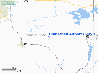
| From nearest city: | 3 nautical miles NE of Eden, WI |
| Location: | Fond Du Lac County, WI |
| Magnetic Variation: | 01W (1985) |
Owner & Manager
| Ownership: | Privately owned |
| Owner: | Dale V. Grahl |
| Address: | Rt 1
Eden, WI 53019 |
| Phone number: | 414-477-5423 |
| Address: |
|
Airport Operations and Facilities
| Airport Use: | Private |
| Wind indicator: | Yes |
| Segmented Circle: | No |
| Control Tower: | No |
| Sectional chart: | Chicago |
| Region: | AGL - Great Lakes |
| Boundary ARTCC: | ZAU - Chicago |
| Tie-in FSS: | GRB - Green Bay |
| FSS on Airport: | No |
| FSS Toll Free: | 1-800-WX-BRIEF |
Runway Information
Runway N/S
| Dimension: | 2000 x 50 ft / 609.6 x 15.2 m |
| Surface: | TURF, |
| |
Runway N |
Runway S |
| Traffic Pattern: | Left | Left |
|
Radio Navigation Aids
| ID |
Type |
Name |
Ch |
Freq |
Var |
Dist |
| LLE | NDB | Kettle Moraine | | 329.00 | 01W | 18.4 nm |
| HXF | NDB | Hartford | | 200.00 | 00E | 22.2 nm |
| UNU | NDB | Juneau | | 344.00 | 01W | 24.7 nm |
| AQ | NDB | Kooky | | 407.00 | 02W | 30.9 nm |
| RYV | NDB | Rock River | | 371.00 | 01W | 37.4 nm |
| UES | NDB | Waukesha | | 359.00 | 01W | 39.9 nm |
| SG | NDB | Depre | | 332.00 | 02W | 42.0 nm |
| BL | NDB | Yanks | | 260.00 | 02W | 42.9 nm |
| PCZ | NDB | Waupaca | | 382.00 | 01W | 49.0 nm |
| GM | NDB | Teels | | 242.00 | 02W | 49.2 nm |
| BJB | VOR | West Bend | | 109.80 | 01W | 18.6 nm |
| FAH | VOR/DME | Falls | 37X | 110.00 | 02W | 19.3 nm |
| MTW | VOR/DME | Manitowoc | 047X | 111.00 | 02W | 36.4 nm |
| LJT | VOR/DME | Timmerman | 072X | 112.50 | 02W | 37.6 nm |
| OSH | VORTAC | Oshkosh | 055X | 111.80 | 02E | 20.6 nm |
| BAE | VORTAC | Badger | 111X | 116.40 | 02E | 35.6 nm |
| MKE | VOT | Milwaukee | | 109.00 | | 48.8 nm |
Images and information placed above are from
http://www.airport-data.com/airport/61WI/
We thank them for the data!
| General Info
|
| Country |
United States
|
| State |
WISCONSIN
|
| FAA ID |
61WI
|
| Latitude |
43-42-29.973N
|
| Longitude |
088-17-08.362W
|
| Elevation |
1120 feet
|
| Near City |
EDEN
|
We don't guarantee the information is fresh and accurate. The data may
be wrong or outdated.
For more up-to-date information please refer to other sources.
|
|


