 |
|
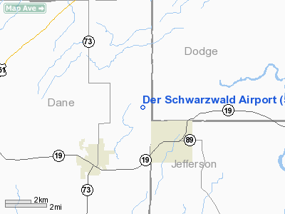
Location & QuickFacts
| FAA Information Effective: | 2008-09-25 |
| Airport Identifier: | 5WI3 |
| Airport Status: | Operational |
| Longitude/Latitude: | 089-01-01.3930W/43-12-27.9800N
-89.017054/43.207772 (Estimated) |
| Elevation: | 925 ft / 281.94 m (Estimated) |
| Land: | 8 acres |
| From nearest city: | 2 nautical miles NW of Waterloo, WI |
| Location: | Dane County, WI |
| Magnetic Variation: | 00W (1985) |
Owner & Manager
| Ownership: | Privately owned |
| Owner: | Hillaker Co. |
| Address: | 6422 York Hts. Rd
Waterloo, WI 53594 |
| Phone number: | 414-478-3800 |
| Manager: | Alvin E. Whitaker |
| Address: | 6422 York Hts. Rd
Waterloo, WI 53594 |
| Phone number: | 414-478-3800 |
Airport Operations and Facilities
| Airport Use: | Private |
| Wind indicator: | Yes |
| Segmented Circle: | No |
| Control Tower: | No |
| Sectional chart: | Chicago |
| Region: | AGL - Great Lakes |
| Boundary ARTCC: | ZAU - Chicago |
| Tie-in FSS: | GRB - Green Bay |
| FSS on Airport: | No |
| FSS Toll Free: | 1-800-WX-BRIEF |
Runway Information
Runway 04/22
| Dimension: | 2000 x 70 ft / 609.6 x 21.3 m |
| Surface: | TURF, |
| |
Runway 04 |
Runway 22 |
| Traffic Pattern: | Left | Left |
| Displaced threshold: | 700.00 ft | 300.00 ft |
| Obstruction: | 50 ft trees, 200.0 ft from runway | 30 ft pline, 600.0 ft from runway |
|
Radio Navigation Aids
| ID |
Type |
Name |
Ch |
Freq |
Var |
Dist |
| RYV | NDB | Rock River | | 371.00 | 01W | 12.9 nm |
| MS | NDB | Monah | | 400.00 | 00E | 16.9 nm |
| UNU | NDB | Juneau | | 344.00 | 01W | 19.1 nm |
| HXF | NDB | Hartford | | 200.00 | 00E | 28.4 nm |
| JVL | NDB | Janesville | | 375.00 | 03E | 35.6 nm |
| UES | NDB | Waukesha | | 359.00 | 01W | 35.7 nm |
| LVV | NDB | Lake Lawn | | 404.00 | 00W | 35.8 nm |
| LLE | NDB | Kettle Moraine | | 329.00 | 01W | 41.0 nm |
| GM | NDB | Teels | | 242.00 | 02W | 46.5 nm |
| BJB | VOR | West Bend | | 109.80 | 01W | 41.1 nm |
| JVL | VOR/DME | Janesville | 090X | 114.30 | 03E | 39.3 nm |
| LJT | VOR/DME | Timmerman | 072X | 112.50 | 02W | 43.4 nm |
| BUU | VOR/DME | Burbun | 092X | 114.50 | 01W | 44.3 nm |
| LNR | VOR/DME | Lone Rock | 075X | 112.80 | 00E | 49.1 nm |
| MSN | VORTAC | Madison | 023X | 108.60 | 03E | 14.6 nm |
| BAE | VORTAC | Badger | 111X | 116.40 | 02E | 32.6 nm |
| DLL | VORTAC | Dells | 117X | 117.00 | 03E | 38.6 nm |
Images and information placed above are from
http://www.airport-data.com/airport/5WI3/
We thank them for the data!
| General Info
|
| Country |
United States
|
| State |
WISCONSIN
|
| FAA ID |
5WI3
|
| Latitude |
43-12-27.980N
|
| Longitude |
089-01-01.393W
|
| Elevation |
925 feet
|
| Near City |
WATERLOO
|
We don't guarantee the information is fresh and accurate. The data may
be wrong or outdated.
For more up-to-date information please refer to other sources.
|
|


