 |
|
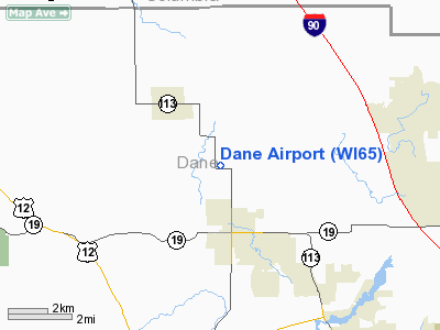
Location & QuickFacts
| FAA Information Effective: | 2008-09-25 |
| Airport Identifier: | WI65 |
| Airport Status: | Operational |
| Longitude/Latitude: | 089-28-05.4290W/43-13-19.9710N
-89.468175/43.222214 (Estimated) |
| Elevation: | 1035 ft / 315.47 m (Estimated) |
| Land: | 0 acres |
| From nearest city: | 3 nautical miles SE of Dane, WI |
| Location: | Dane County, WI |
| Magnetic Variation: | 00E (1985) |
Owner & Manager
| Ownership: | Privately owned |
| Owner: | Herbert J. Statz |
| Address: | 6648 Highway 113
Dane, WI 53529 |
| Phone number: | 608-849-4675 |
| Manager: | Herbert J. Statz |
| Address: | 6648 Highway 113
Dane, WI 53529 |
| Phone number: | 608-849-4675 |
Airport Operations and Facilities
| Airport Use: | Private |
| Wind indicator: | Yes |
| Segmented Circle: | No |
| Control Tower: | No |
| Landing fee charge: | No |
| Sectional chart: | Chicago |
| Region: | AGL - Great Lakes |
| Boundary ARTCC: | ZAU - Chicago |
| Tie-in FSS: | GRB - Green Bay |
| FSS on Airport: | No |
| FSS Toll Free: | 1-800-WX-BRIEF |
Airport Services
| Airframe Repair: | NONE |
| Power Plant Repair: | NONE |
Runway Information
Runway 04/22
| Dimension: | 1400 x 50 ft / 426.7 x 15.2 m
HAS OVRN RWY 4 END. |
| Surface: | TURF, |
| |
Runway 04 |
Runway 22 |
| Traffic Pattern: | Left | Left |
|
Radio Navigation Aids
| ID |
Type |
Name |
Ch |
Freq |
Var |
Dist |
| MS | NDB | Monah | | 400.00 | 00E | 11.0 nm |
| RYV | NDB | Rock River | | 371.00 | 01W | 32.7 nm |
| UNU | NDB | Juneau | | 344.00 | 01W | 35.7 nm |
| MRJ | NDB | Mineral Point | | 365.00 | 00W | 38.9 nm |
| JVL | NDB | Janesville | | 375.00 | 03E | 41.0 nm |
| HBW | NDB | Kickapoo | | 251.00 | 03E | 45.8 nm |
| HXF | NDB | Hartford | | 200.00 | 00E | 47.5 nm |
| LVV | NDB | Lake Lawn | | 404.00 | 00W | 49.7 nm |
| LNR | VOR/DME | Lone Rock | 075X | 112.80 | 00E | 29.4 nm |
| JVL | VOR/DME | Janesville | 090X | 114.30 | 03E | 43.0 nm |
| MSN | VORTAC | Madison | 023X | 108.60 | 03E | 7.3 nm |
| DLL | VORTAC | Dells | 117X | 117.00 | 03E | 23.6 nm |
Remarks
- PLINE 100 FEET SE OF CTRLN AT MIDPT RWY.
Images and information placed above are from
http://www.airport-data.com/airport/WI65/
We thank them for the data!
| General Info
|
| Country |
United States
|
| State |
WISCONSIN
|
| FAA ID |
WI65
|
| Latitude |
43-13-19.971N
|
| Longitude |
089-28-05.429W
|
| Elevation |
1035 feet
|
| Near City |
DANE
|
We don't guarantee the information is fresh and accurate. The data may
be wrong or outdated.
For more up-to-date information please refer to other sources.
|
|


