 |
|
| Cumberland Municipal Airport |
| IATA: none – ICAO: KUBE – FAA LID: UBE |
| Summary |
| Airport type |
Public |
| Owner |
City of Cumberland |
| Serves |
Cumberland, Wisconsin |
| Elevation AMSL |
1,241 ft / 378 m |
| Coordinates |
45°30′21″N 091°58′52″W / 45.50583°N 91.98111°W / 45.50583; -91.98111 |
| Runways |
| Direction |
Length |
Surface |
| ft |
m |
| 9/27 |
4,050 |
1,234 |
Asphalt |
| 18/36 |
2,000 |
610 |
Turf |
| Statistics (2005) |
| Aircraft operations |
10,900 |
| Source: Federal Aviation Administration |
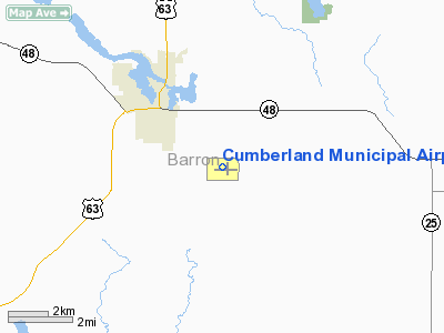
Cumberland Municipal Airport (ICAO: KUBE, FAA LID: UBE) is a city-owned public-use airport located three nautical miles (6 km) southeast of the central business district of Cumberland, a city in Barron County, Wisconsin, United States.
Although most U.S. airports use the same three-letter location identifier for the FAA and IATA, this airport is assigned UBE by the FAA but has no designation from the IATA.
Facilities and aircraft
Cumberland Municipal Airport covers an area of 120 acres (49 ha) at an elevation of 1,241 feet (378 m) above mean sea level. It has two runways: 9/27 is 4,050 by 75 feet (1,234 x 23 m) with an asphalt pavement and 18/36 is 2,000 by 120 feet (610 x 37 m) with an turf surface. For the 12-month period ending September 7, 2005, the airport had 10,900 general aviation aircraft operations, an average of 29 per day.
The above content comes from Wikipedia and is published under free licenses – click here to read more.
Location & QuickFacts
| FAA Information Effective: | 2008-09-25 |
| Airport Identifier: | UBE |
| Airport Status: | Operational |
| Longitude/Latitude: | 091-58-51.9130W/45-30-21.4930N
-91.981087/45.505970 (Estimated) |
| Elevation: | 1241 ft / 378.26 m (Surveyed) |
| Land: | 120 acres |
| From nearest city: | 3 nautical miles SE of Cumberland, WI |
| Location: | Barron County, WI |
| Magnetic Variation: | 01E (2000) |
Owner & Manager
| Ownership: | Publicly owned |
| Owner: | City Of Cumberland
ARPT PHONE 715-822-4554. |
| Address: | City Hall Box 155
Cumberland, WI 54829 |
| Phone number: | 715-822-2752 |
| Manager: | Al Seierstad |
| Address: | 224 241/2 Avenue
Cumberland, WI 54829 |
| Phone number: | 715-205-4474 |
Airport Operations and Facilities
| Airport Use: | Open to public |
| Wind indicator: | Yes |
| Segmented Circle: | Yes |
| Control Tower: | No |
| Lighting Schedule: | DUSK-DAWN
MIRL RY 09/27 PRESET ON LOW INTST, TO INCR INTST& ACTVT REIL RY 27 - CTAF. |
| Beacon Color: | Clear-Green (lighted land airport) |
| Landing fee charge: | No |
| Sectional chart: | Green Bay |
| Region: | AGL - Great Lakes |
| Boundary ARTCC: | ZMP - Minneapolis |
| Tie-in FSS: | GRB - Green Bay |
| FSS on Airport: | No |
| FSS Toll Free: | 1-800-WX-BRIEF |
| NOTAMs Facility: | GRB (NOTAM-d service avaliable) |
| Federal Agreements: | N1 |
Airport Communications
| CTAF: | 122.800 |
| Unicom: | 122.800 |
Airport Services
| Fuel available: | 100LLMOGAS
FOR FUEL OTHER HRS CALL 715-822-8321 DAYS & 715-205-4474 NIGHTS. |
| Airframe Repair: | MAJOR |
| Power Plant Repair: | MAJOR |
| Bottled Oxygen: | NONE |
| Bulk Oxygen: | NONE |
Runway Information
Runway 09/27
| Dimension: | 4050 x 75 ft / 1234.4 x 22.9 m |
| Surface: | ASPH, Good Condition |
| Edge Lights: | Medium |
| |
Runway 09 |
Runway 27 |
| Longitude: | 091-59-20.3400W | 091-58-23.4800W |
| Latitude: | 45-30-21.6400N | 45-30-21.3500N |
| Elevation: | 1241.00 ft | 1232.00 ft |
| Alignment: | 90 | 127 |
| Traffic Pattern: | Left | Left |
| Markings: | Non-precision instrument, Fair Condition | Non-precision instrument, Fair Condition |
| Crossing Height: | 26.00 ft | 29.00 ft |
| VASI: | 2-box on left side | 2-box on left side |
| Visual Glide Angle: | 3.00° | 3.00° |
| Runway End Identifier: | | Yes |
| Obstruction: | 16 ft road, 630.0 ft from runway, 26:1 slope to clear | 16 ft road, 610.0 ft from runway, 25:1 slope to clear |
|
Runway 18/36
| Dimension: | 2000 x 120 ft / 609.6 x 36.6 m |
| Surface: | TURF, Good Condition |
| |
Runway 18 |
Runway 36 |
| Longitude: | 091-58-45.6400W | 091-58-48.6400W |
| Latitude: | 45-30-32.8380N | 45-30-12.8380N |
| Traffic Pattern: | Left | Left |
| Obstruction: | 16 ft road, 320.0 ft from runway, 20:1 slope to clear | 71 ft tree, 2250.0 ft from runway, 50 ft right of centerline, 31:1 slope to clear |
|
Radio Navigation Aids
| ID |
Type |
Name |
Ch |
Freq |
Var |
Dist |
| UBE | NDB | Cumberland | | 375.00 | 01E | 0.3 nm |
| SSQ | NDB | Shell Lake | | 212.00 | 01E | 13.6 nm |
| AHH | NDB | Ameron | | 278.00 | 01E | 21.3 nm |
| BXR | NDB | Big Doctor | | 203.00 | 02E | 24.9 nm |
| RNH | NDB | New Richmond | | 257.00 | 02E | 31.8 nm |
| OEO | NDB | Osceola | | 233.00 | 01E | 32.1 nm |
| RCX | NDB | Rusk County | | 356.00 | 00W | 41.3 nm |
| ROS | NDB | Rush City | | 282.00 | 02E | 42.6 nm |
| SLY | NDB | Seeley | | 344.00 | 01E | 44.2 nm |
| OLG | NDB | Solon Springs | | 388.00 | 01E | 49.3 nm |
| RPD | VOR/DME | Rice Lake | 037X | 110.00 | 01E | 10.2 nm |
| RZN | VOR/DME | Siren | 031X | 109.40 | 02E | 25.1 nm |
| HYR | VOR/DME | Hayward | 081X | 113.40 | 03E | 38.1 nm |
| EAU | VORTAC | Eau Claire | 076X | 112.90 | 04E | 42.3 nm |
Remarks
- GCO AVBL ON FREQ 121.725 THRU FLT SVCS.
- E111: DETERMINATION PENDING.
Images and information placed above are from
http://www.airport-data.com/airport/UBE/
We thank them for the data!
| General Info
|
| Country |
United States
|
| State |
WISCONSIN
|
| FAA ID |
UBE
|
| Latitude |
45-30-21.493N
|
| Longitude |
091-58-51.913W
|
| Elevation |
1241 feet
|
| Near City |
CUMBERLAND
|
We don't guarantee the information is fresh and accurate. The data may
be wrong or outdated.
For more up-to-date information please refer to other sources.
|
|


