 |
|
Location & QuickFacts
| FAA Information Effective: | 2008-09-25 |
| Airport Identifier: | 0WI5 |
| Airport Status: | Operational |
| Longitude/Latitude: | 087-53-26.2870W/42-47-36.0660N
-87.890635/42.793352 (Estimated) |
| Elevation: | 755 ft / 230.12 m (Estimated) |
| Land: | 70 acres |
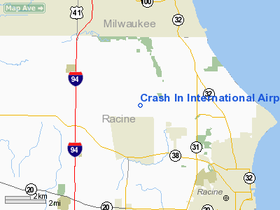
| From nearest city: | 2 nautical miles S of Husher, WI |
| Location: | Racine County, WI |
| Magnetic Variation: | 02W (1990) |
Owner & Manager
| Ownership: | Privately owned |
| Owner: | Eric Woelbing |
| Address: | 5619 Nicholson Rd
Franksville, WI 53126 |
| Phone number: | 414-835-2746 |
| Manager: | Eric Woelbing |
| Address: | 5619 Nicholson Rd
Franksville, WI 53126 |
| Phone number: | 414-421-7707 |
Airport Operations and Facilities
| Airport Use: | Private |
| Wind indicator: | Yes |
| Segmented Circle: | Yes |
| Control Tower: | No |
| Sectional chart: | Chicago |
| Region: | AGL - Great Lakes |
| Boundary ARTCC: | ZAU - Chicago |
| Tie-in FSS: | GRB - Green Bay |
| FSS Toll Free: | 1-800-WX-BRIEF |
Runway Information
Runway 09/27
| Dimension: | 2000 x 100 ft / 609.6 x 30.5 m |
| Surface: | TURF, |
| |
Runway 09 |
Runway 27 |
| Traffic Pattern: | Left | Left |
| Displaced threshold: | 0.00 ft | 730.00 ft |
| Obstruction: | | 115 ft pline, 2310.0 ft from runway |
|
Radio Navigation Aids
| ID |
Type |
Name |
Ch |
Freq |
Var |
Dist |
| RA | NDB | Paser | | 206.00 | 00E | 6.7 nm |
| GM | NDB | Teels | | 242.00 | 02W | 9.6 nm |
| BL | NDB | Yanks | | 260.00 | 02W | 16.0 nm |
| UES | NDB | Waukesha | | 359.00 | 01W | 21.4 nm |
| LVV | NDB | Lake Lawn | | 404.00 | 00W | 31.5 nm |
| LLE | NDB | Kettle Moraine | | 329.00 | 01W | 39.4 nm |
| HXF | NDB | Hartford | | 200.00 | 00E | 40.1 nm |
| RYV | NDB | Rock River | | 371.00 | 01W | 43.2 nm |
| ME | NDB | Deana | | 350.00 | 00E | 50.0 nm |
| BJB | VOR | West Bend | | 109.80 | 01W | 39.2 nm |
| HRK | VOR/DME | Horlick | 124X | 117.70 | 02W | 3.9 nm |
| ENW | VOR/DME | Kenosha | 029X | 109.20 | 02W | 11.8 nm |
| BUU | VOR/DME | Burbun | 092X | 114.50 | 01W | 19.2 nm |
| LJT | VOR/DME | Timmerman | 072X | 112.50 | 02W | 20.1 nm |
| OBK | VOR/DME | Northbrook | 077X | 113.00 | 02W | 34.5 nm |
| ORD | VOR/DME | Chicago O'hare | 086X | 113.90 | 02E | 48.4 nm |
| BAE | VORTAC | Badger | 111X | 116.40 | 02E | 26.0 nm |
| MKE | VOT | Milwaukee | | 109.00 | | 9.3 nm |
| ORD | VOT | Chicago O'hare Intl | | 112.00 | | 48.7 nm |
Remarks
- CATEGORY A ACFT ONLY; OBS REMOVED/LOWERED OR THRS DSPLCD TO PRVD 20:1 APCH SLOPES; 125' EITHER SIDE OF CNTRLN & 200' OFF RY ENDS BE CLEAR; AREA GRADED & CLEARED.
Images and information placed above are from
http://www.airport-data.com/airport/0WI5/
We thank them for the data!
| General Info
|
| Country |
United States
|
| State |
WISCONSIN
|
| FAA ID |
0WI5
|
| Latitude |
42-47-36.066N
|
| Longitude |
087-53-26.287W
|
| Elevation |
755 feet
|
| Near City |
HUSHER
|
We don't guarantee the information is fresh and accurate. The data may
be wrong or outdated.
For more up-to-date information please refer to other sources.
|
|


