 |
|
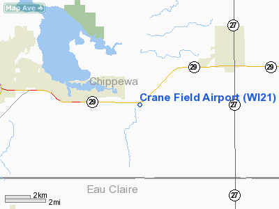
Location & QuickFacts
| FAA Information Effective: | 2008-09-25 |
| Airport Identifier: | WI21 |
| Airport Status: | Operational |
| Longitude/Latitude: | 091-14-30.5450W/44-54-34.8620N
-91.241818/44.909684 (Estimated) |
| Elevation: | 936 ft / 285.29 m (Surveyed) |
| Land: | 8 acres |
| From nearest city: | 4 nautical miles SW of Cadott, WI |
| Location: | Chippewa County, WI |
| Magnetic Variation: | 01E (1985) |
Owner & Manager
| Ownership: | Privately owned |
| Owner: | David D. Crane |
| Address: | 405 West Prairie View Rd
Chippewa Falls, WI 54729-3382 |
| Phone number: | 715-723-1662 |
| Manager: | David D. Crane |
| Address: | 405 West Prairie View Rd
Chippewa Falls, WI 54729 |
| Phone number: | 715-723-1662 |
Airport Operations and Facilities
| Airport Use: | Private |
| Wind indicator: | Yes |
| Segmented Circle: | No |
| Control Tower: | No |
| Lighting Schedule: | RDO-CTL
ACTVT LIRL RY 08/26 - 122.9. |
| Landing fee charge: | No |
| Sectional chart: | Green Bay |
| Region: | AGL - Great Lakes |
| Boundary ARTCC: | ZMP - Minneapolis |
| Tie-in FSS: | GRB - Green Bay |
| FSS on Airport: | No |
| FSS Toll Free: | 1-800-WX-BRIEF |
Airport Services
| Bottled Oxygen: | NONE |
| Bulk Oxygen: | NONE |
Runway Information
Runway 08/26
| Dimension: | 2620 x 96 ft / 798.6 x 29.3 m |
| Surface: | TURF, Good Condition |
| Edge Lights: | Low |
| |
Runway 08 |
Runway 26 |
| Traffic Pattern: | Left | Left |
| Displaced threshold: | 165.00 ft | 0.00 ft |
| Touchdown Lights: | No | No |
|
Radio Navigation Aids
| ID |
Type |
Name |
Ch |
Freq |
Var |
Dist |
| RCX | NDB | Rusk County | | 356.00 | 00W | 37.0 nm |
| VIQ | NDB | Neillsville | | 368.00 | 01W | 37.6 nm |
| MDZ | NDB | Medford | | 335.00 | 00E | 41.4 nm |
| BCK | NDB | Black River Falls | | 362.00 | 00E | 42.8 nm |
| UBE | NDB | Cumberland | | 375.00 | 01E | 47.6 nm |
| MFI | NDB | Marshfield | | 391.00 | 00E | 47.8 nm |
| RPD | VOR/DME | Rice Lake | 037X | 110.00 | 01E | 37.9 nm |
| EAU | VORTAC | Eau Claire | 076X | 112.90 | 04E | 10.1 nm |
Remarks
- FENCE 3' ADJ TO N EDGE OF W HALF OF RWY.
- HWY 6', N & GEN PARALLEL TO RWY; 175' EST BTW HWY & RWY CNTRLN AT RWY MIDPOINT.
Images and information placed above are from
http://www.airport-data.com/airport/WI21/
We thank them for the data!
| General Info
|
| Country |
United States
|
| State |
WISCONSIN
|
| FAA ID |
WI21
|
| Latitude |
44-54-34.862N
|
| Longitude |
091-14-30.545W
|
| Elevation |
936 feet
|
| Near City |
CADOTT
|
We don't guarantee the information is fresh and accurate. The data may
be wrong or outdated.
For more up-to-date information please refer to other sources.
|
|


