 |
|
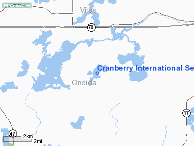
Cranberry Intl Seaplane Base Airport |
Location & QuickFacts
| FAA Information Effective: | 2008-09-25 |
| Airport Identifier: | WN66 |
| Airport Status: | Operational |
| Longitude/Latitude: | 089-27-04.4970W/45-51-04.8310N
-89.451249/45.851342 (Estimated) |
| Elevation: | 1605 ft / 489.20 m (Estimated) |
| Land: | 0 acres |
| From nearest city: | 10 nautical miles SW of Eagle River, WI |
| Location: | Oneida County, WI |
| Magnetic Variation: | 01W (1990) |
Owner & Manager
| Ownership: | Privately owned |
| Owner: | David Zawistowski |
| Address: | 6031 County D
Eagle River, WI 54521 |
| Phone number: | 715-479-6546 |
| Manager: | David Zawistowski |
| Address: | 6031 County D
Eagle River, WI 54521 |
| Phone number: | 715-479-6546 |
Airport Operations and Facilities
| Airport Use: | Private |
| Segmented Circle: | No |
| Control Tower: | No |
| Sectional chart: | Green Bay |
| Region: | AGL - Great Lakes |
| Boundary ARTCC: | ZMP - Minneapolis |
| Tie-in FSS: | GRB - Green Bay |
| FSS Toll Free: | 1-800-WX-BRIEF |
Airport Communications
Airport Services
Runway Information
Runway 04/22
| Dimension: | 7250 x 2500 ft / 2209.8 x 762.0 m |
| Surface: | WATER, |
| |
Runway 04 |
Runway 22 |
| Traffic Pattern: | Left | Left |
|
Radio Navigation Aids
| ID |
Type |
Name |
Ch |
Freq |
Var |
Dist |
| EGV | NDB | Eagle River | | 341.00 | 02W | 9.3 nm |
| DO | NDB | Dougy | | 236.00 | 01W | 11.7 nm |
| ARV | NDB | Arbor Vitae | | 221.00 | 01W | 12.5 nm |
| BDJ | NDB | Boulder Junction | | 206.00 | 02E | 19.0 nm |
| LNL | NDB | Land O Lakes | | 396.00 | 02W | 20.6 nm |
| MHA | NDB | Manitowish | | 364.00 | 01W | 24.3 nm |
| RXW | NDB | Watersmeet | | 407.00 | 01E | 27.2 nm |
| RRL | NDB | Merrill | | 257.00 | 01W | 40.7 nm |
| PKF | NDB | Park Falls | | 371.00 | 01W | 41.2 nm |
| PBH | NDB | Phillips | | 263.00 | 00E | 41.3 nm |
| AIG | NDB | Antigo | | 347.00 | 02W | 44.0 nm |
| RHI | VORTAC | Rhinelander | 029X | 109.20 | 02E | 13.1 nm |
| IWD | VORTAC | Ironwood | 025X | 108.80 | 01E | 49.6 nm |
Remarks
- PRVDD 20:1 APCH CLNC BE PRVDD; REF FAR PART 91.115.
Images and information placed above are from
http://www.airport-data.com/airport/WN66/
We thank them for the data!
| General Info
|
| Country |
United States
|
| State |
WISCONSIN
|
| FAA ID |
WN66
|
| Latitude |
45-51-04.831N
|
| Longitude |
089-27-04.497W
|
| Elevation |
1605 feet
|
| Near City |
EAGLE RIVER
|
We don't guarantee the information is fresh and accurate. The data may
be wrong or outdated.
For more up-to-date information please refer to other sources.
|
|


