 |
|
Location & QuickFacts
| FAA Information Effective: | 2008-09-25 |
| Airport Identifier: | 9WN1 |
| Airport Status: | Operational |
| Longitude/Latitude: | 088-41-02.3990W/44-06-24.9360N
-88.684000/44.106927 (Estimated) |
| Elevation: | 758 ft / 231.04 m (Surveyed) |
| Land: | 20 acres |
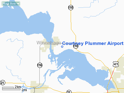
| From nearest city: | 1 nautical miles E of Winneconne, WI |
| Location: | Winnebago County, WI |
| Magnetic Variation: | 01W (1985) |
Owner & Manager
| Ownership: | Privately owned |
| Owner: | Sjs International Llc |
| Address: | 5691 Courtney Plummer Rd
Winneconne, WI 54986 |
| Phone number: | 920-582-0688 |
| Manager: | Lyall Stilp |
| Address: | 5691 Courtney Plummer Rd
Winneconne, WI 54986 |
| Phone number: | 920-582-0688 |
Airport Operations and Facilities
| Airport Use: | Private |
| Wind indicator: | Yes |
| Segmented Circle: | No |
| Control Tower: | No |
| Lighting Schedule: | DUSK-DAWN |
| Beacon Color: | Clear-Green (lighted land airport)
ARPT BCN OTS INDEFLY. |
| Landing fee charge: | No |
| Sectional chart: | Green Bay |
| Region: | AGL - Great Lakes |
| Traffic Pattern Alt: | 1000 ft |
| Boundary ARTCC: | ZAU - Chicago |
| Tie-in FSS: | GRB - Green Bay |
| FSS on Airport: | No |
| FSS Toll Free: | 1-800-WX-BRIEF |
Airport Services
| Airframe Repair: | NONE |
| Power Plant Repair: | NONE |
| Bottled Oxygen: | NONE |
| Bulk Oxygen: | NONE |
Runway Information
Runway 18/36
| Dimension: | 3403 x 32 ft / 1037.2 x 9.8 m |
| Surface: | ASPH, Poor Condition
NUMEROUS CRACKS IN SFC. |
| Edge Lights: | Low
ONLY SOUTH 2250' OF RWY 18/36 LIGHTED. |
| |
Runway 18 |
Runway 36 |
| Traffic Pattern: | Left | Left |
| Markings: | Nonstandard, Poor Condition
MARKED WITH YELLOW & WHITE CNTRLN. | Nonstandard, Poor Condition |
| Displaced threshold: | 1147.00 ft
DSPLCD THR MARKED WITH ARROWS & LGTS. | 47.00 ft |
| Runway End Identifier: | No | No |
| Centerline Lights: | No | No |
| Touchdown Lights: | No | No |
| Obstruction: | 40 ft pline, 220.0 ft from runway
PLINE RUNS PERPENDICULAR TO RWY.
APCH RATIO 34:1 AT DSPLCD THR.
ROAD 55'L OFCL ADJ TO THR PARALLEL TO RWY. +6'SIGN 10'FM THR 55'R OF CL. | 25 ft tree, 200.0 ft from runway, 110 ft right of centerline
ROAD R&L OF CL & 40'TREE 75'FM THR 125'R. +6-8'BRUSH 50'FM THR R&L OF CL. |
|
Radio Navigation Aids
| ID |
Type |
Name |
Ch |
Freq |
Var |
Dist |
| AQ | NDB | Kooky | | 407.00 | 02W | 13.9 nm |
| PCZ | NDB | Waupaca | | 382.00 | 01W | 19.7 nm |
| SG | NDB | Depre | | 332.00 | 02W | 29.5 nm |
| CLI | NDB | Clintonville | | 209.00 | 02W | 30.8 nm |
| UNU | NDB | Juneau | | 344.00 | 01W | 40.8 nm |
| HXF | NDB | Hartford | | 200.00 | 00E | 47.3 nm |
| LLE | NDB | Kettle Moraine | | 329.00 | 01W | 47.6 nm |
| BJB | VOR | West Bend | | 109.80 | 01W | 47.8 nm |
| FAH | VOR/DME | Falls | 37X | 110.00 | 02W | 41.5 nm |
| MTW | VOR/DME | Manitowoc | 047X | 111.00 | 02W | 43.3 nm |
| OSH | VORTAC | Oshkosh | 055X | 111.80 | 02E | 8.9 nm |
| GRB | VORTAC | Green Bay | 102X | 115.50 | 01E | 34.2 nm |
| STE | VORTAC | Stevens Point | 043X | 110.60 | 01W | 44.9 nm |
Images and information placed above are from
http://www.airport-data.com/airport/9WN1/
We thank them for the data!
| General Info
|
| Country |
United States
|
| State |
WISCONSIN
|
| FAA ID |
9WN1
|
| Latitude |
44-06-24.936N
|
| Longitude |
088-41-02.399W
|
| Elevation |
758 feet
|
| Near City |
WINNECONNE
|
We don't guarantee the information is fresh and accurate. The data may
be wrong or outdated.
For more up-to-date information please refer to other sources.
|
|


