 |
|
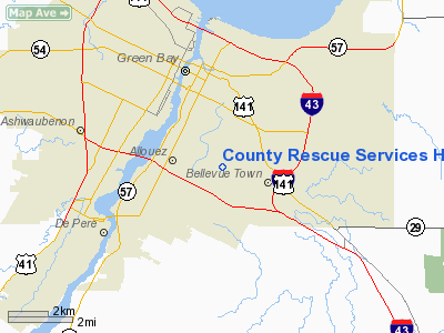
County Rescue Services Heliport |
Location & QuickFacts
| FAA Information Effective: | 2008-09-25 |
| Airport Identifier: | 4WN7 |
| Airport Status: | Operational |
| Longitude/Latitude: | 087-59-39.3704W/44-28-16.1734N
-87.994270/44.471159 (Estimated) |
| Elevation: | 640 ft / 195.07 m (Estimated) |
| Land: | 16 acres |
| From nearest city: | 10 nautical miles SE of Green Bay, WI |
| Location: | Brown County, WI |
| Magnetic Variation: | 03W (2000) |
Owner & Manager
| Ownership: | Privately owned |
| Owner: | County Rescue Services |
| Address: | 1765 Allouez Ave.
Green Bay, WI 54311 |
| Phone number: | 920-469-9779 |
| Manager: | Tom Madigan |
| Address: | 1765 Allouez Ave.
Green Bay, WI 54311 |
| Phone number: | 920-469-9779 |
Airport Operations and Facilities
| Airport Use: | Private
MEDICAL |
| Wind indicator: | Yes |
| Segmented Circle: | No |
| Control Tower: | No |
| Sectional chart: | Chicago |
| Region: | AGL - Great Lakes |
| Boundary ARTCC: | ZMP - Minneapolis |
| Tie-in FSS: | GRB - Green Bay |
| FSS Toll Free: | 1-800-WX-BRIEF |
Runway Information
Helipad H1
| Dimension: | 107 x 75 ft / 32.6 x 22.9 m |
| Surface: | CONC, |
| |
Runway H1 |
Runway |
| Traffic Pattern: | Left | Left |
|
Radio Navigation Aids
| ID |
Type |
Name |
Ch |
Freq |
Var |
Dist |
| SG | NDB | Depre | | 332.00 | 02W | 7.4 nm |
| AQ | NDB | Kooky | | 407.00 | 02W | 23.2 nm |
| OCQ | NDB | Oconto | | 388.00 | 03W | 24.6 nm |
| CLI | NDB | Clintonville | | 209.00 | 02W | 32.9 nm |
| SUE | NDB | Sturgeon Bay | | 414.00 | 03W | 32.9 nm |
| PCZ | NDB | Waupaca | | 382.00 | 01W | 44.7 nm |
| MTW | VOR/DME | Manitowoc | 047X | 111.00 | 02W | 24.6 nm |
| FAH | VOR/DME | Falls | 37X | 110.00 | 02W | 42.7 nm |
| MNM | VOR/DME | Menominee | 033X | 109.60 | 00E | 45.1 nm |
| GRB | VORTAC | Green Bay | 102X | 115.50 | 01E | 10.0 nm |
| OSH | VORTAC | Oshkosh | 055X | 111.80 | 02E | 37.7 nm |
Remarks
- DAY VFR; INGRESS-EGRESS 280-015 DEGREES. NON-OBSTRUCTING WIND INDICATOR INSTALLED, TKOF/LND AREA MARKED.
Images and information placed above are from
http://www.airport-data.com/airport/4WN7/
We thank them for the data!
| General Info
|
| Country |
United States
|
| State |
WISCONSIN
|
| FAA ID |
4WN7
|
| Latitude |
44-28-16.173N
|
| Longitude |
087-59-39.370W
|
| Elevation |
640 feet
|
| Near City |
GREEN BAY
|
We don't guarantee the information is fresh and accurate. The data may
be wrong or outdated.
For more up-to-date information please refer to other sources.
|
|


