 |
|
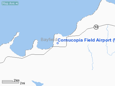
Location & QuickFacts
| FAA Information Effective: | 2008-09-25 |
| Airport Identifier: | WI23 |
| Airport Status: | Operational |
| Longitude/Latitude: | 091-05-00.6710W/46-51-59.7550N
-91.083520/46.866599 (Estimated) |
| Elevation: | 760 ft / 231.65 m (Estimated) |
| Land: | 0 acres |
| From nearest city: | 1 nautical miles W of Cornucopia, WI |
| Location: | Bayfield County, WI |
| Magnetic Variation: | 01E (1985) |
Owner & Manager
| Ownership: | Publicly owned |
| Owner: | Town Of Bell |
| Address: | Cornucopia Men Club; Box 113
Cornucopia, WI 54827 |
| Phone number: | 715-742-3902 |
| Manager: | Todd Kessler |
| Address: | Box 176
Cornucopia, WI 54827 |
| Phone number: | 715-742-3902 |
Airport Operations and Facilities
| Airport Use: | Private |
| Wind indicator: | Yes |
| Segmented Circle: | No |
| Control Tower: | No |
| Landing fee charge: | No |
| Sectional chart: | Green Bay |
| Region: | AGL - Great Lakes |
| Boundary ARTCC: | ZMP - Minneapolis |
| Tie-in FSS: | GRB - Green Bay |
| FSS on Airport: | No |
| FSS Toll Free: | 1-800-WX-BRIEF |
Airport Services
| Airframe Repair: | NONE |
| Power Plant Repair: | NONE |
Runway Information
Runway 05/23
| Dimension: | 2010 x 80 ft / 612.6 x 24.4 m |
| Surface: | TURF, Fair Condition |
| |
Runway 05 |
Runway 23 |
| Traffic Pattern: | Left | Left |
| Obstruction: | 5 ft brush, 45 ft right of centerline | 4 ft trees, 0.0 ft from runway, 54 ft right of centerline |
|
Radio Navigation Aids
| ID |
Type |
Name |
Ch |
Freq |
Var |
Dist |
| ENY | NDB | Kennedy | | 254.00 | 02E | 20.1 nm |
| BFW | NDB | Silver Bay | | 350.00 | 00E | 26.8 nm |
| TWM | NDB | Two Harbors | | 243.00 | 01E | 29.3 nm |
| SUW | NDB | Bong | | 260.00 | 01E | 43.3 nm |
| OLG | NDB | Solon Springs | | 388.00 | 01E | 44.7 nm |
| SLY | NDB | Seeley | | 344.00 | 01E | 47.0 nm |
| LKI | TACAN | Lakeside | 011X | | 05E | 45.3 nm |
| ASX | VOR/DME | Ashland | 039X | 110.20 | 02E | 20.3 nm |
| IWD | VORTAC | Ironwood | 025X | 108.80 | 01E | 44.3 nm |
| DLH | VORTAC | Duluth | 073X | 112.60 | 05E | 46.2 nm |
Remarks
- RY 05/23 HAS A 110' STWY ON SW END & 80' STWY ON NE END.
- TERRAIN DROPS OFF APRXLY 8-10' IN LAST 200' OF RWY/STOPWAY SOUTHWEST END RWY 05/23.
Images and information placed above are from
http://www.airport-data.com/airport/WI23/
We thank them for the data!
| General Info
|
| Country |
United States
|
| State |
WISCONSIN
|
| FAA ID |
WI23
|
| Latitude |
46-51-59.755N
|
| Longitude |
091-05-00.671W
|
| Elevation |
760 feet
|
| Near City |
CORNUCOPIA
|
We don't guarantee the information is fresh and accurate. The data may
be wrong or outdated.
For more up-to-date information please refer to other sources.
|
|


