 |
|
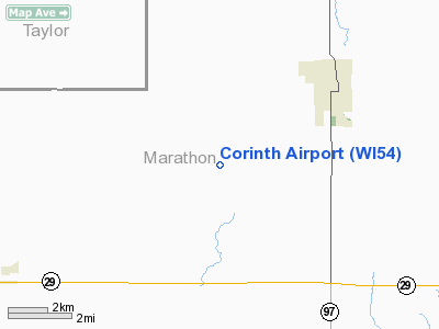
Location & QuickFacts
| FAA Information Effective: | 2008-09-25 |
| Airport Identifier: | WI54 |
| Airport Status: | Operational |
| Longitude/Latitude: | 090-08-58.4830W/44-59-57.8810N
-90.149579/44.999411 (Estimated) |
| Elevation: | 1425 ft / 434.34 m (Estimated) |
| Land: | 0 acres |
| From nearest city: | 3 nautical miles SW of Athens, WI |
| Location: | Marathon County, WI |
| Magnetic Variation: | 01E (1985) |
Owner & Manager
| Ownership: | Privately owned |
| Owner: | Norman Bhend |
| Address: | 1961 Cty Hwy A
Athens, WI 54411 |
| Phone number: | 715-257-7005 |
| Manager: | Norman Bhend |
| Address: | 1961 Cty Hwy A
Athens, WI 54411 |
| Phone number: | 715-257-7005 |
Airport Operations and Facilities
| Airport Use: | Private |
| Wind indicator: | Yes |
| Segmented Circle: | No |
| Control Tower: | No |
| Sectional chart: | Green Bay |
| Region: | AGL - Great Lakes |
| Boundary ARTCC: | ZMP - Minneapolis |
| Tie-in FSS: | GRB - Green Bay |
| FSS on Airport: | No |
| FSS Toll Free: | 1-800-WX-BRIEF |
Runway Information
Runway 08/26
| Dimension: | 2000 x 50 ft / 609.6 x 15.2 m |
| Surface: | TURF, |
| |
Runway 08 |
Runway 26 |
| Traffic Pattern: | Left | Left |
|
Radio Navigation Aids
| ID |
Type |
Name |
Ch |
Freq |
Var |
Dist |
| MDZ | NDB | Medford | | 335.00 | 00E | 9.3 nm |
| MFI | NDB | Marshfield | | 391.00 | 00E | 21.6 nm |
| RRL | NDB | Merrill | | 257.00 | 01W | 22.4 nm |
| FZK | NDB | Wausau | | 243.00 | 01E | 22.7 nm |
| VIQ | NDB | Neillsville | | 368.00 | 01W | 30.8 nm |
| ISW | NDB | Wisconsin Rapids | | 215.00 | 01W | 40.4 nm |
| PBH | NDB | Phillips | | 263.00 | 00E | 43.7 nm |
| AIG | NDB | Antigo | | 347.00 | 02W | 45.0 nm |
| RCX | NDB | Rusk County | | 356.00 | 00W | 47.0 nm |
| AUW | VORTAC | Wausau | 053X | 111.60 | 02E | 25.7 nm |
| STE | VORTAC | Stevens Point | 043X | 110.60 | 01W | 38.1 nm |
| RHI | VORTAC | Rhinelander | 029X | 109.20 | 02E | 48.1 nm |
Images and information placed above are from
http://www.airport-data.com/airport/WI54/
We thank them for the data!
| General Info
|
| Country |
United States
|
| State |
WISCONSIN
|
| FAA ID |
WI54
|
| Latitude |
44-59-57.881N
|
| Longitude |
090-08-58.483W
|
| Elevation |
1425 feet
|
| Near City |
ATHENS
|
We don't guarantee the information is fresh and accurate. The data may
be wrong or outdated.
For more up-to-date information please refer to other sources.
|
|


