 |
|
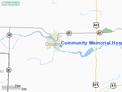
Community Memorial Hospital Heliport |
Location & QuickFacts
| FAA Information Effective: | 2008-09-25 |
| Airport Identifier: | 22WI |
| Airport Status: | Operational |
| Longitude/Latitude: | 088-07-42.3680W/44-51-53.9690N
-88.128436/44.864991 (Estimated) |
| Elevation: | 720 ft / 219.46 m (Estimated) |
| Land: | 0 acres |
| From nearest city: | 1 nautical miles SE of Oconto Falls, WI |
| Location: | Oconto County, WI |
| Magnetic Variation: | 02W (1990) |
Owner & Manager
| Ownership: | Privately owned |
| Owner: | Community Memorial Hospital |
| Address: | 855 S. Main St.
Oconto Falls, WI 54154 |
| Phone number: | 414-846-3444 |
| Manager: | James Van Dornick |
| Address: | 855 S. Main St.
Oconto Falls, WI 54154 |
| Phone number: | 414-846-3444 |
Airport Operations and Facilities
| Airport Use: | Private
MEDICAL USE. |
| Segmented Circle: | No |
| Control Tower: | No |
| Sectional chart: | Green Bay |
| Region: | AGL - Great Lakes |
| Boundary ARTCC: | ZMP - Minneapolis |
| Tie-in FSS: | GRB - Green Bay |
| FSS Toll Free: | 1-800-WX-BRIEF |
Runway Information
Helipad H1
| Dimension: | 75 x 75 ft / 22.9 x 22.9 m |
| Surface: | TURF, |
| |
Runway H1 |
Runway |
| Traffic Pattern: | Left | Left |
|
Radio Navigation Aids
| ID |
Type |
Name |
Ch |
Freq |
Var |
Dist |
| OCQ | NDB | Oconto | | 388.00 | 03W | 9.2 nm |
| SG | NDB | Depre | | 332.00 | 02W | 28.0 nm |
| CLI | NDB | Clintonville | | 209.00 | 02W | 29.8 nm |
| SUE | NDB | Sturgeon Bay | | 414.00 | 03W | 30.1 nm |
| AQ | NDB | Kooky | | 407.00 | 02W | 40.7 nm |
| AIG | NDB | Antigo | | 347.00 | 02W | 45.4 nm |
| PCZ | NDB | Waupaca | | 382.00 | 01W | 49.7 nm |
| MNM | VOR/DME | Menominee | 033X | 109.60 | 00E | 27.9 nm |
| MTW | VOR/DME | Manitowoc | 047X | 111.00 | 02W | 48.3 nm |
| GRB | VORTAC | Green Bay | 102X | 115.50 | 01E | 18.8 nm |
Remarks
- FOR RECORD PURPOSES ONLY.
Images and information placed above are from
http://www.airport-data.com/airport/22WI/
We thank them for the data!
| General Info
|
| Country |
United States
|
| State |
WISCONSIN
|
| FAA ID |
WS21
|
| Latitude |
43-09-50.029N
|
| Longitude |
088-08-22.329W
|
| Elevation |
918 feet
|
| Near City |
MENOMONEE FALLS
|
We don't guarantee the information is fresh and accurate. The data may
be wrong or outdated.
For more up-to-date information please refer to other sources.
|
|


