 |
|
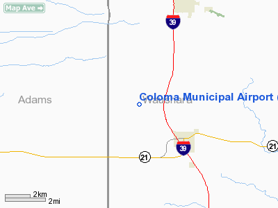
Location & QuickFacts
| FAA Information Effective: | 2008-09-25 |
| Airport Identifier: | 9WN9 |
| Airport Status: | Operational |
| Longitude/Latitude: | 089-34-00.4420W/44-03-35.9020N
-89.566789/44.059973 (Estimated) |
| Elevation: | 1100 ft / 335.28 m (Estimated) |
| Land: | 180 acres |
| From nearest city: | 3 nautical miles NW of Coloma, WI |
| Location: | Waushara County, WI |
| Magnetic Variation: | 00W (1985) |
Owner & Manager
| Ownership: | Publicly owned |
| Owner: | Village Of Coloma |
| Address: | P.o. Box 353
Coloma, WI 54930 |
| Phone number: | 715-228-2871 |
| Manager: | Village Board |
| Address: | P. O. Box 353
Coloma, WI 54930 |
| Phone number: | 715-228-2871 |
Airport Operations and Facilities
| Airport Use: | Private |
| Wind indicator: | Yes |
| Segmented Circle: | Yes |
| Control Tower: | No |
| Landing fee charge: | No |
| Sectional chart: | Green Bay |
| Region: | AGL - Great Lakes |
| Boundary ARTCC: | ZAU - Chicago |
| Tie-in FSS: | GRB - Green Bay |
| FSS on Airport: | No |
| FSS Toll Free: | 1-800-WX-BRIEF |
| Federal Agreements: | 1 |
Airport Services
| Airframe Repair: | NONE |
| Power Plant Repair: | NONE |
| Bottled Oxygen: | NONE |
| Bulk Oxygen: | NONE |
Runway Information
Runway 18/36
| Dimension: | 2600 x 40 ft / 792.5 x 12.2 m |
| Surface: | GRAVEL,
GRAVEL-OILED. |
| |
Runway 18 |
Runway 36 |
| Traffic Pattern: | Left | Left |
| Markings: | Basic, | Basic, |
| Runway End Identifier: | No | No |
| Centerline Lights: | No | No |
| Touchdown Lights: | No | No |
| Obstruction: | , 80.0 ft from runway, 2:1 slope to clear
+40' TREES 165' LEFT OF CNTRLN. | 20 ft road, 100.0 ft from runway, 3:1 slope to clear
+45' TREES; ROAD RIGHT & LEFT OF CNTRLN. |
|
Radio Navigation Aids
| ID |
Type |
Name |
Ch |
Freq |
Var |
Dist |
| ISW | NDB | Wisconsin Rapids | | 215.00 | 01W | 21.7 nm |
| PCZ | NDB | Waupaca | | 382.00 | 01W | 28.8 nm |
| HBW | NDB | Kickapoo | | 251.00 | 03E | 41.2 nm |
| MFI | NDB | Marshfield | | 391.00 | 00E | 43.9 nm |
| CMY | NDB | Mccoy | | 412.00 | 00E | 47.1 nm |
| CLI | NDB | Clintonville | | 209.00 | 02W | 49.1 nm |
| VOK | TACAN | Volk | 041X | | 00E | 30.7 nm |
| STE | VORTAC | Stevens Point | 043X | 110.60 | 01W | 29.1 nm |
| DLL | VORTAC | Dells | 117X | 117.00 | 03E | 31.8 nm |
| OSH | VORTAC | Oshkosh | 055X | 111.80 | 02E | 43.9 nm |
| AUW | VORTAC | Wausau | 053X | 111.60 | 02E | 47.3 nm |
Remarks
- ARPT CLSD WINTERS.
- CROP SPRAYERS OPERATING IN SEASON.
Images and information placed above are from
http://www.airport-data.com/airport/9WN9/
We thank them for the data!
| General Info
|
| Country |
United States
|
| State |
WISCONSIN
|
| FAA ID |
9WN9
|
| Latitude |
44-03-35.902N
|
| Longitude |
089-34-00.442W
|
| Elevation |
1100 feet
|
| Near City |
COLOMA
|
We don't guarantee the information is fresh and accurate. The data may
be wrong or outdated.
For more up-to-date information please refer to other sources.
|
|


