 |
|
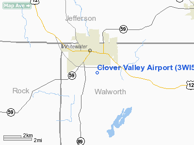
Location & QuickFacts
| FAA Information Effective: | 2008-09-25 |
| Airport Identifier: | 3WI5 |
| Airport Status: | Operational |
| Longitude/Latitude: | 088-43-35.3780W/42-48-45.0350N
-88.726494/42.812510 (Estimated) |
| Elevation: | 850 ft / 259.08 m (Estimated) |
| Land: | 0 acres |
| From nearest city: | 1 nautical miles S of Whitewater, WI |
| Location: | Walworth County, WI |
| Magnetic Variation: | 00W (1985) |
Owner & Manager
| Ownership: | Privately owned |
| Owner: | W. R. Frison & J. Frison |
| Address: | N 8884 Clover Valley Rd
Whitewater, WI 53190 |
| Phone number: | 414-473-4836 |
| Manager: | Joyce Frison |
| Address: | N 8884 Clover Valley Rd
Whitewater, WI 53190 |
| Phone number: | 414-473-4836 |
Airport Operations and Facilities
| Airport Use: | Private |
| Wind indicator: | Yes |
| Segmented Circle: | No |
| Control Tower: | No |
| Landing fee charge: | No |
| Sectional chart: | Chicago |
| Region: | AGL - Great Lakes |
| Boundary ARTCC: | ZAU - Chicago |
| Tie-in FSS: | GRB - Green Bay |
| FSS on Airport: | No |
| FSS Toll Free: | 1-800-WX-BRIEF |
Airport Services
| Airframe Repair: | NONE |
| Power Plant Repair: | NONE |
Runway Information
Runway 16/34
| Dimension: | 1600 x 100 ft / 487.7 x 30.5 m |
| Surface: | TURF, |
| |
Runway 16 |
Runway 34 |
| Traffic Pattern: | Left | Left |
|
Radio Navigation Aids
| ID |
Type |
Name |
Ch |
Freq |
Var |
Dist |
| LVV | NDB | Lake Lawn | | 404.00 | 00W | 9.0 nm |
| JVL | NDB | Janesville | | 375.00 | 03E | 18.3 nm |
| RYV | NDB | Rock River | | 371.00 | 01W | 21.7 nm |
| UES | NDB | Waukesha | | 359.00 | 01W | 25.7 nm |
| GM | NDB | Teels | | 242.00 | 02W | 30.8 nm |
| MS | NDB | Monah | | 400.00 | 00E | 31.1 nm |
| HXF | NDB | Hartford | | 200.00 | 00E | 35.3 nm |
| UNU | NDB | Juneau | | 344.00 | 01W | 37.1 nm |
| RA | NDB | Paser | | 206.00 | 00E | 37.3 nm |
| BL | NDB | Yanks | | 260.00 | 02W | 40.2 nm |
| LLE | NDB | Kettle Moraine | | 329.00 | 01W | 45.2 nm |
| BJB | VOR | West Bend | | 109.80 | 01W | 45.1 nm |
| BUU | VOR/DME | Burbun | 092X | 114.50 | 01W | 20.2 nm |
| JVL | VOR/DME | Janesville | 090X | 114.30 | 03E | 22.7 nm |
| LJT | VOR/DME | Timmerman | 072X | 112.50 | 02W | 35.2 nm |
| ENW | VOR/DME | Kenosha | 029X | 109.20 | 02W | 37.4 nm |
| HRK | VOR/DME | Horlick | 124X | 117.70 | 02W | 40.3 nm |
| RFD | VOR/DME | Rockford | 045X | 110.80 | 01E | 41.0 nm |
| OBK | VOR/DME | Northbrook | 077X | 113.00 | 02W | 49.4 nm |
| BAE | VORTAC | Badger | 111X | 116.40 | 02E | 26.7 nm |
| MSN | VORTAC | Madison | 023X | 108.60 | 03E | 33.6 nm |
| MKE | VOT | Milwaukee | | 109.00 | | 37.5 nm |
Remarks
- ALL OBSTNS BELOW APCH SFC SLOPE OF 20:1.
- SOFT WHEN WET.
- NO SNOW REMOVAL.
- CAUTION 140' TWR IN CNTR OF GROUP OF BLDGS ON NE SIDE OF FLD.
Images and information placed above are from
http://www.airport-data.com/airport/3WI5/
We thank them for the data!
| General Info
|
| Country |
United States
|
| State |
WISCONSIN
|
| FAA ID |
3WI5
|
| Latitude |
42-48-45.035N
|
| Longitude |
088-43-35.378W
|
| Elevation |
850 feet
|
| Near City |
WHITEWATER
|
We don't guarantee the information is fresh and accurate. The data may
be wrong or outdated.
For more up-to-date information please refer to other sources.
|
|


