|
|
Clintonville Muni Airport |
| Clintonville Municipal Airport |
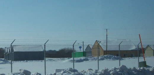 |
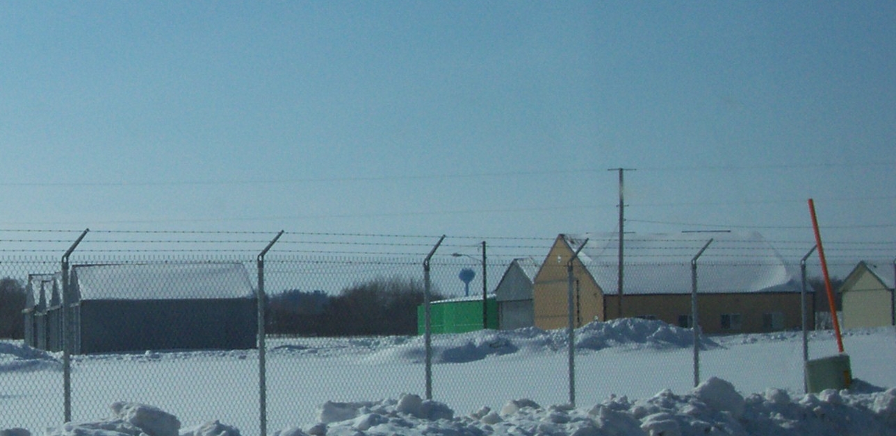
| Buildings |
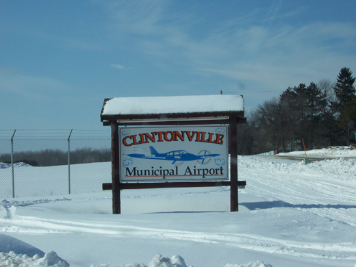 |
| Sign |
| IATA: CLI – ICAO: KCLI – FAA LID: CLI |
| Summary |
| Airport type |
Public |
| Owner/Operator |
City of Clintonville |
| Serves |
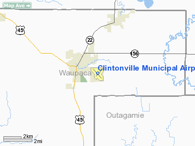
Clintonville, Wisconsin |
| Elevation AMSL |
822 ft / 250.5 m |
| Coordinates |
44°36.829′N 088°43.876′W / 44.613817°N 88.731267°W / 44.613817; -88.731267Coordinates: 44°36.829′N 088°43.876′W / 44.613817°N 88.731267°W / 44.613817; -88.731267 |
| Runways |
| Direction |
Length |
Surface |
| ft |
m |
| 14/32 |
4,600 |
1,402 |
Asphalt |
| 4/22 |
3,299 |
1,006 |
Asphalt |
| 9/27 |
2,040 |
622 |
Turf |
| Statistics (2005) |
| Operations |
8,000 |
| Stats for 12 months ending September 22, 2005 |
Clintonville Municipal Airport (IATA: CLI, ICAO: KCLI, FAA LID: CLI) is a public airport located in Clintonville, Wisconsin. It was the birthplace of Wisconsin Central Airlines which became North Central Airlines. Facilities
- Runway 14/32 4,600 x 75 ft. (1,402 x 23 m), asphalt
- Runway 4/22 3,299 x 100 ft. (1,006 x 30 m), asphalt
- Runway 9/27 2,040 x 170 ft. (622 x 52 m), turf
- CLINTONVILLE (CLI) non-directional beacon, 209 kHz, is located on field.
The above content comes from Wikipedia and is published under free licenses – click here to read more.
Location & QuickFacts
| FAA Information Effective: | 2008-09-25 |
| Airport Identifier: | CLI |
| Airport Status: | Operational |
| Longitude/Latitude: | 088-43-52.5600W/44-36-49.7270N
-88.731267/44.613813 (Estimated) |
| Elevation: | 822 ft / 250.55 m (Surveyed) |
| Land: | 533 acres |
| From nearest city: | 1 nautical miles SE of Clintonville, WI |
| Location: | Waupaca County, WI |
| Magnetic Variation: | 02W (1995) |
Owner & Manager
| Ownership: | Publicly owned |
| Owner: | City Of Clintonville |
| Address: | City Hall; 50 Tenth Street
Clintonville, WI 54929 |
| Phone number: | 715-823-7600 |
| Manager: | City Of Clintonville |
| Address: | 50 10th St
Clintonville, WI 54929 |
| Phone number: | 715-823-7600 |
Airport Operations and Facilities
| Airport Use: | Open to public |
| Wind indicator: | Yes |
| Segmented Circle: | No |
| Control Tower: | No |
| Lighting Schedule: | DUSK-DAWN
ACTVT MIRL RYS 04/22 & 14/32; REIL RY 32 AND PAPI RY 32 - CTAF. |
| Beacon Color: | Clear-Green (lighted land airport) |
| Landing fee charge: | No |
| Sectional chart: | Green Bay |
| Region: | AGL - Great Lakes |
| Boundary ARTCC: | ZMP - Minneapolis |
| Tie-in FSS: | GRB - Green Bay |
| FSS on Airport: | No |
| FSS Toll Free: | 1-800-WX-BRIEF |
| NOTAMs Facility: | CLI (NOTAM-d service avaliable) |
| Federal Agreements: | NGY |
Airport Communications
| CTAF: | 122.800 |
| Unicom: | 122.800 |
Airport Services
| Fuel available: | 100LLA
24 HR SELF SERVICE |
| Airframe Repair: | MAJOR |
| Power Plant Repair: | MAJOR |
Runway Information
Runway 04/22
| Dimension: | 3299 x 100 ft / 1005.5 x 30.5 m |
| Surface: | ASPH, Good Condition |
| Weight Limit: | Single wheel: 40000 lbs.
Dual wheel: 70000 lbs. |
| Edge Lights: | Medium |
| |
Runway 04 |
Runway 22 |
| Longitude: | 088-44-02.5130W | 088-43-31.5980W |
| Latitude: | 44-36-39.3330N | 44-37-03.2780N |
| Elevation: | 822.00 ft | 810.00 ft |
| Alignment: | 43 | 127 |
| Traffic Pattern: | Left | Left |
| Markings: | Basic, Fair Condition | Basic, Fair Condition |
| Runway End Identifier: | No | No |
| Centerline Lights: | No | No |
| Touchdown Lights: | No | No |
| Obstruction: | 61 ft trees, 2100.0 ft from runway, 150 ft right of centerline, 31:1 slope to clear | 15 ft road, 500.0 ft from runway, 150 ft left of centerline, 20:1 slope to clear |
|
Runway 09/27
| Dimension: | 2040 x 170 ft / 621.8 x 51.8 m |
| Surface: | TURF, Fair Condition |
| |
Runway 09 |
Runway 27 |
| Longitude: | 088-43-57.3380W | 088-43-29.7030W |
| Latitude: | 44-36-40.5840N | 44-36-41.1650N |
| Elevation: | 820.00 ft | 815.00 ft |
| Alignment: | 89 | 127 |
| Traffic Pattern: | Left | Left |
| Markings: | None,
RWY 09 /27 THLDS MKD WITH WHITE CONES. | None, |
| Runway End Identifier: | No | No |
| Centerline Lights: | No | No |
| Touchdown Lights: | No | No |
| Obstruction: | 27 ft tree, 670.0 ft from runway, 17 ft right of centerline, 24:1 slope to clear | 42 ft tree, 1100.0 ft from runway, 120 ft left of centerline, 26:1 slope to clear |
|
Runway 14/32
| Dimension: | 4600 x 75 ft / 1402.1 x 22.9 m |
| Surface: | ASPH, Good Condition |
| Weight Limit: | Single wheel: 30000 lbs.
Dual wheel: 55000 lbs. |
| Edge Lights: | Medium |
| |
Runway 14 |
Runway 32 |
| Longitude: | 088-44-17.7310W | 088-43-34.3280W |
| Latitude: | 44-37-04.9070N | 44-36-31.7110N |
| Elevation: | 818.00 ft | 814.00 ft |
| Alignment: | 127 | 127 |
| Traffic Pattern: | Left | Left |
| Markings: | Non-precision instrument, Fair Condition | Non-precision instrument, Fair Condition |
| Crossing Height: | 0.00 ft | 26.00 ft |
| VASI: | | 2-light PAPI on left side |
| Visual Glide Angle: | 0.00° | 3.00° |
| Runway End Identifier: | | Yes |
| Centerline Lights: | No | No |
| Touchdown Lights: | No | No |
| Obstruction: | 32 ft trees, 850.0 ft from runway, 200 ft left of centerline, 20:1 slope to clear | 30 ft tree, 1240.0 ft from runway, 25 ft right of centerline, 34:1 slope to clear |
|
Radio Navigation Aids
| ID |
Type |
Name |
Ch |
Freq |
Var |
Dist |
| CLI | NDB | Clintonville | | 209.00 | 02W | 0.3 nm |
| PCZ | NDB | Waupaca | | 382.00 | 01W | 20.9 nm |
| AQ | NDB | Kooky | | 407.00 | 02W | 27.9 nm |
| SG | NDB | Depre | | 332.00 | 02W | 28.7 nm |
| AIG | NDB | Antigo | | 347.00 | 02W | 36.6 nm |
| OCQ | NDB | Oconto | | 388.00 | 03W | 38.3 nm |
| FZK | NDB | Wausau | | 243.00 | 01E | 42.6 nm |
| ISW | NDB | Wisconsin Rapids | | 215.00 | 01W | 49.8 nm |
| GRB | VORTAC | Green Bay | 102X | 115.50 | 01E | 23.2 nm |
| STE | VORTAC | Stevens Point | 043X | 110.60 | 01W | 34.5 nm |
| OSH | VORTAC | Oshkosh | 055X | 111.80 | 02E | 38.2 nm |
| AUW | VORTAC | Wausau | 053X | 111.60 | 02E | 39.1 nm |
Remarks
- RY 09/27 CLSD FM 1 DEC TO 15 APR, OT CFM RY COND WITH AMGR AT 715-823-7690.
- DEER; FOX AND BIRDS ON & INVOF ARPT.
- 200 FT CRANE 6000 FT NW APCH END RY 14.
- GCO AVBL ON FREQ 121.725 THRU FLT SVCS.
Images and information placed above are from
http://www.airport-data.com/airport/CLI/
We thank them for the data!
| General Info
|
| Country |
United States
|
| State |
WISCONSIN
|
| FAA ID |
CLI
|
| Latitude |
44-36-49.727N
|
| Longitude |
088-43-52.560W
|
| Elevation |
822 feet
|
| Near City |
CLINTONVILLE
|
We don't guarantee the information is fresh and accurate. The data may
be wrong or outdated.
For more up-to-date information please refer to other sources.
|
|