 |
|
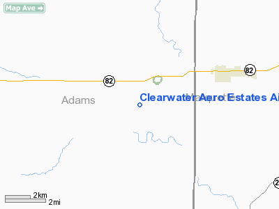
Clearwater Aero Estates Airport |
Location & QuickFacts
| FAA Information Effective: | 2008-09-25 |
| Airport Identifier: | JB01 |
| Airport Status: | Closed Indefinitely |
| Longitude/Latitude: | 089-39-09.4450W/43-45-25.9170N
-89.652624/43.757199 (Estimated) |
| Elevation: | 944 ft / 287.73 m (Surveyed) |
| Land: | 60 acres |
| From nearest city: | 10 nautical miles NE of Wisconsin Dells, WI |
| Location: | Adams County, WI |
| Magnetic Variation: | 00E (1985) |
Owner & Manager
| Ownership: | Privately owned |
| Owner: | L. Floyd & C. Johnson |
| Address: | 3426 Country Rd G
Oxford Wi, WI 53952 |
| Phone number: | 608-586-6336 |
| Manager: | P. Studtmann & J. Knautz |
| Address: | 3426 Country Road G
Oxford, WI 53952 |
| Phone number: | 608-586-6336 |
Airport Operations and Facilities
| Airport Use: | Private |
| Wind indicator: | Yes |
| Segmented Circle: | No |
| Control Tower: | No |
| Landing fee charge: | No |
| Sectional chart: | Chicago |
| Region: | AGL - Great Lakes |
| Traffic Pattern Alt: | 1000 ft |
| Boundary ARTCC: | ZAU - Chicago |
| Tie-in FSS: | GRB - Green Bay |
| FSS on Airport: | No |
| FSS Toll Free: | 1-800-WX-BRIEF |
| NOTAMs Facility: | GRB (NOTAM-d service avaliable) |
Runway Information
Runway 01/19
| Dimension: | 2675 x 30 ft / 815.3 x 9.1 m |
| Surface: | ASPH, Good Condition |
| Edge Lights: | Low
LGTD N 1800 FT ONLY TO DSPLCD THR; 1 THR LGT EACH SIDE OF RY; LIRL OTS INDEFLY. |
| |
Runway 01 |
Runway 19 |
| Traffic Pattern: | Left | Left |
| Markings: | Basic, Fair Condition
RY 01/19; APRT NAME PAINTED ON CENTER OF RY. | Basic, Fair Condition |
| Displaced threshold: | 610.00 ft
NSTD DSPLCD THR MKGS; ARROWS AT THR LEAD TO A DOUBLE WHITE LINE ON RY. | 305.00 ft |
| Runway End Identifier: | No | No |
| Centerline Lights: | No | No |
| Touchdown Lights: | No | No |
| Obstruction: | 43 ft tree, 850.0 ft from runway | 17 ft road, 200.0 ft from runway |
|
Radio Navigation Aids
| ID |
Type |
Name |
Ch |
Freq |
Var |
Dist |
| HBW | NDB | Kickapoo | | 251.00 | 03E | 30.2 nm |
| ISW | NDB | Wisconsin Rapids | | 215.00 | 01W | 37.4 nm |
| MS | NDB | Monah | | 400.00 | 00E | 43.8 nm |
| PCZ | NDB | Waupaca | | 382.00 | 01W | 44.2 nm |
| CMY | NDB | Mccoy | | 412.00 | 00E | 44.2 nm |
| UNU | NDB | Juneau | | 344.00 | 01W | 45.8 nm |
| VOK | TACAN | Volk | 041X | | 00E | 28.6 nm |
| LNR | VOR/DME | Lone Rock | 075X | 112.80 | 00E | 34.8 nm |
| DLL | VORTAC | Dells | 117X | 117.00 | 03E | 13.3 nm |
| MSN | VORTAC | Madison | 023X | 108.60 | 03E | 39.3 nm |
| STE | VORTAC | Stevens Point | 043X | 110.60 | 01W | 47.5 nm |
| OSH | VORTAC | Oshkosh | 055X | 111.80 | 02E | 49.5 nm |
Remarks
- MICROWAVE TWR, 1382' MSL/285' AGL, 1.6 NM NW.
- 69' PLINE 1525' N OF AER 19.
- RY 01 30' DROPOFF 50' FM THR.
- DEER IN & ON VICINITY OF ARPT.
- (58-19) +30'WIND SOCK 65'R OF CL 50'FM THR 10:1 BASED ON DSPLCD THR.
- (ARPT STATUS) ARPT CLSD INDEFLY.
Images and information placed above are from
http://www.airport-data.com/airport/JB01/
We thank them for the data!
| General Info
|
| Country |
United States
|
| State |
WISCONSIN
|
| FAA ID |
JB01
|
| Latitude |
43-45-25.917N
|
| Longitude |
089-39-09.445W
|
| Elevation |
944 feet
|
| Near City |
WISCONSIN DELLS
|
We don't guarantee the information is fresh and accurate. The data may
be wrong or outdated.
For more up-to-date information please refer to other sources.
|
|


