 |
|
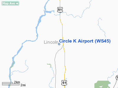
Location & QuickFacts
| FAA Information Effective: | 2008-09-25 |
| Airport Identifier: | WS45 |
| Airport Status: | Operational |
| Longitude/Latitude: | 089-40-28.4670W/45-20-29.8770N
-89.674574/45.341633 (Estimated) |
| Elevation: | 1500 ft / 457.20 m (Estimated) |
| Land: | 5 acres |
| From nearest city: | 1 nautical miles SW of Irma, WI |
| Location: | Lincoln County, WI |
| Magnetic Variation: | 00E (1985) |
Owner & Manager
| Ownership: | Privately owned |
| Owner: | Darrell Kuhn |
| Address: | W 5138 Winkelman Ave
Irma, WI 54442 |
| Phone number: | 715-536-2791 |
| Manager: | Darrell Kuhn |
| Address: | W 5138 Winkelman Ave
Irma, WI 54442 |
| Phone number: | 715-536-2791 |
Airport Operations and Facilities
| Airport Use: | Private |
| Wind indicator: | Yes |
| Segmented Circle: | No |
| Control Tower: | No |
| Sectional chart: | Green Bay |
| Region: | AGL - Great Lakes |
| Boundary ARTCC: | ZMP - Minneapolis |
| Tie-in FSS: | GRB - Green Bay |
| FSS Toll Free: | 1-800-WX-BRIEF |
Runway Information
Runway 09/27
| Dimension: | 1900 x 60 ft / 579.1 x 18.3 m |
| Surface: | TURF, |
| |
Runway 09 |
Runway 27 |
| Traffic Pattern: | Left | Left |
| Obstruction: | | 35 ft trees, 750.0 ft from runway |
|
Radio Navigation Aids
| ID |
Type |
Name |
Ch |
Freq |
Var |
Dist |
| RRL | NDB | Merrill | | 257.00 | 01W | 8.7 nm |
| FZK | NDB | Wausau | | 243.00 | 01E | 25.0 nm |
| AIG | NDB | Antigo | | 347.00 | 02W | 26.2 nm |
| DO | NDB | Dougy | | 236.00 | 01W | 29.7 nm |
| MDZ | NDB | Medford | | 335.00 | 00E | 30.4 nm |
| ARV | NDB | Arbor Vitae | | 221.00 | 01W | 35.2 nm |
| PBH | NDB | Phillips | | 263.00 | 00E | 37.9 nm |
| EGV | NDB | Eagle River | | 341.00 | 02W | 39.5 nm |
| MFI | NDB | Marshfield | | 391.00 | 00E | 47.4 nm |
| BDJ | NDB | Boulder Junction | | 206.00 | 02E | 47.6 nm |
| MHA | NDB | Manitowish | | 364.00 | 01W | 47.8 nm |
| PKF | NDB | Park Falls | | 371.00 | 01W | 48.5 nm |
| RHI | VORTAC | Rhinelander | 029X | 109.20 | 02E | 19.8 nm |
| AUW | VORTAC | Wausau | 053X | 111.60 | 02E | 30.0 nm |
| STE | VORTAC | Stevens Point | 043X | 110.60 | 01W | 48.4 nm |
Images and information placed above are from
http://www.airport-data.com/airport/WS45/
We thank them for the data!
| General Info
|
| Country |
United States
|
| State |
WISCONSIN
|
| FAA ID |
WS45
|
| Latitude |
45-20-29.877N
|
| Longitude |
089-40-28.467W
|
| Elevation |
1500 feet
|
| Near City |
IRMA
|
We don't guarantee the information is fresh and accurate. The data may
be wrong or outdated.
For more up-to-date information please refer to other sources.
|
|


