 |
|
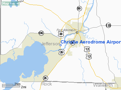
Christie Aerodrome Airport |
Location & QuickFacts
| FAA Information Effective: | 2008-09-25 |
| Airport Identifier: | WS49 |
| Airport Status: | Operational |
| Longitude/Latitude: | 088-52-39.3870W/42-54-24.0200N
-88.877607/42.906672 (Estimated) |
| Elevation: | 795 ft / 242.32 m (Estimated) |
| Land: | 0 acres |
| From nearest city: | 2 nautical miles SW of Fort Atkinson, WI |
| Location: | Jefferson County, WI |
| Magnetic Variation: | 00W (1985) |
Owner & Manager
| Ownership: | Privately owned |
| Owner: | Lisa Lubbert |
| Address: | W6856 Christie Court
Fort Atkinson, WI 53538 |
| Phone number: | 920-674-4000 |
| Address: |
|
Airport Operations and Facilities
| Airport Use: | Private |
| Segmented Circle: | No |
| Control Tower: | No |
| Sectional chart: | Chicago |
| Region: | AGL - Great Lakes |
| Boundary ARTCC: | ZAU - Chicago |
| Tie-in FSS: | GRB - Green Bay |
| FSS Toll Free: | 1-800-WX-BRIEF |
Runway Information
Runway 05/23
| Dimension: | 1927 x 85 ft / 587.3 x 25.9 m |
| Surface: | TURF, |
| |
Runway 05 |
Runway 23 |
| Traffic Pattern: | Left | Left |
|
Radio Navigation Aids
| ID |
Type |
Name |
Ch |
Freq |
Var |
Dist |
| RYV | NDB | Rock River | | 371.00 | 01W | 17.4 nm |
| LVV | NDB | Lake Lawn | | 404.00 | 00W | 17.7 nm |
| JVL | NDB | Janesville | | 375.00 | 03E | 19.0 nm |
| MS | NDB | Monah | | 400.00 | 00E | 22.6 nm |
| UES | NDB | Waukesha | | 359.00 | 01W | 29.4 nm |
| UNU | NDB | Juneau | | 344.00 | 01W | 32.3 nm |
| HXF | NDB | Hartford | | 200.00 | 00E | 33.9 nm |
| GM | NDB | Teels | | 242.00 | 02W | 36.8 nm |
| BL | NDB | Yanks | | 260.00 | 02W | 45.0 nm |
| RA | NDB | Paser | | 206.00 | 00E | 45.2 nm |
| LLE | NDB | Kettle Moraine | | 329.00 | 01W | 45.3 nm |
| BJB | VOR | West Bend | | 109.80 | 01W | 45.3 nm |
| JVL | VOR/DME | Janesville | 090X | 114.30 | 03E | 23.2 nm |
| BUU | VOR/DME | Burbun | 092X | 114.50 | 01W | 28.6 nm |
| LJT | VOR/DME | Timmerman | 072X | 112.50 | 02W | 38.9 nm |
| RFD | VOR/DME | Rockford | 045X | 110.80 | 01E | 43.3 nm |
| ENW | VOR/DME | Kenosha | 029X | 109.20 | 02W | 45.7 nm |
| HRK | VOR/DME | Horlick | 124X | 117.70 | 02W | 47.7 nm |
| MSN | VORTAC | Madison | 023X | 108.60 | 03E | 24.8 nm |
| BAE | VORTAC | Badger | 111X | 116.40 | 02E | 29.0 nm |
| MKE | VOT | Milwaukee | | 109.00 | | 43.3 nm |
Remarks
- OBSTRUCTIONS IN APPROACH SURFACE BE REMOVED/LOWERED OR THRESHOLD DISPLACED TO PROVIDE A 20:1 CLRNCE.AREA 125' EITHER SIDE OF CTRLN BE CLEAR OF OBSTRUCTIONS; USED IN ACCORD WITH LTR OF AGREEMENT WITH BLACKHAWK ISLAND ARPT.
Images and information placed above are from
http://www.airport-data.com/airport/WS49/
We thank them for the data!
| General Info
|
| Country |
United States
|
| State |
WISCONSIN
|
| FAA ID |
WS49
|
| Latitude |
42-54-24.020N
|
| Longitude |
088-52-39.387W
|
| Elevation |
795 feet
|
| Near City |
FORT ATKINSON
|
We don't guarantee the information is fresh and accurate. The data may
be wrong or outdated.
For more up-to-date information please refer to other sources.
|
|


