|
|
Chippewa Valley Rgnl Airport |
| Chippewa Valley Regional Airport |
| IATA: EAU – ICAO: KEAU – FAA LID: EAU |
| Summary |
| Airport type |
Public |
| Owner |
Eau Claire County |
| Serves |
Eau Claire, Wisconsin |
| Location |
Chippewa County |
| Elevation AMSL |
913 ft / 278 m |
| Coordinates |
44°51′57″N 091°29′03″W / 44.86583°N 91.48417°W / 44.86583; -91.48417 |
| Website |
ChippewaValleyAirport.com |
| Runways |
| Direction |
Length |
Surface |
| ft |
m |
| 4/22 |
8,101 |
2,469 |
Concrete |
| 14/32 |
5,000 |
1,524 |
Asphalt/Concrete |
| Statistics (2005) |
| Aircraft operations |
52,506 |
| Based aircraft |
77 |
| Source: Federal Aviation Administration |
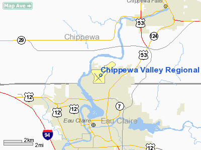
Chippewa Valley Regional Airport (IATA: EAU, ICAO: KEAU, FAA LID: EAU) is a public-use airport located in Chippewa County, Wisconsin, United States. It is three nautical miles (6 km) north of the central business district of Eau Claire and is owned by Eau Claire County.
It is the largest airport in the 30-county northern Wisconsin area, and serves primarily the Chippewa Valley region, operating on a budget approved by a commission equally representing the interests of Chippewa, Eau Claire and Dunn counties.
The airport is occasionally used as an alternative landing site for flights bound for Minneapolis-Saint Paul International Airport. As of April 2010, only one commercial airline, United Airlines, provides service for CVRA to Chicago O'Hare International.
A new $3.9M 65' control tower was built in 2005. In November 2006, the tower opened, thus making it safer for pilots. Passenger loading is from the tarmac. History
In 1923, 80 acres (320,000 m) of land in Putnam Heights were purchased to build an airport. In 1929, Eau Claire Airways was started at the airport, offering training and scheduled taxi service to destinations in Wisconsin and Minnesota.
In 1939, work on a new airport started north of Eau Claire. In 1940, Eau Claire County Airport started operations at its current site. Eau Claire Municipal Airport opened in 1945, while Chippewa Valley Regional Airport was officially opened in 1947 with the arrival of a Northwest Airlines DC-3. At this time, Eau Claire had three airports. Upgrades at Chippewa Valley Regional Airport were made in further decades, with a terminal addition in 1981. Another Terminal Remodeling/ expansion was completed in 2009 thus making travel flow faster.
Facilities and aircraft
Chippewa Valley Regional Airport covers an area of 1,100 acres (445 ha) at an elevation of 913 feet (278 m) above mean sea level. It has two runways: 4/22 is 8,101 by 150 feet (2,469 x 46 m) with a concrete surface; 14/32 is 5,000 by 100 feet (1,524 x 30 m) with an asphalt/concrete surface.
For the 12-month period ending December 31, 2005, the airport had 52,506 aircraft operations, an average of 143 per day: 80% general aviation, 11% air taxi, 9% scheduled commercial and <1% military. At that time there were 77 aircraft based at this airport: 78% single-engine, 13% multi-engine and 9% jet.
Airlines and destinations
The airport is mainly used for general aviation and business travel, though one airline operates scheduled service:
| Airlines |
Destinations |
| United Express operated by SkyWest Airlines |
Chicago-O'Hare, Wausau |
The above content comes from Wikipedia and is published under free licenses – click here to read more.
 |
(Click on the photo to enlarge) |
Location & QuickFacts
| FAA Information Effective: | 2008-09-25 |
| Airport Identifier: | EAU |
| Airport Status: | Operational |
| Longitude/Latitude: | 091-29-03.3186W/44-51-56.8963N
-91.484255/44.865805 (Estimated) |
| Elevation: | 913 ft / 278.28 m (Surveyed) |
| Land: | 1100 acres |
| From nearest city: | 3 nautical miles N of Eau Claire, WI |
| Location: | Chippewa County, WI |
| Magnetic Variation: | 01E (1995) |
Owner & Manager
| Ownership: | Publicly owned |
| Owner: | Eau Claire County |
| Address: | 721 Oxford Ave
Eau Claire, WI 54701 |
| Phone number: | 715-839-4900 |
| Manager: | Charity Speich |
| Address: | 3800 Starr Ave
Eau Claire, WI 54703 |
| Phone number: | 715-839-4900 |
Airport Operations and Facilities
| Airport Use: | Open to public |
| Wind indicator: | Yes |
| Segmented Circle: | Yes |
| Control Tower: | Yes |
| Lighting Schedule: | DUSK-DAWN
HIRL RY 04/22 PRESET ON LOW INTST; TO INCR INTST & ACTVT MIRL RY 14/32; PAPI RYS 14 & 32 & 22; REIL RYS 04 & 14; MALSR RY 22 - CTAF. PAPI 04 ON CONTINOUSLY. |
| Beacon Color: | Clear-Green (lighted land airport) |
| Landing fee charge: | No |
| Sectional chart: | Green Bay |
| Region: | AGL - Great Lakes |
| Traffic Pattern Alt: | 1000 ft |
| Boundary ARTCC: | ZMP - Minneapolis |
| Tie-in FSS: | GRB - Green Bay |
| FSS on Airport: | No |
| FSS Toll Free: | 1-800-WX-BRIEF |
| NOTAMs Facility: | EAU (NOTAM-d service avaliable) |
| Certification type/date: | I A S 05/1973
ARFF NOT AVBL 24 HRS. PPR FOR UNSCHEDULED ACR OPNS WITH MORE THAN 9 PASSENGER SEATS; CONTACT ARPT MGR 715-839-6241. ACR OPNS WITH MORE THAN 9 PASSENGER SEATS NA IN EXCESS OF 15 MIN BEFORE OR AFTER SKED ARR/DEP TIMES WITHOUT PPR WITH ARPT MGR AND CONFIRMATION ARFF IS AVLB PRIOR TO LDG OR TKF. |
| Federal Agreements: | NGY3 |
Airport Communications
| CTAF: | 118.575 |
| Unicom: | 122.950 |
Airport Services
| Fuel available: | 100LLA |
| Airframe Repair: | MAJOR |
| Power Plant Repair: | MAJOR |
| Bottled Oxygen: | LOW |
Runway Information
Runway 04/22
| Dimension: | 8101 x 150 ft / 2469.2 x 45.7 m |
| Surface: | CONC-TRTD, |
| Surface Treatment: | Rubberized Friction Seal Coat |
| Weight Limit: | Single wheel: 100000 lbs.
Dual wheel: 180000 lbs.
Dual tandem wheel: 320000 lbs. |
| Edge Lights: | High |
| |
Runway 04 |
Runway 22 |
| Longitude: | 091-29-33.7840W | 091-28-14.2819W |
| Latitude: | 44-51-33.4370N | 44-52-30.0180N |
| Elevation: | 887.00 ft | 913.00 ft |
| Alignment: | 45 | 127 |
| ILS Type: | | ILS
|
| Traffic Pattern: | Left | Left |
| Markings: | Precision instrument, Good Condition | Precision instrument, Good Condition |
| Crossing Height: | 44.00 ft | 50.00 ft |
| Displaced threshold: | 801.00 ft | 0.00 ft |
| VASI: | 4-light PAPI on left side | 4-light PAPI on left side |
| Visual Glide Angle: | 3.00° | 3.00° |
| Approach lights: | | MALSR |
| Runway End Identifier: | Yes | No |
| Centerline Lights: | No | No |
| Touchdown Lights: | No | No |
| Obstruction: | 5 ft road, 140.0 ft from runway, 481 ft left of centerline
APCH RATIO 50:1 AT DSPLCD THLD.
ROAD 140 FT FM RWY END 481 FT LEFT OF CNTRLN. | , 50:1 slope to clear |
| Decleard distances: | Take off run available 8101.00 ft
Take off distance available 8101.00 ft
Actual stop distance available 8101.00 ft
Landing distance available 7301.00 ft
| Take off run available 7301.00 ft
Take off distance available 7301.00 ft
Actual stop distance available 7301.00 ft
Landing distance available 7301.00 ft
|
|
Runway 14/32
| Dimension: | 5000 x 100 ft / 1524.0 x 30.5 m |
| Surface: | ASPH-CONC, Good Condition |
| Weight Limit: | Single wheel: 40000 lbs.
Dual wheel: 60000 lbs. |
| Edge Lights: | Medium |
| |
Runway 14 |
Runway 32 |
| Longitude: | 091-29-41.1518W | 091-28-55.5745W |
| Latitude: | 44-52-07.6868N | 44-51-30.4508N |
| Elevation: | 883.00 ft | 888.00 ft |
| Alignment: | 127 | 127 |
| Traffic Pattern: | Left | Left |
| Markings: | Basic, Good Condition | Basic, Good Condition |
| Crossing Height: | 43.00 ft | 70.00 ft |
| VASI: | 4-light PAPI on left side | 4-light PAPI on left side |
| Visual Glide Angle: | 3.00° | 4.00° |
| Runway End Identifier: | Yes | |
| Centerline Lights: | No | No |
| Touchdown Lights: | No | No |
| Obstruction: | 50 ft trees, 1100.0 ft from runway, 280 ft left of centerline, 18:1 slope to clear | 37 ft tree, 1161.0 ft from runway, 327 ft left of centerline, 16:1 slope to clear |
|
Radio Navigation Aids
| ID |
Type |
Name |
Ch |
Freq |
Var |
Dist |
| RCX | NDB | Rusk County | | 356.00 | 00W | 43.4 nm |
| UBE | NDB | Cumberland | | 375.00 | 01E | 43.9 nm |
| AHH | NDB | Ameron | | 278.00 | 01E | 45.2 nm |
| VIQ | NDB | Neillsville | | 368.00 | 01W | 45.4 nm |
| BCK | NDB | Black River Falls | | 362.00 | 00E | 45.7 nm |
| RNH | NDB | New Richmond | | 257.00 | 02E | 47.7 nm |
| RPD | VOR/DME | Rice Lake | 037X | 110.00 | 01E | 35.3 nm |
| ONA | VOR/DME | Winona | 051X | 111.40 | 01E | 48.4 nm |
| EAU | VORTAC | Eau Claire | 076X | 112.90 | 04E | 1.9 nm |
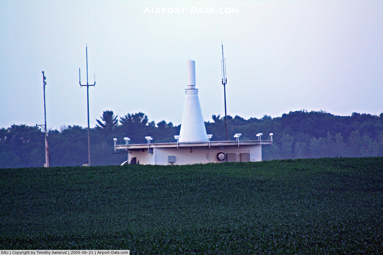
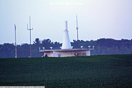
Images and information placed above are from
http://www.airport-data.com/airport/EAU/
We thank them for the data!
| General Info
|
| Country |
United States
|
| State |
WISCONSIN
|
| FAA ID |
EAU
|
| Latitude |
44-51-54.926N
|
| Longitude |
091-29-06.259W
|
| Elevation |
907 feet
|
| Near City |
EAU CLAIRE
|
We don't guarantee the information is fresh and accurate. The data may
be wrong or outdated.
For more up-to-date information please refer to other sources.
|
|