 |
|
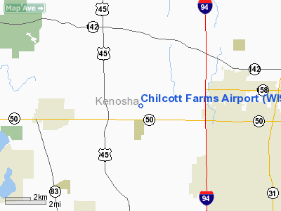
Location & QuickFacts
| FAA Information Effective: | 2008-09-25 |
| Airport Identifier: | WI95 |
| Airport Status: | Operational |
| Longitude/Latitude: | 088-00-55.2950W/42-34-40.0680N
-88.015360/42.577797 (Estimated) |
| Elevation: | 700 ft / 213.36 m (Estimated) |
| Land: | 40 acres |
| From nearest city: | 4 nautical miles E of Paddock Lake, WI |
| Location: | Kenosha County, WI |
| Magnetic Variation: | 01W (1985) |
Owner & Manager
| Ownership: | Privately owned |
| Owner: | Bret & Leslie Chilcott |
| Address: | Airstrip Rd., 17001 60th St.
Bristol, WI 53104 |
| Phone number: | 414-857-9373 |
| Manager: | Bret A. Chilcott |
| Address: | Airstrip Rd., 17001 60th St.
Bristol, WI 53104 |
| Phone number: | 414-857-9373 |
Airport Operations and Facilities
| Airport Use: | Private
PERSONAL USE. |
| Wind indicator: | Yes |
| Segmented Circle: | No |
| Control Tower: | No |
| Sectional chart: | Chicago |
| Region: | AGL - Great Lakes |
| Boundary ARTCC: | ZAU - Chicago |
| Tie-in FSS: | GRB - Green Bay |
| FSS on Airport: | No |
| FSS Toll Free: | 1-800-WX-BRIEF |
Runway Information
Runway 18/36
| Dimension: | 2000 x 75 ft / 609.6 x 22.9 m |
| Surface: | TURF, |
| |
Runway 18 |
Runway 36 |
| Traffic Pattern: | Right | Left |
| Obstruction: | 40 ft trees, 60.0 ft from runway | 35 ft plines, 400.0 ft from runway |
|
Radio Navigation Aids
| ID |
Type |
Name |
Ch |
Freq |
Var |
Dist |
| RA | NDB | Paser | | 206.00 | 00E | 8.1 nm |
| GM | NDB | Teels | | 242.00 | 02W | 19.9 nm |
| LVV | NDB | Lake Lawn | | 404.00 | 00W | 26.6 nm |
| BL | NDB | Yanks | | 260.00 | 02W | 29.6 nm |
| UES | NDB | Waukesha | | 359.00 | 01W | 29.7 nm |
| ME | NDB | Deana | | 350.00 | 00E | 36.7 nm |
| JVL | NDB | Janesville | | 375.00 | 03E | 45.4 nm |
| RYV | NDB | Rock River | | 371.00 | 01W | 47.5 nm |
| HXF | NDB | Hartford | | 200.00 | 00E | 49.2 nm |
| DKB | NDB | Dekalb | | 209.00 | 02W | 49.4 nm |
| ENW | VOR/DME | Kenosha | 029X | 109.20 | 02W | 3.9 nm |
| HRK | VOR/DME | Horlick | 124X | 117.70 | 02W | 14.2 nm |
| BUU | VOR/DME | Burbun | 092X | 114.50 | 01W | 14.3 nm |
| OBK | VOR/DME | Northbrook | 077X | 113.00 | 02W | 21.6 nm |
| LJT | VOR/DME | Timmerman | 072X | 112.50 | 02W | 32.0 nm |
| ORD | VOR/DME | Chicago O'hare | 086X | 113.90 | 02E | 35.8 nm |
| DPA | VOR/DME | Dupage | 021X | 108.40 | 02E | 43.9 nm |
| JVL | VOR/DME | Janesville | 090X | 114.30 | 03E | 48.3 nm |
| BAE | VORTAC | Badger | 111X | 116.40 | 02E | 34.5 nm |
| MKE | VOT | Milwaukee | | 109.00 | | 22.9 nm |
| ORD | VOT | Chicago O'hare Intl | | 112.00 | | 36.1 nm |
| MDW | VOT | Chicago Midway | | 111.00 | | 49.0 nm |
Remarks
- OWNER DESIRES ARPT NOT TO BE CHARTED.
- PRVDD OBSTN IN RY APCH SLOPE SFC BE LOWERED OR REMOVED OR THRS DSPLCD & MKD TO PROVIDE A MINIMUM 20:1 APCH CLNC OVER OBSTNS; AREA 125' EITHER SIDE OF RY CNTRLN CLEAR OF OBSTN.
Images and information placed above are from
http://www.airport-data.com/airport/WI95/
We thank them for the data!
| General Info
|
| Country |
United States
|
| State |
WISCONSIN
|
| FAA ID |
WI95
|
| Latitude |
42-34-40.068N
|
| Longitude |
088-00-55.295W
|
| Elevation |
700 feet
|
| Near City |
PADDOCK LAKE
|
We don't guarantee the information is fresh and accurate. The data may
be wrong or outdated.
For more up-to-date information please refer to other sources.
|
|


