 |
|
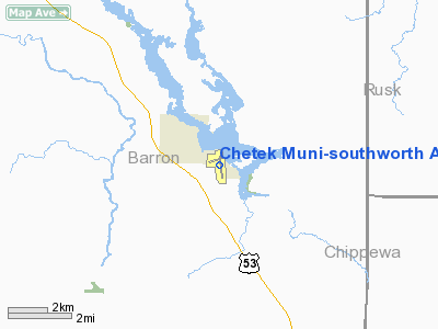
Chetek Muni-southworth Airport |
| Chetek Southworth Municipal Airport |
| IATA: none – ICAO: none – FAA LID: Y23 |
| Summary |
| Airport type |
Public |
| Owner |
City of Chetek |
| Serves |
Chetek, Wisconsin |
| Elevation AMSL |
1,055 ft / 322 m |
| Coordinates |
45°18′22″N 091°38′10″W / 45.30611°N 91.63611°W / 45.30611; -91.63611 |
| Runways |
| Direction |
Length |
Surface |
| ft |
m |
| 17/35 |
3,400 |
1,036 |
Asphalt |
| 7/25 |
1,100 |
335 |
Turf |
| Statistics (2005) |
| Aircraft operations |
7,240 |
| Based aircraft |
51 |
| Source: Airport web page and FAA |
Chetek Southworth Municipal Airport (FAA LID: Y23), also known as Chetek Municipal-Southworth Airport, is a city-owned, public-use airport located one nautical mile (2 km) southeast of the central business district of Chetek, a city in Barron County, Wisconsin, United States.
Facilities and aircraft
Chetek Southworth Municipal Airport covers an area of 92 acres (37 ha) at an elevation of 1,055 feet (322 m) above mean sea level. It has two runways: 17/35 with a 3,400 x 60 ft (1,036 x 18 m) asphalt pavement and 7/25 with a 1,100 x 70 ft (335 x 21 m) turf surface.
For the 12-month period ending September 7, 2005, the airport had 7,240 aircraft operations, an average of 19 per day: 99% general aviation and 1% air taxi. At that time there were 51 aircraft based at this airport: 73% single-engine, 12% multi-engine and 16% ultralight.
The above content comes from Wikipedia and is published under free licenses – click here to read more.
Location & QuickFacts
| FAA Information Effective: | 2008-09-25 |
| Airport Identifier: | Y23 |
| Airport Status: | Operational |
| Longitude/Latitude: | 091-38-10.2140W/45-18-22.3940N
-91.636171/45.306221 (Estimated) |
| Elevation: | 1055 ft / 321.56 m (Surveyed) |
| Land: | 92 acres |
| From nearest city: | 1 nautical miles SE of Chetek, WI |
| Location: | Barron County, WI |
| Magnetic Variation: | 00E (2000) |
Owner & Manager
| Ownership: | Publicly owned |
| Owner: | City Of Chetek |
| Address: | 220 Stout St
Chetek, WI 54728 |
| Phone number: | 715-924-4838 |
| Manager: | Howard Thalacker |
| Address: | 220 Douglas Street
Chetek, WI 54728 |
| Phone number: | 715-924-4811 |
Airport Operations and Facilities
| Airport Use: | Open to public |
| Wind indicator: | Yes |
| Segmented Circle: | No |
| Control Tower: | No |
| Lighting Schedule: | DUSK-DAWN
MIRL RY 17/35 PRESET ON LOW INTST, TO INCR INTST & ACTVT PAPI & REIL RYS 17 & 35 - CTAF. |
| Beacon Color: | Clear-Green (lighted land airport) |
| Landing fee charge: | No |
| Sectional chart: | Green Bay |
| Region: | AGL - Great Lakes |
| Traffic Pattern Alt: | 1000 ft |
| Boundary ARTCC: | ZMP - Minneapolis |
| Tie-in FSS: | GRB - Green Bay |
| FSS on Airport: | No |
| FSS Toll Free: | 1-800-WX-BRIEF |
| NOTAMs Facility: | GRB (NOTAM-d service avaliable) |
Airport Communications
Airport Services
| Fuel available: | 100LL
24 HR SELF SERVICE FUEL. |
| Airframe Repair: | MINOR |
| Power Plant Repair: | MINOR |
| Bottled Oxygen: | NONE |
| Bulk Oxygen: | NONE |
Runway Information
Runway 07/25
| Dimension: | 1100 x 70 ft / 335.3 x 21.3 m |
| Surface: | TURF, Fair Condition |
| |
Runway 07 |
Runway 25 |
| Longitude: | 091-38-26.4920W | 091-38-11.6460W |
| Latitude: | 45-18-28.9120N | 45-18-31.7780N |
| Elevation: | 1048.00 ft | 1052.00 ft |
| Alignment: | 75 | 127 |
| Traffic Pattern: | Left | Left |
| Markings: | None,
RWY 07 /25 THLDS MKD BY YELLOW CONES. | None, |
| Runway End Identifier: | No | No |
| Centerline Lights: | No | No |
| Touchdown Lights: | No | No |
| Obstruction: | 55 ft trees, 1100.0 ft from runway, 175 ft right of centerline, 20:1 slope to clear | 50 ft trees, 1000.0 ft from runway, 160 ft right of centerline, 20:1 slope to clear |
|
Runway 17/35
| Dimension: | 3400 x 60 ft / 1036.3 x 18.3 m |
| Surface: | ASPH, Fair Condition |
| Edge Lights: | Medium |
| |
Runway 17 |
Runway 35 |
| Longitude: | 091-38-09.6000W | 091-38-05.1000W |
| Latitude: | 45-18-36.5380N | 45-18-03.1080N |
| Elevation: | 1054.00 ft | 1055.00 ft |
| Alignment: | 127 | 127 |
| Traffic Pattern: | Left | Left |
| Markings: | Non-precision instrument, Fair Condition | Non-precision instrument, Fair Condition |
| Crossing Height: | 22.00 ft | 29.00 ft |
| Displaced threshold: | 600.00 ft | 0.00 ft |
| VASI: | 2-light PAPI on left side | 2-light PAPI on left side |
| Visual Glide Angle: | 4.00° | 3.00° |
| Runway End Identifier: | Yes | Yes |
| Centerline Lights: | No | No |
| Touchdown Lights: | No | No |
| Obstruction: | 80 ft trees, 1000.0 ft from runway, 180 ft right of centerline, 10:1 slope to clear
APCH RATIO 20:1 TO DSPLCD THLD.
HANGAR 200 FT LEFT. | 13 ft road, 370.0 ft from runway, 13:1 slope to clear |
|
Radio Navigation Aids
| ID |
Type |
Name |
Ch |
Freq |
Var |
Dist |
| UBE | NDB | Cumberland | | 375.00 | 01E | 18.9 nm |
| SSQ | NDB | Shell Lake | | 212.00 | 01E | 28.0 nm |
| RCX | NDB | Rusk County | | 356.00 | 00W | 29.3 nm |
| AHH | NDB | Ameron | | 278.00 | 01E | 31.1 nm |
| RNH | NDB | New Richmond | | 257.00 | 02E | 39.2 nm |
| BXR | NDB | Big Doctor | | 203.00 | 02E | 43.6 nm |
| OEO | NDB | Osceola | | 233.00 | 01E | 44.5 nm |
| SLY | NDB | Seeley | | 344.00 | 01E | 49.6 nm |
| RPD | VOR/DME | Rice Lake | 037X | 110.00 | 01E | 8.9 nm |
| HYR | VOR/DME | Hayward | 081X | 113.40 | 03E | 43.6 nm |
| RZN | VOR/DME | Siren | 031X | 109.40 | 02E | 43.8 nm |
| EAU | VORTAC | Eau Claire | 076X | 112.90 | 04E | 25.5 nm |
Remarks
- RY 07/25 NOT PLOWED; RY CLSD NOV 15 THRU APR 15.
- RY 17/35 MAY NOT BE PLOWED FOR 24-48 HRS AFT HVY SNOWFALL OR DRIFTING SNOW.
Images and information placed above are from
http://www.airport-data.com/airport/Y23/
We thank them for the data!
| General Info
|
| Country |
United States
|
| State |
WISCONSIN
|
| FAA ID |
Y23
|
| Latitude |
45-18-22.394N
|
| Longitude |
091-38-10.214W
|
| Elevation |
1055 feet
|
| Near City |
CHETEK
|
We don't guarantee the information is fresh and accurate. The data may
be wrong or outdated.
For more up-to-date information please refer to other sources.
|
|


