|
|
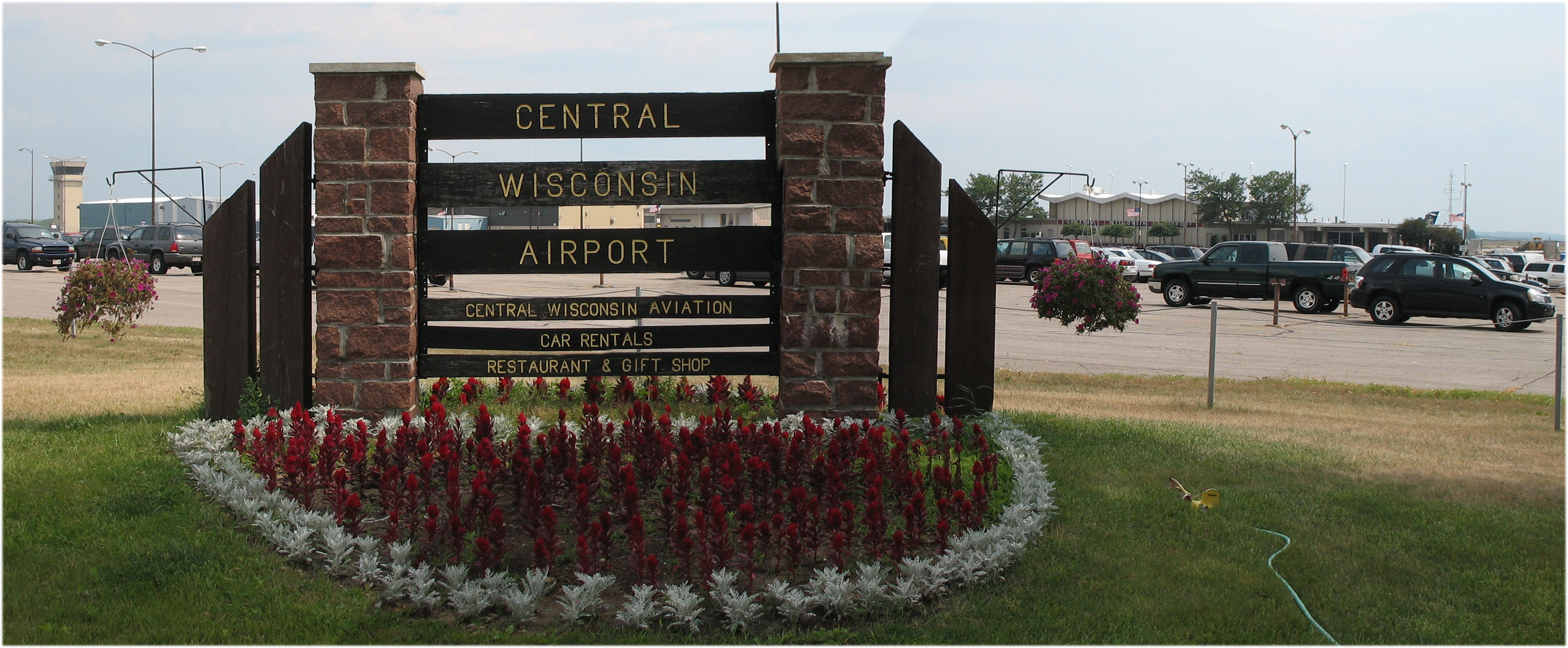
Central Wisconsin Airport |
| Central Wisconsin Airport |
 |
| IATA: CWA – ICAO: KCWA – FAA LID: CWA |
| Summary |
| Airport type |
Public |
| Owner |
Marathon and Portage Counties |
| Operator |
Central Wisconsin Joint Airport Board |
| Location |
Mosinee, Wisconsin |
| Elevation AMSL |
1,277 ft / 389 m |
| Coordinates |
44°46′39″N 089°40′00″W / 44.7775°N 89.6666667°W / 44.7775; -89.6666667Coordinates: 44°46′39″N 089°40′00″W / 44.7775°N 89.6666667°W / 44.7775; -89.6666667 |
| Website |
www.fly-cwa.org |
| Runways |
| Direction |
Length |
Surface |
| ft |
m |
| 8/26 |
7,645 |
2,330 |
Concrete |
| 17/35 |
6,500 |
1,981 |
Concrete |
| Statistics (2006) |
| Aircraft operations |
29,151 |
| Based aircraft |
50 |
| Source: Federal Aviation Administration |
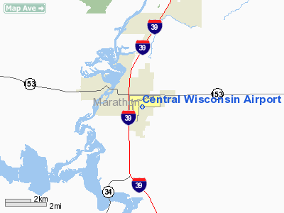
Central Wisconsin Airport (IATA: CWA, ICAO: KCWA, FAA LID: CWA), referred to as "C-Way", is a public airport located 5 miles (8 km) southeast of the central business district of Mosinee, in Marathon County, Wisconsin, United States. It is owned by Marathon County and Portage County.
The airport serves the cities of Stevens Point, Wausau, Marshfield, Wisconsin Rapids, tourism communities in northern Wisconsin, and the smaller exurbs of Hatley, Bevent, Rosholt, and Five Corners. It is 10 miles (16 km) south-southeast of Granite Peak Ski Area, located in Rib Mountain State Park. Facilities and aircraft
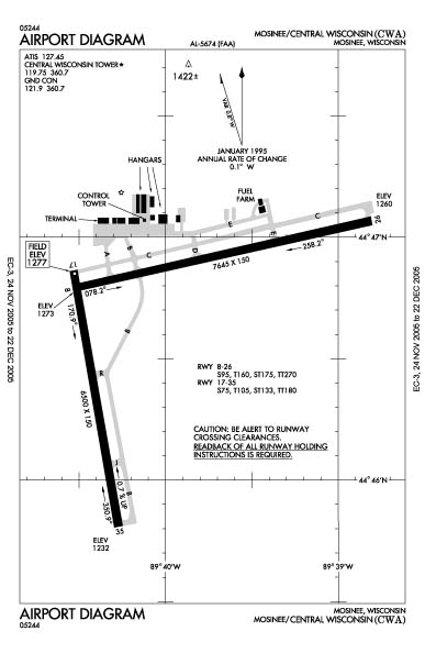
Central Wisconsin Airport covers an area of 1,800 acres (728 ha) which contains two concrete paved runways: 8/26 measuring 7,645 x 150 ft (2,330 x 46 m) and 17/35 measuring 6,500 x 150 ft (1,981 x 46 m). For the 12-month period ending August 31, 2008, the airport had an average of 62 aircraft operations per day: 52% scheduled commercial, 43% general aviation and 5% military.
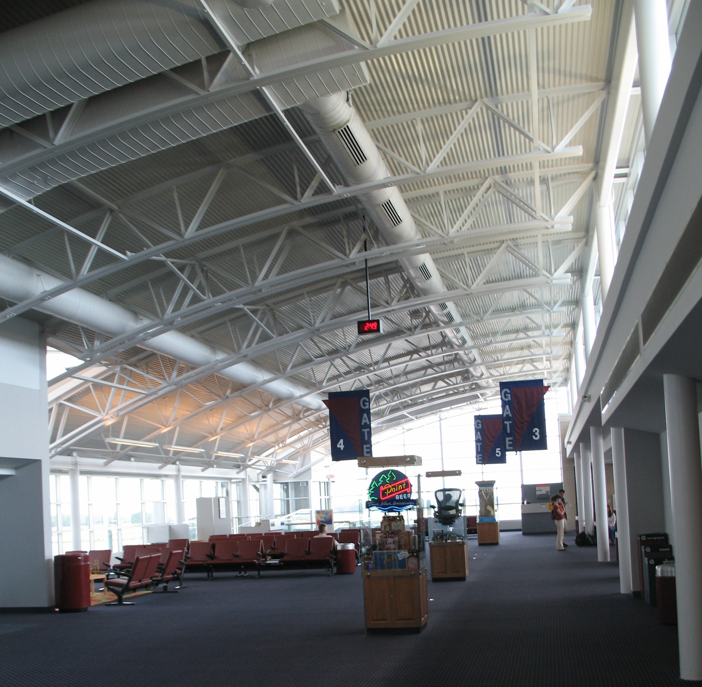
In 1997, the terminal was modernized with five new gates, and the highway access has been reconstructed. A 2005 master plan calls for relocation of the main terminal to a central location on the airport site. The final design can be viewed here: [1]
CWA has T-Hangars for lease or an individual or corporation can construct their own hangar.
Airlines and destinations
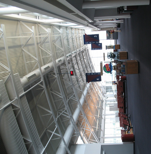 | |
Gate area |
{{Airport-dest-list | American Connection operated by Chautauqua Airlines | Chicago-O'Hare | Delta Connection operated by Mesaba Airlines | Detroit, Minneapolis/St. Paul | Delta Connection operated by Pinnacle Airlines | Detroit, Minneapolis/St. Paul | United Express operated by SkyWest Airlines | Chicago-O'Hare, Eau Claire | United Express operated by Mesa Airlines | Chicago-O'Hare
Cargo
 | |
November 2006 Airport Diagram |
The above content comes from Wikipedia and is published under free licenses – click here to read more.
Location & QuickFacts
| FAA Information Effective: | 2008-09-25 |
| Airport Identifier: | CWA |
| Airport Status: | Operational |
| Longitude/Latitude: | 089-40-00.4060W/44-46-39.4290N
-89.666779/44.777619 (Estimated) |
| Elevation: | 1277 ft / 389.23 m (Surveyed) |
| Land: | 1800 acres |
| From nearest city: | 3 nautical miles SE of Mosinee, WI |
| Location: | Marathon County, WI |
| Magnetic Variation: | 00E (1985) |
Owner & Manager
| Ownership: | Publicly owned |
| Owner: | Marathon And Portage Co |
| Address: | 200 Cwa Dr. Suite 201
Mosinee, WI 54455 |
| Phone number: | 715-693-2147 |
| Manager: | Tony Yaron |
| Address: | 200 Cwa Dr. Suite 201
Mosinee, WI 54455 |
| Phone number: | 715-693-2147
EXT. 7. |
Airport Operations and Facilities
| Airport Use: | Open to public |
| Wind indicator: | Yes |
| Segmented Circle: | No |
| Control Tower: | Yes |
| Lighting Schedule: | DUSK-DAWN
WHEN ATCT CLSD ACTVT MALSR RYS 08 & 35 - CTAF ACTVT HIRL RYS 17/35 & 08/26 & PAPI RY 26 - CTAF. VASI RY 17 OPER 24 HRS. |
| Beacon Color: | Clear-Green (lighted land airport) |
| Landing fee charge: | No |
| Sectional chart: | Green Bay |
| Region: | AGL - Great Lakes |
| Boundary ARTCC: | ZMP - Minneapolis |
| Tie-in FSS: | GRB - Green Bay |
| FSS on Airport: | No |
| FSS Toll Free: | 1-800-WX-BRIEF |
| NOTAMs Facility: | CWA (NOTAM-d service avaliable) |
| Certification type/date: | I A S 05/1973
48 HR PPR FOR UNSKED ACR OPNS WITH MORE THAN 30 PSGR SEATS CALL AMGR 715-693-2147. |
| Federal Agreements: | NGY |
Airport Communications
| CTAF: | 119.750 |
| Unicom: | 122.950 |
Airport Services
| Fuel available: | 100LLA |
| Airframe Repair: | MAJOR |
| Power Plant Repair: | MAJOR |
| Bottled Oxygen: | NONE |
| Bulk Oxygen: | HIGH |
Runway Information
Runway 08/26
| Dimension: | 7645 x 150 ft / 2330.2 x 45.7 m |
| Surface: | CONC, Good Condition |
| Surface Treatment: | Saw-cut or plastic Grooved |
| Weight Limit: | Single wheel: 95000 lbs.
Dual wheel: 160000 lbs.
Dual tandem wheel: 270000 lbs. |
| Edge Lights: | High |
| |
Runway 08 |
Runway 26 |
| Longitude: | 089-40-31.9190W | 089-38-48.4950W |
| Latitude: | 44-46-47.5620N | 44-47-04.0610N |
| Elevation: | 1273.00 ft | 1260.00 ft |
| Alignment: | 77 | 127 |
| ILS Type: | ILS/DME
| |
| Traffic Pattern: | Left | Left |
| Markings: | Precision instrument, Good Condition | Precision instrument, Good Condition |
| Crossing Height: | 0.00 ft | 49.00 ft |
| VASI: | | 4-light PAPI on left side |
| Visual Glide Angle: | 0.00° | 3.00° |
| Approach lights: | MALSR | |
| Runway End Identifier: | No | Yes |
| Centerline Lights: | No | No |
| Touchdown Lights: | No | No |
|
Runway 17/35
| Dimension: | 6500 x 150 ft / 1981.2 x 45.7 m |
| Surface: | CONC, Good Condition |
| Surface Treatment: | Saw-cut or plastic Grooved |
| Weight Limit: | Single wheel: 75000 lbs.
Dual wheel: 105000 lbs.
Dual tandem wheel: 180000 lbs. |
| Edge Lights: | High |
| |
Runway 17 |
Runway 35 |
| Longitude: | 089-40-31.9530W | 089-40-16.3710W |
| Latitude: | 44-46-51.7680N | 44-45-48.5540N |
| Elevation: | 1277.00 ft | 1232.00 ft |
| Alignment: | 127 | 127 |
| ILS Type: | | ILS/DME
|
| Traffic Pattern: | Left | Left |
| Markings: | Non-precision instrument, Fair Condition | Precision instrument, Fair Condition |
| Crossing Height: | 42.00 ft | 0.00 ft |
| VASI: | 4-box on left side | |
| Visual Glide Angle: | 3.00° | 0.00° |
| Approach lights: | | MALSR |
| Runway End Identifier: | Yes | |
| Centerline Lights: | No | No |
| Touchdown Lights: | No | No |
|
Radio Navigation Aids
| ID |
Type |
Name |
Ch |
Freq |
Var |
Dist |
| FZK | NDB | Wausau | | 243.00 | 01E | 9.2 nm |
| MFI | NDB | Marshfield | | 391.00 | 00E | 23.7 nm |
| RRL | NDB | Merrill | | 257.00 | 01W | 25.4 nm |
| ISW | NDB | Wisconsin Rapids | | 215.00 | 01W | 25.9 nm |
| AIG | NDB | Antigo | | 347.00 | 02W | 32.8 nm |
| MDZ | NDB | Medford | | 335.00 | 00E | 33.7 nm |
| VIQ | NDB | Neillsville | | 368.00 | 01W | 38.6 nm |
| PCZ | NDB | Waupaca | | 382.00 | 01W | 38.7 nm |
| CLI | NDB | Clintonville | | 209.00 | 02W | 41.0 nm |
| AUW | VORTAC | Wausau | 053X | 111.60 | 02E | 5.4 nm |
| STE | VORTAC | Stevens Point | 043X | 110.60 | 01W | 15.2 nm |
Remarks
- TWY E; NORTH OF TWY C IS NOT AVBL FOR ACR OPNS OVR 60000 LBS.
- LANDING FEE FOR ACFT PROVIDING COMMERICAL SVCS.
Images and information placed above are from
http://www.airport-data.com/airport/CWA/
We thank them for the data!
| General Info
|
| Country |
United States
|
| State |
WISCONSIN
|
| FAA ID |
CWA
|
| Latitude |
44-46-39.429N
|
| Longitude |
089-40-00.406W
|
| Elevation |
1277 feet
|
| Near City |
MOSINEE
|
We don't guarantee the information is fresh and accurate. The data may
be wrong or outdated.
For more up-to-date information please refer to other sources.
|
|