 |
|
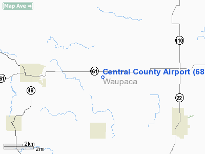
Location & QuickFacts
| FAA Information Effective: | 2008-09-25 |
| Airport Identifier: | 68C |
| Airport Status: | Operational |
| Longitude/Latitude: | 089-01-30.3940W/44-30-19.9320N
-89.025109/44.505537 (Estimated) |
| Elevation: | 876 ft / 267.00 m (Estimated) |
| Land: | 120 acres |
| From nearest city: | 4 nautical miles E of Iola, WI |
| Location: | Waupaca County, WI |
| Magnetic Variation: | 01W (1985) |
Owner & Manager
| Ownership: | Privately owned |
| Owner: | Central County Flyers |
| Address: | Rr 1
Manawa, WI 54949 |
| Phone number: | 920-244-7808 |
| Manager: | Bill Kinsman |
| Address: | 716 S. Bridge Road
Manawa, WI 54849 |
| Phone number: | 920-596-3400 |
Airport Operations and Facilities
| Airport Use: | Open to public |
| Wind indicator: | Yes |
| Segmented Circle: | Yes |
| Control Tower: | No |
| Landing fee charge: | No |
| Sectional chart: | Green Bay |
| Region: | AGL - Great Lakes |
| Traffic Pattern Alt: | 1000 ft |
| Boundary ARTCC: | ZMP - Minneapolis |
| Tie-in FSS: | GRB - Green Bay |
| FSS on Airport: | No |
| FSS Toll Free: | 1-800-WX-BRIEF |
| NOTAMs Facility: | GRB (NOTAM-d service avaliable) |
Airport Communications
Airport Services
| Airframe Repair: | MAJOR |
| Power Plant Repair: | MAJOR |
| Bottled Oxygen: | NONE |
| Bulk Oxygen: | NONE |
Runway Information
Runway 04/22
| Dimension: | 2530 x 60 ft / 771.1 x 18.3 m |
| Surface: | TURF, Fair Condition |
| |
Runway 04 |
Runway 22 |
| Longitude: | 089-01-45.6300W | 089-01-18.1600W |
| Latitude: | 44-30-10.8000N | 44-30-26.0600N |
| Elevation: | 871.00 ft | 870.00 ft |
| Traffic Pattern: | Left | Left |
| Runway End Identifier: | No | No |
| Centerline Lights: | No | No |
| Touchdown Lights: | No | No |
| Obstruction: | 35 ft trees, 50.0 ft from runway, 110 ft right of centerline, 1:1 slope to clear | 59 ft tree, 650.0 ft from runway, 110 ft left of centerline, 11:1 slope to clear |
|
Runway 09/27
| Dimension: | 1800 x 120 ft / 548.6 x 36.6 m |
| Surface: | TURF, Fair Condition |
| |
Runway 09 |
Runway 27 |
| Longitude: | 089-01-44.6400W | 089-01-20.1500W |
| Latitude: | 44-30-15.9300N | 44-30-15.9300N |
| Elevation: | 871.00 ft | 876.00 ft |
| Traffic Pattern: | Left | Left |
| Runway End Identifier: | No | No |
| Centerline Lights: | No | No |
| Touchdown Lights: | No | No |
| Obstruction: | 35 ft trees, 110 ft right of centerline | 58 ft tree, 700.0 ft from runway, 200 ft right of centerline, 11:1 slope to clear |
|
Runway 13/31
| Dimension: | 1745 x 130 ft / 531.9 x 39.6 m |
| Surface: | TURF, Fair Condition |
| |
Runway 13 |
Runway 31 |
| Longitude: | 089-01-40.7300W | 089-01-19.7200W |
| Latitude: | 44-30-21.6800N | 44-30-13.6700N |
| Elevation: | 871.00 ft | 876.00 ft |
| Traffic Pattern: | Left | Left |
| Runway End Identifier: | No | No |
| Centerline Lights: | No | No |
| Touchdown Lights: | No | No |
| Obstruction: | 30 ft trees, 10.0 ft from runway, 100 ft right of centerline | 65 ft trees, 800.0 ft from runway, 80 ft right of centerline, 12:1 slope to clear |
|
Radio Navigation Aids
| ID |
Type |
Name |
Ch |
Freq |
Var |
Dist |
| PCZ | NDB | Waupaca | | 382.00 | 01W | 10.4 nm |
| CLI | NDB | Clintonville | | 209.00 | 02W | 14.2 nm |
| AQ | NDB | Kooky | | 407.00 | 02W | 32.0 nm |
| ISW | NDB | Wisconsin Rapids | | 215.00 | 01W | 36.0 nm |
| FZK | NDB | Wausau | | 243.00 | 01E | 36.1 nm |
| SG | NDB | Depre | | 332.00 | 02W | 38.8 nm |
| AIG | NDB | Antigo | | 347.00 | 02W | 39.4 nm |
| STE | VORTAC | Stevens Point | 043X | 110.60 | 01W | 21.8 nm |
| AUW | VORTAC | Wausau | 053X | 111.60 | 02E | 31.6 nm |
| GRB | VORTAC | Green Bay | 102X | 115.50 | 01E | 35.7 nm |
| OSH | VORTAC | Oshkosh | 055X | 111.80 | 02E | 37.0 nm |
Remarks
- ARPT CLSD TO WHEELED ACFT WHEN RYS COVERED WITH SNOW OR ICE. SKI TFC USE RY 04/22 ONLY.
- DEER ON & INVOF ARPT.
- EXISTED PRIOR TO 1959.
Images and information placed above are from
http://www.airport-data.com/airport/68C/
We thank them for the data!
| General Info
|
| Country |
United States
|
| State |
WISCONSIN
|
| FAA ID |
68C
|
| Latitude |
44-30-19.932N
|
| Longitude |
089-01-30.394W
|
| Elevation |
876 feet
|
| Near City |
IOLA
|
We don't guarantee the information is fresh and accurate. The data may
be wrong or outdated.
For more up-to-date information please refer to other sources.
|
|


