 |
|
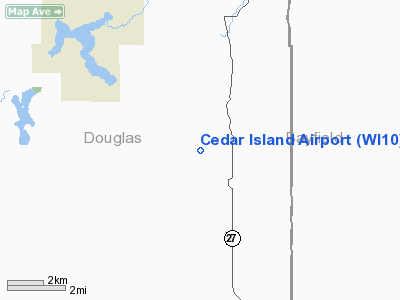
Location & QuickFacts
| FAA Information Effective: | 2008-09-25 |
| Airport Identifier: | WI10 |
| Airport Status: | Operational |
| Longitude/Latitude: | 091-37-00.6830W/46-26-59.7910N
-91.616856/46.449942 (Estimated) |
| Elevation: | 1229 ft / 374.60 m (Estimated) |
| Land: | 0 acres |
| From nearest city: | 6 nautical miles S of Brule, WI |
| Location: | Douglas County, WI |
| Magnetic Variation: | 01E (1985) |
Owner & Manager
| Ownership: | Privately owned |
| Owner: | J G Ordway Jr |
| Address: | Cedar Island Causeway Ltd, 1500 Pioneer Bldg
St Paul, MN 55101-1507 |
| Manager: | John D. Swanson |
| Address: | Po Box 106
Brule, WI 54820-0106 |
| Phone number: | 715-372-4824 |
Airport Operations and Facilities
| Airport Use: | Private |
| Wind indicator: | Yes |
| Segmented Circle: | No |
| Control Tower: | No |
| Landing fee charge: | No |
| Sectional chart: | Green Bay |
| Region: | AGL - Great Lakes |
| Boundary ARTCC: | ZMP - Minneapolis |
| Tie-in FSS: | GRB - Green Bay |
| FSS on Airport: | No |
| FSS Toll Free: | 1-800-WX-BRIEF |
Airport Services
| Airframe Repair: | NONE |
| Power Plant Repair: | NONE |
Runway Information
Runway NE/SW
| Dimension: | 3800 x 150 ft / 1158.2 x 45.7 m |
| Surface: | TURF, |
| |
Runway NE |
Runway SW |
| Traffic Pattern: | Left | Left |
|
Runway NW/SE
| Dimension: | 1400 x 150 ft / 426.7 x 45.7 m |
| Surface: | TURF, |
| |
Runway NW |
Runway SE |
| Traffic Pattern: | Left | Left |
|
Radio Navigation Aids
| ID |
Type |
Name |
Ch |
Freq |
Var |
Dist |
| OLG | NDB | Solon Springs | | 388.00 | 01E | 11.4 nm |
| SLY | NDB | Seeley | | 344.00 | 01E | 22.5 nm |
| SUW | NDB | Bong | | 260.00 | 01E | 24.8 nm |
| ENY | NDB | Kennedy | | 254.00 | 02E | 29.7 nm |
| TWM | NDB | Two Harbors | | 243.00 | 01E | 36.6 nm |
| DL | NDB | Pykla | | 379.00 | 02E | 38.6 nm |
| COQ | NDB | Cloquet | | 335.00 | 03E | 39.5 nm |
| SSQ | NDB | Shell Lake | | 212.00 | 01E | 45.2 nm |
| BFW | NDB | Silver Bay | | 350.00 | 00E | 48.8 nm |
| BXR | NDB | Big Doctor | | 203.00 | 02E | 49.0 nm |
| MZH | NDB | Moose Lake | | 362.00 | 02E | 49.2 nm |
| LKI | TACAN | Lakeside | 011X | | 05E | 33.4 nm |
| HYR | VOR/DME | Hayward | 081X | 113.40 | 03E | 26.9 nm |
| ASX | VOR/DME | Ashland | 039X | 110.20 | 02E | 29.6 nm |
| RZN | VOR/DME | Siren | 031X | 109.40 | 02E | 49.3 nm |
| DLH | VORTAC | Duluth | 073X | 112.60 | 05E | 32.1 nm |
Remarks
- ARPT NOT ACTIVELY USED. GRASS COULD BE LONG IN THE SUMMER.
- PRIOR TO 1959.
Images and information placed above are from
http://www.airport-data.com/airport/WI10/
We thank them for the data!
| General Info
|
| Country |
United States
|
| State |
WISCONSIN
|
| FAA ID |
WI10
|
| Latitude |
46-26-59.791N
|
| Longitude |
091-37-00.683W
|
| Elevation |
1229 feet
|
| Near City |
BRULE
|
We don't guarantee the information is fresh and accurate. The data may
be wrong or outdated.
For more up-to-date information please refer to other sources.
|
|


