 |
|
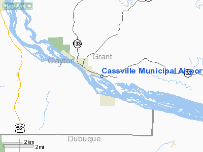
Location & QuickFacts
| FAA Information Effective: | 2008-09-25 |
| Airport Identifier: | C74 |
| Airport Status: | Operational |
| Longitude/Latitude: | 090-57-52.4600W/42-42-14.9760N
-90.964572/42.704160 (Estimated) |
| Elevation: | 627 ft / 191.11 m (Estimated) |
| Land: | 60 acres |
| From nearest city: | 1 nautical miles SE of Cassville, WI |
| Location: | Grant County, WI |
| Magnetic Variation: | 02E (1985) |
Owner & Manager
| Ownership: | Publicly owned |
| Owner: | Village Of Cassville |
| Address: | Village Hall
Cassville, WI 53806 |
| Phone number: | 608-725-5180 |
| Manager: | Al Muller |
| Address: | 117 1/1 Front St
Cassville, WI 53806 |
| Phone number: | 608-725-2362 |
Airport Operations and Facilities
| Airport Use: | Open to public |
| Wind indicator: | Yes |
| Segmented Circle: | No |
| Control Tower: | No |
| Lighting Schedule: | DUSK-DAWN |
| Landing fee charge: | No |
| Sectional chart: | Chicago |
| Region: | AGL - Great Lakes |
| Boundary ARTCC: | ZAU - Chicago |
| Tie-in FSS: | GRB - Green Bay |
| FSS on Airport: | No |
| FSS Toll Free: | 1-800-WX-BRIEF |
| NOTAMs Facility: | GRB (NOTAM-d service avaliable) |
Airport Communications
Airport Services
| Airframe Repair: | NONE |
| Power Plant Repair: | NONE |
| Bottled Oxygen: | NONE |
| Bulk Oxygen: | NONE |
Runway Information
Runway 11/29
| Dimension: | 3000 x 50 ft / 914.4 x 15.2 m |
| Surface: | ASPH, Fair Condition |
| Weight Limit: | Single wheel: 21000 lbs.
Dual wheel: 40000 lbs. |
| Edge Lights: | Low |
| |
Runway 11 |
Runway 29 |
| Longitude: | 090-58-10.2300W | 090-57-34.6900W |
| Latitude: | 42-42-21.8900N | 42-42-08.0600N |
| Elevation: | 627.00 ft | 627.00 ft |
| Traffic Pattern: | Right | Left |
| Markings: | Basic, Fair Condition | Basic, Fair Condition |
| Displaced threshold: | 0.00 ft | 600.00 ft |
| Runway End Identifier: | No | No |
| Centerline Lights: | No | No |
| Touchdown Lights: | No | No |
| Obstruction: | 30 ft tree, 200.0 ft from runway, 105 ft left of centerline
30 FT BRUSH 0-200 FT FM THR 105 FT L. | 15 ft road, 200.0 ft from runway, 90 ft left of centerline
RWY 29 RY 19 HAS 40 FT TREE650 FT FM DSPLCD THR 166 FT L; APCH RATIO 16:1 TO DSPLCD THR.
4 FT FENCE 70 FT L & ROAD 90 FT L OF EXTDD CNTRLN. |
|
Radio Navigation Aids
| ID |
Type |
Name |
Ch |
Freq |
Var |
Dist |
| PVB | NDB | Platteville | | 203.00 | 01E | 23.3 nm |
| MXO | NDB | Monticello | | 397.00 | 01E | 31.2 nm |
| MRJ | NDB | Mineral Point | | 365.00 | 00W | 34.4 nm |
| XWY | NDB | West Union | | 278.00 | 02E | 38.8 nm |
| OQW | NDB | Maquoketa | | 386.00 | 02E | 40.5 nm |
| OLZ | NDB | Oelwein | | 260.00 | 02E | 44.7 nm |
| IIB | NDB | Wapsie | | 206.00 | 02E | 46.2 nm |
| DEH | NDB | Decorah | | 236.00 | 01E | 48.3 nm |
| DBQ | VORTAC | Dubuque | 105X | 115.80 | 04E | 21.4 nm |
| UKN | VORTAC | Waukon | 113X | 116.60 | 05E | 42.8 nm |
Remarks
- 1350'X 20' TWY WEST END RWY 11.
- 200' STACK 3900' W RY 11.
- 270'BLUFF PARALLELS RWY 800'N.
- FOR WINTER COND & SNOW REMOVAL CALL AMGR 608-725-5895
- EST PRIOR TO 1959.
Images and information placed above are from
http://www.airport-data.com/airport/C74/
We thank them for the data!
| General Info
|
| Country |
United States
|
| State |
WISCONSIN
|
| FAA ID |
C74
|
| Latitude |
42-42-14.976N
|
| Longitude |
090-57-52.460W
|
| Elevation |
627 feet
|
| Near City |
CASSVILLE
|
We don't guarantee the information is fresh and accurate. The data may
be wrong or outdated.
For more up-to-date information please refer to other sources.
|
|


