 |
|
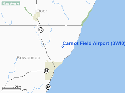
Location & QuickFacts
| FAA Information Effective: | 2008-09-25 |
| Airport Identifier: | 3WI0 |
| Airport Status: | Operational |
| Longitude/Latitude: | 087-25-11.3250W/44-38-31.9980N
-87.419813/44.642222 (Estimated) |
| Elevation: | 655 ft / 199.64 m (Estimated) |
| Land: | 3 acres |
| From nearest city: | 2 nautical miles N of Algoma, WI |
| Location: | Kewaunee County, WI |
| Magnetic Variation: | 03W (1990) |
Owner & Manager
| Ownership: | Privately owned |
| Owner: | Bruce H Steinhagen |
| Address: | 1020 Lakeview Dr
Algoma, WI 54201 |
| Phone number: | 414-487-3581 |
| Manager: | Bruce H Steinhagen |
| Address: | 1020 Lakeview Dr
Algoma, WI 54201 |
| Phone number: | 414-487-3581 |
Airport Operations and Facilities
| Airport Use: | Private |
| Wind indicator: | Yes |
| Segmented Circle: | No |
| Control Tower: | No |
| Sectional chart: | Green Bay |
| Region: | AGL - Great Lakes |
| Boundary ARTCC: | ZMP - Minneapolis |
| Tie-in FSS: | GRB - Green Bay |
| FSS Toll Free: | 1-800-WX-BRIEF |
Runway Information
Runway 09/27
| Dimension: | 1100 x 60 ft / 335.3 x 18.3 m |
| Surface: | TURF, |
| |
Runway 09 |
Runway 27 |
| Traffic Pattern: | Left | Left |
|
Runway 18/36
| Dimension: | 1700 x 60 ft / 518.2 x 18.3 m |
| Surface: | TURF, |
| |
Runway 18 |
Runway 36 |
| Traffic Pattern: | Left | Left |
|
Radio Navigation Aids
| ID |
Type |
Name |
Ch |
Freq |
Var |
Dist |
| SUE | NDB | Sturgeon Bay | | 414.00 | 03W | 11.7 nm |
| OCQ | NDB | Oconto | | 388.00 | 03W | 25.3 nm |
| SG | NDB | Depre | | 332.00 | 02W | 33.9 nm |
| AQ | NDB | Kooky | | 407.00 | 02W | 49.2 nm |
| MTW | VOR/DME | Manitowoc | 047X | 111.00 | 02W | 32.8 nm |
| MNM | VOR/DME | Menominee | 033X | 109.60 | 00E | 33.8 nm |
| GRB | VORTAC | Green Bay | 102X | 115.50 | 01E | 33.6 nm |
Remarks
- 125' EITHER SIDE OF CNTRLN & 200' END OF RYS BE CLEAR OF ANY OBS. OBS LOWERED/REMOVED OR THR DSPLCD TO PRVD 20:1 APCH SLOPE.
Images and information placed above are from
http://www.airport-data.com/airport/3WI0/
We thank them for the data!
| General Info
|
| Country |
United States
|
| State |
WISCONSIN
|
| FAA ID |
3WI0
|
| Latitude |
44-38-31.998N
|
| Longitude |
087-25-11.325W
|
| Elevation |
655 feet
|
| Near City |
ALGOMA
|
We don't guarantee the information is fresh and accurate. The data may
be wrong or outdated.
For more up-to-date information please refer to other sources.
|
|


