 |
|
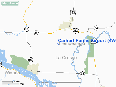
Location & QuickFacts
| FAA Information Effective: | 2008-09-25 |
| Airport Identifier: | 4WI8 |
| Airport Status: | Operational |
| Longitude/Latitude: | 091-22-34.5280W/44-03-04.8630N
-91.376258/44.051351 (Estimated) |
| Elevation: | 737 ft / 224.64 m (Surveyed) |
| Land: | 0 acres |
| From nearest city: | 3 nautical miles SW of Galesville, WI |
| Location: | Trempealeau County, WI |
| Magnetic Variation: | 02E (1985) |
Owner & Manager
| Ownership: | Privately owned |
| Owner: | Tom Carhart |
| Address: | Rr 3
Galesville, WI 54630 |
| Phone number: | 608-582-2796 |
| Manager: | Tom Carhart |
| Address: | Rr 3
Galesville, WI 54630 |
| Phone number: | 608-582-2796 |
Airport Operations and Facilities
| Airport Use: | Private |
| Wind indicator: | Yes |
| Segmented Circle: | No |
| Control Tower: | No |
| Sectional chart: | Green Bay |
| Region: | AGL - Great Lakes |
| Boundary ARTCC: | ZMP - Minneapolis |
| Tie-in FSS: | GRB - Green Bay |
| FSS on Airport: | No |
| FSS Toll Free: | 1-800-WX-BRIEF |
Runway Information
Runway 09/27
| Dimension: | 2500 x 50 ft / 762.0 x 15.2 m |
| Surface: | TURF, |
| |
Runway 09 |
Runway 27 |
| Traffic Pattern: | Left | Left |
| Displaced threshold: | 1300.00 ft | 500.00 ft |
| Obstruction: | 50 ft pline | , 30.0 ft from runway |
|
Radio Navigation Aids
| ID |
Type |
Name |
Ch |
Freq |
Var |
Dist |
| BCK | NDB | Black River Falls | | 362.00 | 00E | 25.8 nm |
| CHU | NDB | Caledonia | | 209.00 | 03E | 28.4 nm |
| CMY | NDB | Mccoy | | 412.00 | 00E | 32.5 nm |
| VIQ | NDB | Neillsville | | 368.00 | 01W | 47.9 nm |
| DEH | NDB | Decorah | | 236.00 | 01E | 49.2 nm |
| VOK | TACAN | Volk | 041X | | 00E | 48.7 nm |
| LSE | VOR/DME | La Crosse | 021X | 108.40 | 02E | 11.7 nm |
| ONA | VOR/DME | Winona | 051X | 111.40 | 01E | 14.3 nm |
| ODI | VORTAC | Nodine | 126X | 117.90 | 01E | 9.2 nm |
| UKN | VORTAC | Waukon | 113X | 116.60 | 05E | 46.9 nm |
Remarks
- EQUIPMENT OCCASSIONALLY BLOCKS RWY.
- NOT MAINTAINED DURG WINTER.
- PROVIDED ALL ARE BRIEFED ON PLINES LCTD E/W ENDS OF RWY IN ADVANCE OF COMMENCING AN APCH,AND ONLY ACTUAL USBL LENGTH IS PUBLISHED.
Images and information placed above are from
http://www.airport-data.com/airport/4WI8/
We thank them for the data!
| General Info
|
| Country |
United States
|
| State |
WISCONSIN
|
| FAA ID |
4WI8
|
| Latitude |
44-03-04.863N
|
| Longitude |
091-22-34.528W
|
| Elevation |
737 feet
|
| Near City |
GALESVILLE
|
We don't guarantee the information is fresh and accurate. The data may
be wrong or outdated.
For more up-to-date information please refer to other sources.
|
|


