 |
|
Location & QuickFacts
| FAA Information Effective: | 2008-09-25 |
| Airport Identifier: | WI24 |
| Airport Status: | Operational |
| Longitude/Latitude: | 089-45-08.0000W/42-52-52.0000N
-89.752222/42.881111 (Estimated) |
| Elevation: | 1080 ft / 329.18 m (Estimated) |
| Land: | 80 acres |
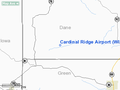
| From nearest city: | 8 nautical miles S of Mt Horeb, WI |
| Location: | Dane County, WI |
| Magnetic Variation: | 01W () |
Owner & Manager
| Ownership: | Privately owned |
| Owner: | Steven Meassick |
| Address: | 650 Perry Center Rd
Mt Horeb, WI 53572 |
| Phone number: | 608-832-0578 |
| Manager: | Steven Meassick |
| Address: | 650 Perry Center Rd
Mt Horeb, WI 53572 |
| Phone number: | 608-832-0578 |
Airport Operations and Facilities
| Airport Use: | Private |
| Segmented Circle: | No |
| Control Tower: | No |
| Sectional chart: | Chicago |
| Region: | AGL - Great Lakes |
| Boundary ARTCC: | ZAU - Chicago |
| Tie-in FSS: | GRB - Green Bay |
| FSS Toll Free: | 1-800-WX-BRIEF |
Runway Information
Runway 03/21
| Dimension: | 1370 x 75 ft / 417.6 x 22.9 m |
| Surface: | TURF, Good Condition |
| |
Runway 03 |
Runway 21 |
| Traffic Pattern: | Left | Left |
|
Radio Navigation Aids
| ID |
Type |
Name |
Ch |
Freq |
Var |
Dist |
| MRJ | NDB | Mineral Point | | 365.00 | 00W | 20.9 nm |
| MS | NDB | Monah | | 400.00 | 00E | 20.9 nm |
| PVB | NDB | Platteville | | 203.00 | 01E | 32.3 nm |
| JVL | NDB | Janesville | | 375.00 | 03E | 35.2 nm |
| FEP | NDB | Freeport | | 335.00 | 00E | 38.9 nm |
| RYV | NDB | Rock River | | 371.00 | 01W | 48.4 nm |
| LNR | VOR/DME | Lone Rock | 075X | 112.80 | 00E | 29.9 nm |
| JVL | VOR/DME | Janesville | 090X | 114.30 | 03E | 34.5 nm |
| RFD | VOR/DME | Rockford | 045X | 110.80 | 01E | 46.4 nm |
| MSN | VORTAC | Madison | 023X | 108.60 | 03E | 24.1 nm |
| DLL | VORTAC | Dells | 117X | 117.00 | 03E | 40.3 nm |
Remarks
- PRVDD CLEAR 20:1 APCHS CLEAR OBSTL FREE ZONE & CLEAR RY SAFETY AREA.
Images and information placed above are from
http://www.airport-data.com/airport/WI24/
We thank them for the data!
| General Info
|
| Country |
United States
|
| State |
WISCONSIN
|
| FAA ID |
WI24
|
| Latitude |
42-52-52.000N
|
| Longitude |
089-45-08.000W
|
| Elevation |
1080 feet
|
| Near City |
MT HOREB
|
We don't guarantee the information is fresh and accurate. The data may
be wrong or outdated.
For more up-to-date information please refer to other sources.
|
|


