 |
|
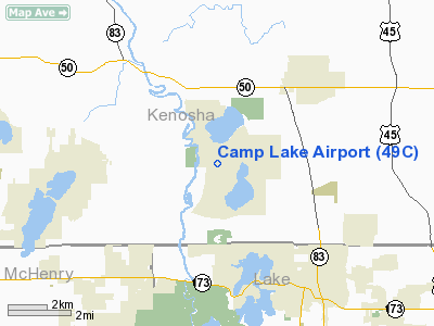
Location & QuickFacts
| FAA Information Effective: | 2008-09-25 |
| Airport Identifier: | 49C |
| Airport Status: | Operational |
| Longitude/Latitude: | 088-09-30.3130W/42-32-00.0670N
-88.158420/42.533352 (Estimated) |
| Elevation: | 755 ft / 230.12 m (Estimated) |
| Land: | 10 acres |
| From nearest city: | 1 nautical miles W of Camp Lake, WI |
| Location: | Kenosha County, WI |
| Magnetic Variation: | 01W (1985) |
Owner & Manager
| Ownership: | Privately owned |
| Owner: | Audrey & Edward Simpson |
| Address: | 22550 W. Washington St.
Antioch, IL 60002 |
| Phone number: | 847-395-4549 |
| Manager: | Ed Simpson |
| Address: | 28701 98th Street
Camp Lake, WI 53109 |
| Phone number: | 262-889-8187 |
Airport Operations and Facilities
| Airport Use: | Open to public |
| Wind indicator: | Yes |
| Segmented Circle: | Yes |
| Control Tower: | No |
| Landing fee charge: | No |
| Sectional chart: | Chicago |
| Region: | AGL - Great Lakes |
| Traffic Pattern Alt: | 600 ft |
| Boundary ARTCC: | ZAU - Chicago |
| Tie-in FSS: | GRB - Green Bay |
| FSS on Airport: | No |
| FSS Toll Free: | 1-800-WX-BRIEF |
| NOTAMs Facility: | GRB (NOTAM-d service avaliable) |
Airport Communications
Airport Services
| Airframe Repair: | MAJOR |
| Power Plant Repair: | MAJOR |
| Bottled Oxygen: | NONE |
| Bulk Oxygen: | NONE |
Runway Information
Runway 18/36
| Dimension: | 2250 x 75 ft / 685.8 x 22.9 m |
| Surface: | TURF, Fair Condition |
| |
Runway 18 |
Runway 36 |
| Longitude: | 088-09-22.3100W | 088-09-22.3100W |
| Latitude: | 42-31-51.2300N | 42-31-28.9100N |
| Elevation: | 755.00 ft | 755.00 ft |
| Traffic Pattern: | Left | Right |
| Obstruction: | 25 ft bldg, 20.0 ft from runway, 80 ft right of centerline | 25 ft trees, 0.0 ft from runway, 100 ft right of centerline |
|
Radio Navigation Aids
| ID |
Type |
Name |
Ch |
Freq |
Var |
Dist |
| RA | NDB | Paser | | 206.00 | 00E | 14.5 nm |
| LVV | NDB | Lake Lawn | | 404.00 | 00W | 21.7 nm |
| GM | NDB | Teels | | 242.00 | 02W | 23.2 nm |
| UES | NDB | Waukesha | | 359.00 | 01W | 30.9 nm |
| BL | NDB | Yanks | | 260.00 | 02W | 34.0 nm |
| ME | NDB | Deana | | 350.00 | 00E | 34.5 nm |
| JVL | NDB | Janesville | | 375.00 | 03E | 39.4 nm |
| DKB | NDB | Dekalb | | 209.00 | 02W | 43.5 nm |
| RYV | NDB | Rock River | | 371.00 | 01W | 45.9 nm |
| ENW | VOR/DME | Kenosha | 029X | 109.20 | 02W | 10.8 nm |
| BUU | VOR/DME | Burbun | 092X | 114.50 | 01W | 11.3 nm |
| HRK | VOR/DME | Horlick | 124X | 117.70 | 02W | 20.5 nm |
| OBK | VOR/DME | Northbrook | 077X | 113.00 | 02W | 20.9 nm |
| ORD | VOR/DME | Chicago O'hare | 086X | 113.90 | 02E | 34.7 nm |
| LJT | VOR/DME | Timmerman | 072X | 112.50 | 02W | 35.1 nm |
| DPA | VOR/DME | Dupage | 021X | 108.40 | 02E | 39.6 nm |
| JVL | VOR/DME | Janesville | 090X | 114.30 | 03E | 42.0 nm |
| RFD | VOR/DME | Rockford | 045X | 110.80 | 01E | 49.8 nm |
| BAE | VORTAC | Badger | 111X | 116.40 | 02E | 35.5 nm |
| MKE | VOT | Milwaukee | | 109.00 | | 27.5 nm |
| ORD | VOT | Chicago O'hare Intl | | 112.00 | | 34.9 nm |
| MDW | VOT | Chicago Midway | | 111.00 | | 48.4 nm |
Remarks
- ARPT NOT PLOWED; CONFIRM CONDS WITH AMGR 262-889-8187.
- ULTRALIGHT ACTVTY ON & IN VCNTY OF ARPT.
- DEER ACTIVITY ON AND INVOF ARPT.
- PRVDD THR DSPLCD SO AS TO PRVD A MINIMUM OF 20-1 CLNC OVER ALL OBSTNS IN APCH AREA; ALL TFC PAT OPNS CONDUCTED ON THE E SIDE OF N/S RWY.
Images and information placed above are from
http://www.airport-data.com/airport/49C/
We thank them for the data!
| General Info
|
| Country |
United States
|
| State |
WISCONSIN
|
| FAA ID |
49C
|
| Latitude |
42-32-00.067N
|
| Longitude |
088-09-30.313W
|
| Elevation |
755 feet
|
| Near City |
CAMP LAKE
|
We don't guarantee the information is fresh and accurate. The data may
be wrong or outdated.
For more up-to-date information please refer to other sources.
|
|


