 |
|
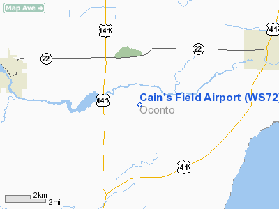
Location & QuickFacts
| FAA Information Effective: | 2008-09-25 |
| Airport Identifier: | WS72 |
| Airport Status: | Operational |
| Longitude/Latitude: | 088-00-43.3700W/44-51-09.9600N
-88.012047/44.852767 (Estimated) |
| Elevation: | 640 ft / 195.07 m (Estimated) |
| Land: | 0 acres |
| From nearest city: | 2 nautical miles E of Stiles, WI |
| Location: | Oconto County, WI |
| Magnetic Variation: | 02W (1990) |
Owner & Manager
| Ownership: | Privately owned |
| Owner: | David W. Cain |
| Address: | 4994 Crawford Rd
Oconto, WI 54153 |
| Phone number: | 414-834-2542 |
| Manager: | David W. Cain |
| Address: | 4994 Crawford Rd
Oconto, WI 54153 |
| Phone number: | 414-834-2542 |
Airport Operations and Facilities
| Airport Use: | Private |
| Segmented Circle: | No |
| Control Tower: | No |
| Sectional chart: | Green Bay |
| Region: | AGL - Great Lakes |
| Boundary ARTCC: | ZMP - Minneapolis |
| Tie-in FSS: | GRB - Green Bay |
| FSS Toll Free: | 1-800-WX-BRIEF |
Runway Information
Runway 18/36
| Dimension: | 1850 x 70 ft / 563.9 x 21.3 m |
| Surface: | TURF, |
| |
Runway 18 |
Runway 36 |
| Traffic Pattern: | Left | Left |
| Obstruction: | 50 ft trees, 500.0 ft from runway | 55 ft trees, 350.0 ft from runway |
|
Radio Navigation Aids
| ID |
Type |
Name |
Ch |
Freq |
Var |
Dist |
| OCQ | NDB | Oconto | | 388.00 | 03W | 4.5 nm |
| SUE | NDB | Sturgeon Bay | | 414.00 | 03W | 25.1 nm |
| SG | NDB | Depre | | 332.00 | 02W | 27.8 nm |
| CLI | NDB | Clintonville | | 209.00 | 02W | 33.9 nm |
| AQ | NDB | Kooky | | 407.00 | 02W | 41.7 nm |
| MNM | VOR/DME | Menominee | 033X | 109.60 | 00E | 25.1 nm |
| MTW | VOR/DME | Manitowoc | 047X | 111.00 | 02W | 45.8 nm |
| GRB | VORTAC | Green Bay | 102X | 115.50 | 01E | 19.5 nm |
Remarks
- PRVDD AREA 125 FT EITHER SIDE OF THE RY CNTRLN & 200 FT FM EITHER END OF THE RY END BE CLEAR OF OBSTN; OBSTN BE LOWERED OR REMOVED. OTHERWISE THE RY THR(S) BE DSPLCD & MKD TO PRVD A 20:1 APCH CLNC OVER OBSTN.
Images and information placed above are from
http://www.airport-data.com/airport/WS72/
We thank them for the data!
| General Info
|
| Country |
United States
|
| State |
WISCONSIN
|
| FAA ID |
WS72
|
| Latitude |
44-51-09.960N
|
| Longitude |
088-00-43.370W
|
| Elevation |
640 feet
|
| Near City |
STILES
|
We don't guarantee the information is fresh and accurate. The data may
be wrong or outdated.
For more up-to-date information please refer to other sources.
|
|


