 |
|
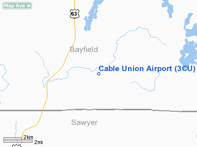
Location & QuickFacts
| FAA Information Effective: | 2008-09-25 |
| Airport Identifier: | 3CU |
| Airport Status: | Operational |
| Longitude/Latitude: | 091-14-47.0750W/46-11-39.2960N
-91.246410/46.194249 (Estimated) |
| Elevation: | 1360 ft / 414.53 m (Surveyed) |
| Land: | 240 acres |
| From nearest city: | 2 nautical miles SE of Cable, WI |
| Location: | Bayfield County, WI |
| Magnetic Variation: | 00E (2000) |
Owner & Manager
| Ownership: | Publicly owned |
| Owner: | Town Of Cable
AND TOWN OF DRUMMOND & NAMEGAGON. |
| Address: | Po Box 476
Cable, WI 54821 |
| Phone number: | 715-798-4440 |
| Manager: | John Sill |
| Address: | Po Box 248
Cable, WI 54821 |
| Phone number: | 715-794-2493 |
Airport Operations and Facilities
| Airport Use: | Open to public |
| Wind indicator: | Yes |
| Segmented Circle: | Yes |
| Control Tower: | No |
| Lighting Schedule: | DUSK-DAWN |
| Beacon Color: | Clear-Green (lighted land airport) |
| Landing fee charge: | No |
| Sectional chart: | Green Bay |
| Region: | AGL - Great Lakes |
| Boundary ARTCC: | ZMP - Minneapolis |
| Tie-in FSS: | GRB - Green Bay |
| FSS on Airport: | No |
| FSS Toll Free: | 1-800-WX-BRIEF |
| NOTAMs Facility: | GRB (NOTAM-d service avaliable) |
| Federal Agreements: | NGY |
Airport Communications
| CTAF: | 122.800 |
| Unicom: | 122.800 |
Airport Services
| Fuel available: | 100LL |
| Airframe Repair: | NONE |
| Power Plant Repair: | NONE |
| Bottled Oxygen: | NONE |
| Bulk Oxygen: | NONE |
Runway Information
Runway 08/26
| Dimension: | 2840 x 200 ft / 865.6 x 61.0 m |
| Surface: | TURF, Good Condition |
| |
Runway 08 |
Runway 26 |
| Longitude: | 091-15-22.1230W | 091-14-42.6620W |
| Latitude: | 46-11-43.9160N | 46-11-49.8330N |
| Alignment: | 78 | 127 |
| Traffic Pattern: | Left | Left |
| Markings: | None,
08/26 MKD WITH ORANGE/WHITE WOODEN A-FRAMES. | None, |
| Displaced threshold: | 400.00 ft | 400.00 ft |
| Runway End Identifier: | No | No |
| Centerline Lights: | No | No |
| Touchdown Lights: | No | No |
| Obstruction: | 92 ft trees, 900.0 ft from runway, 200 ft right of centerline, 9:1 slope to clear
RY 08 APPROACH RATIO 14:1 TO DISPLACED THRESHOLD. | 70 ft trees, 1000.0 ft from runway, 50 ft left of centerline, 14:1 slope to clear
RY 26 APPROACH RATIO 20:1 TO DISPLACED THRESHOLD. |
|
Runway 16/34
| Dimension: | 3709 x 75 ft / 1130.5 x 22.9 m |
| Surface: | ASPH, Good Condition |
| Weight Limit: | Single wheel: 28000 lbs. |
| Edge Lights: | Low |
| |
Runway 16 |
Runway 34 |
| Longitude: | 091-14-53.9760W | 091-14-40.1750W |
| Latitude: | 46-11-56.9650N | 46-11-21.6270N |
| Elevation: | 1347.00 ft | 1360.00 ft |
| Alignment: | 127 | 127 |
| Traffic Pattern: | Left | Left |
| Markings: | Non-precision instrument, Good Condition | Non-precision instrument, Good Condition |
| Runway End Identifier: | Yes | No |
| Centerline Lights: | No | No |
| Touchdown Lights: | No | No |
| Obstruction: | 114 ft tree, 2400.0 ft from runway, 200 ft left of centerline, 19:1 slope to clear
+2 FT RY MARKERS 113 FT FM CNTRLN AT THLD; 15 FT TREES 210 FT L AT THLD. | 95 ft trees, 1100.0 ft from runway, 300 ft left of centerline, 9:1 slope to clear
+2 FT RY MARKERS 113 FT FM CNTRLN AT THLD; 20 FT TREES 190 FT FM THLD 190 FT L & 180 FT R. |
|
Radio Navigation Aids
| ID |
Type |
Name |
Ch |
Freq |
Var |
Dist |
| SLY | NDB | Seeley | | 344.00 | 01E | 7.6 nm |
| OLG | NDB | Solon Springs | | 388.00 | 01E | 24.7 nm |
| ENY | NDB | Kennedy | | 254.00 | 02E | 25.6 nm |
| PKF | NDB | Park Falls | | 371.00 | 01W | 37.2 nm |
| SSQ | NDB | Shell Lake | | 212.00 | 01E | 39.7 nm |
| RCX | NDB | Rusk County | | 356.00 | 00W | 42.9 nm |
| PBH | NDB | Phillips | | 263.00 | 00E | 45.7 nm |
| SUW | NDB | Bong | | 260.00 | 01E | 46.4 nm |
| HYR | VOR/DME | Hayward | 081X | 113.40 | 03E | 13.4 nm |
| ASX | VOR/DME | Ashland | 039X | 110.20 | 02E | 25.3 nm |
Remarks
- RY 08/26 CLSD NOV 21 - MAY 1.
- FOR AMGR AFT HRS CALL 715-794-2493.
- NO HEATING UNITS AVBL TO START ACFT.
Images and information placed above are from
http://www.airport-data.com/airport/3CU/
We thank them for the data!
| General Info
|
| Country |
United States
|
| State |
WISCONSIN
|
| FAA ID |
3CU
|
| Latitude |
46-11-39.296N
|
| Longitude |
091-14-47.075W
|
| Elevation |
1360 feet
|
| Near City |
CABLE
|
We don't guarantee the information is fresh and accurate. The data may
be wrong or outdated.
For more up-to-date information please refer to other sources.
|
|


