 |
|
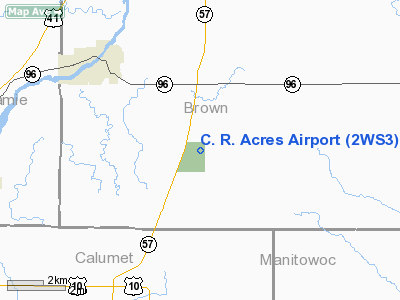
Location & QuickFacts
| FAA Information Effective: | 2008-09-25 |
| Airport Identifier: | 2WS3 |
| Airport Status: | Operational |
| Longitude/Latitude: | 088-05-36.8800W/44-16-49.5400N
-88.093578/44.280428 (Estimated) |
| Elevation: | 800 ft / 243.84 m (Estimated) |
| Land: | 0 acres |
| From nearest city: | 3 nautical miles S of Greenleaf, WI |
| Location: | Brown County, WI |
| Magnetic Variation: | () |
Owner & Manager
| Ownership: | Privately owned |
| Owner: | Raymond L. Gabriel |
| Address: | 7492 St. Pats Church Rd
Greenleaf, WI 54126 |
| Phone number: | 920-532-4437 |
| Manager: | Raymond L. Gabriel |
| Address: | 7492 St. Pats Church Rd
Greenleaf, WI 54126 |
| Phone number: | 920-532-4437 |
Airport Operations and Facilities
| Airport Use: | Private |
| Wind indicator: | Yes |
| Control Tower: | No |
| Sectional chart: | Chicago |
| Region: | AGL - Great Lakes |
| Boundary ARTCC: | ZMP - Minneapolis |
| Tie-in FSS: | GRB - Green Bay |
| FSS Toll Free: | 1-800-WX-BRIEF |
Runway Information
Runway 09/27
| Dimension: | 1300 x 100 ft / 396.2 x 30.5 m |
| Surface: | TURF, |
| |
Runway 09 |
Runway 27 |
| Traffic Pattern: | Left | Left |
| Obstruction: | | 25 ft pline, 0.0 ft from runway |
|
Radio Navigation Aids
| ID |
Type |
Name |
Ch |
Freq |
Var |
Dist |
| SG | NDB | Depre | | 332.00 | 02W | 7.3 nm |
| AQ | NDB | Kooky | | 407.00 | 02W | 13.7 nm |
| CLI | NDB | Clintonville | | 209.00 | 02W | 34.2 nm |
| OCQ | NDB | Oconto | | 388.00 | 03W | 36.6 nm |
| PCZ | NDB | Waupaca | | 382.00 | 01W | 39.8 nm |
| SUE | NDB | Sturgeon Bay | | 414.00 | 03W | 44.1 nm |
| MTW | VOR/DME | Manitowoc | 047X | 111.00 | 02W | 20.0 nm |
| FAH | VOR/DME | Falls | 37X | 110.00 | 02W | 32.5 nm |
| GRB | VORTAC | Green Bay | 102X | 115.50 | 01E | 17.1 nm |
| OSH | VORTAC | Oshkosh | 055X | 111.80 | 02E | 26.5 nm |
Remarks
- 90 FT ELECTRICAL TWRS 3000 FT W OF ARPT.
- PRVDD CLEAR 20:1 APCHS AND VFR OPNS.
Images and information placed above are from
http://www.airport-data.com/airport/2WS3/
We thank them for the data!
|
|


