 |
|
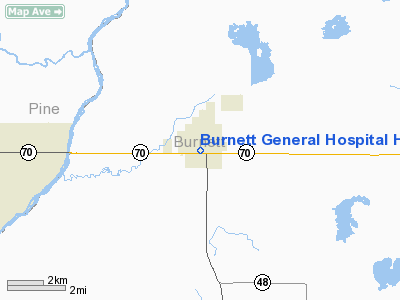
Burnett General Hospital Heliport |
Location & QuickFacts
| FAA Information Effective: | 2008-09-25 |
| Airport Identifier: | WI59 |
| Airport Status: | Operational |
| Longitude/Latitude: | 092-41-11.7350W/45-46-27.8300N
-92.686593/45.774397 (Estimated) |
| Elevation: | 950 ft / 289.56 m (Estimated) |
| Land: | 1 acres |
| From nearest city: | 0 nautical miles N of Grantsburg, WI |
| Location: | Burnett County, WI |
| Magnetic Variation: | 03E (1985) |
Owner & Manager
| Ownership: | Privately owned |
| Owner: | Burnett General Hospital |
| Address: | 257 W St. George Ave
Grantsburg, WI 54840 |
| Phone number: | 715-463-5353 |
| Manager: | John Hesson |
| Address: | 257 W St. George Ave
Grantsburg, WI 54840 |
| Phone number: | 715-463-5353 |
Airport Operations and Facilities
| Airport Use: | Private
MEDICAL |
| Wind indicator: | Yes |
| Segmented Circle: | No |
| Control Tower: | No |
| Sectional chart: | Green Bay |
| Region: | AGL - Great Lakes |
| Boundary ARTCC: | ZMP - Minneapolis |
| Tie-in FSS: | GRB - Green Bay |
| FSS on Airport: | No |
| FSS Toll Free: | 1-800-WX-BRIEF |
Runway Information
Helipad H1
| Dimension: | 300 x 200 ft / 91.4 x 61.0 m |
| Surface: | TURF, |
| |
Runway H1 |
Runway |
| Traffic Pattern: | Left | Left |
|
Radio Navigation Aids
| ID |
Type |
Name |
Ch |
Freq |
Var |
Dist |
| ROS | NDB | Rush City | | 282.00 | 02E | 12.2 nm |
| BXR | NDB | Big Doctor | | 203.00 | 02E | 13.7 nm |
| JMR | NDB | Mora | | 327.00 | 03E | 25.3 nm |
| CBG | NDB | Cambridge | | 350.00 | 03E | 27.5 nm |
| OEO | NDB | Osceola | | 233.00 | 01E | 27.9 nm |
| SSQ | NDB | Shell Lake | | 212.00 | 01E | 32.3 nm |
| AHH | NDB | Ameron | | 278.00 | 01E | 32.5 nm |
| UBE | NDB | Cumberland | | 375.00 | 01E | 33.8 nm |
| RNH | NDB | New Richmond | | 257.00 | 02E | 38.2 nm |
| MZH | NDB | Moose Lake | | 362.00 | 02E | 38.9 nm |
| PNM | NDB | Princeton | | 368.00 | 03E | 40.7 nm |
| OLG | NDB | Solon Springs | | 388.00 | 01E | 48.9 nm |
| RZN | VOR/DME | Siren | 031X | 109.40 | 02E | 13.4 nm |
| RPD | VOR/DME | Rice Lake | 037X | 110.00 | 01E | 43.9 nm |
| GEP | VORTAC | Gopher | 120X | 117.30 | 06E | 47.6 nm |
Remarks
- FILED FOR RECORD PURPOSES ONLY.
Images and information placed above are from
http://www.airport-data.com/airport/WI59/
We thank them for the data!
| General Info
|
| Country |
United States
|
| State |
WISCONSIN
|
| FAA ID |
WI59
|
| Latitude |
45-46-27.830N
|
| Longitude |
092-41-11.735W
|
| Elevation |
950 feet
|
| Near City |
GRANTSBURG
|
We don't guarantee the information is fresh and accurate. The data may
be wrong or outdated.
For more up-to-date information please refer to other sources.
|
|


