|
|
| Burnett County Airport |
| IATA: none – ICAO: KRZN – FAA LID: RZN |
| Summary |
| Airport type |
Public |
| Owner |
Burnett County |
| Serves |
Siren, Wisconsin |
| Built |
March 1947 |
| Elevation AMSL |
989 ft / 301 m |
| Coordinates |
45°49′22″N 092°22′21″W / 45.82278°N 92.3725°W / 45.82278; -92.3725 |
| Runways |
| Direction |
Length |
Surface |
| ft |
m |
| 5/23 |
3,900 |
1,189 |
Asphalt |
| 14/32 |
3,500 |
1,067 |
Asphalt |
| Statistics (2007) |
| Aircraft operations |
14,700 |
| Based aircraft |
24 |
| Source: Federal Aviation Administration |
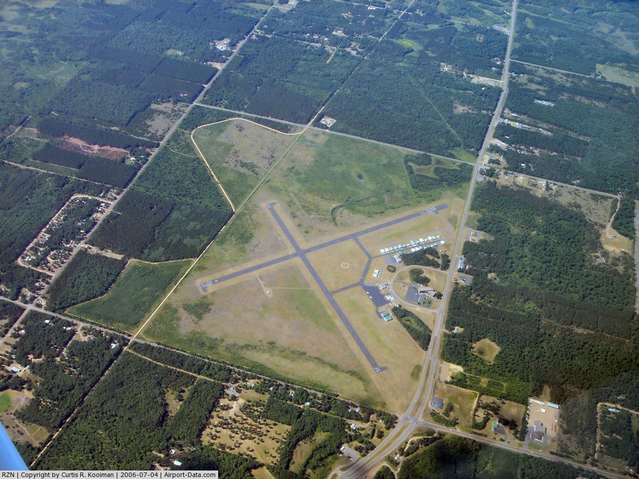
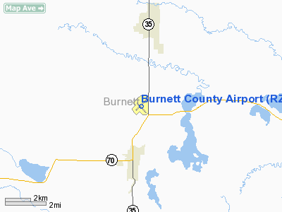
Burnett County Airport (ICAO: KRZN, FAA LID: RZN) is a county-owned public-use airport located three nautical miles (6 km) north of the central business district of Siren, in Burnett County, Wisconsin, United States. According to the FAA's National Plan of Integrated Airport Systems for 2009–2013, it is categorized as a general aviation facility.
Burnett County is in northwestern Wisconsin, on the border with Minnesota; Burnett County Airport is about 95 miles (153 km) northeast of Minneapolis, Minnesota by car. The rural area is known for its abundant lakes and associated recreational opportunities, as well as for its wintertime snowmobile trails.
Although many U.S. airports use the same three-letter location identifier for the FAA and IATA, this facility is assigned RZN by the FAA but has no designation from the IATA (which assigned RZN to Turlatovo Airport in Ryazan, Russia).
Facilities and aircraft
Burnett County Airport covers an area of 576 acres (233 ha) at an elevation of 989 feet (301 m) above mean sea level. It has two asphalt paved runways: 5/23 is 3,900 by 75 feet (1,189 x 23 m) and 14/32 is 3,500 by 75 feet (1,067 x 23 m).
For the 12-month period ending September 19, 2007, the airport had 14,700 aircraft operations, an average of 40 per day: 99% general aviation and 1% air taxi. At that time there were 24 aircraft based at this airport: 96% single-engine and 4% multi-engine.
The above content comes from Wikipedia and is published under free licenses – click here to read more.
 |
(Click on the photo to enlarge) |
 |
(Click on the photo to enlarge) |
Location & QuickFacts
| FAA Information Effective: | 2008-09-25 |
| Airport Identifier: | RZN |
| Airport Status: | Operational |
| Longitude/Latitude: | 092-22-21.0030W/45-49-21.8190N
-92.372501/45.822727 (Estimated) |
| Elevation: | 989 ft / 301.45 m (Surveyed) |
| Land: | 576 acres |
| From nearest city: | 3 nautical miles N of Siren, WI |
| Location: | Burnett County, WI |
| Magnetic Variation: | 02E (1990) |
Owner & Manager
| Ownership: | Publicly owned |
| Owner: | Burnett County |
| Address: | 7410 Cth K
Siren, WI 54872 |
| Phone number: | 715-349-2904 |
| Manager: | Jeremy Sickler |
| Address: | 7425 Cth K
Siren, WI 54872 |
| Phone number: | 715-349-7076
AFTER HRS CALL 715-222-1702. |
Airport Operations and Facilities
| Airport Use: | Open to public |
| Wind indicator: | Yes |
| Segmented Circle: | No |
| Control Tower: | No |
| Lighting Schedule: | DUSK-DAWN
ACTVT MIRL RYS 04/22 & 13/31; REIL RYS 04; 22; 13 & 31 - CTAF. |
| Beacon Color: | Clear-Green (lighted land airport) |
| Landing fee charge: | No |
| Sectional chart: | Green Bay |
| Region: | AGL - Great Lakes |
| Boundary ARTCC: | ZMP - Minneapolis |
| Tie-in FSS: | GRB - Green Bay |
| FSS on Airport: | No |
| FSS Toll Free: | 1-800-WX-BRIEF |
| NOTAMs Facility: | RZN (NOTAM-d service avaliable) |
| Federal Agreements: | N13 |
Airport Communications
| CTAF: | 122.800 |
| Unicom: | 122.800 |
Airport Services
| Fuel available: | 100LLA MOGAS
24 HR SELF SVC. |
| Bottled Oxygen: | NONE |
| Bulk Oxygen: | NONE |
Runway Information
Runway 04/22
| Dimension: | 3900 x 75 ft / 1188.7 x 22.9 m |
| Surface: | ASPH, Fair Condition |
| Weight Limit: | Single wheel: 8000 lbs. |
| Edge Lights: | Medium |
| |
Runway 04 |
Runway 22 |
| Longitude: | 092-22-41.2790W | 092-22-02.0380W |
| Latitude: | 45-49-11.5770N | 45-49-38.5950N |
| Elevation: | 989.00 ft | 984.00 ft |
| Alignment: | 45 | 127 |
| Traffic Pattern: | Left | Left |
| Markings: | Non-precision instrument, Fair Condition | Non-precision instrument, Fair Condition |
| Crossing Height: | 27.00 ft | 28.00 ft |
| VASI: | 2-light PAPI on left side | 2-light PAPI on left side |
| Visual Glide Angle: | 3.45° | 3.00° |
| Runway End Identifier: | Yes | Yes |
| Centerline Lights: | No | No |
| Touchdown Lights: | No | No |
| Obstruction: | 45 ft trees, 1600.0 ft from runway, 320 ft right of centerline, 31:1 slope to clear | 15 ft road, 420.0 ft from runway, 270 ft left of centerline, 14:1 slope to clear |
|
Runway 13/31
| Dimension: | 3500 x 75 ft / 1066.8 x 22.9 m |
| Surface: | ASPH, Fair Condition |
| Weight Limit: | Single wheel: 8000 lbs. |
| Edge Lights: | Medium |
| |
Runway 13 |
Runway 31 |
| Longitude: | 092-22-37.2530W | 092-22-03.2930W |
| Latitude: | 45-49-30.7290N | 45-49-05.6270N |
| Elevation: | 986.00 ft | 987.00 ft |
| Alignment: | 127 | 127 |
| Traffic Pattern: | Left | Left |
| Markings: | Basic, Fair Condition | Basic, Fair Condition |
| Crossing Height: | 28.00 ft | 27.00 ft |
| VASI: | 2-light PAPI on left side | 2-light PAPI on left side |
| Visual Glide Angle: | 3.00° | 3.45° |
| Runway End Identifier: | Yes
RY 13 & 31 REIL OTS INDEFLY. | Yes |
| Centerline Lights: | No | No |
| Touchdown Lights: | No | No |
| Obstruction: | 83 ft trees, 2800.0 ft from runway, 300 ft left of centerline, 31:1 slope to clear | 66 ft trees, 1200.0 ft from runway, 15:1 slope to clear |
|
Radio Navigation Aids
| ID |
Type |
Name |
Ch |
Freq |
Var |
Dist |
| BXR | NDB | Big Doctor | | 203.00 | 02E | 0.3 nm |
| SSQ | NDB | Shell Lake | | 212.00 | 01E | 19.8 nm |
| UBE | NDB | Cumberland | | 375.00 | 01E | 25.1 nm |
| ROS | NDB | Rush City | | 282.00 | 02E | 25.6 nm |
| AHH | NDB | Ameron | | 278.00 | 01E | 32.5 nm |
| OEO | NDB | Osceola | | 233.00 | 01E | 33.5 nm |
| JMR | NDB | Mora | | 327.00 | 03E | 37.7 nm |
| OLG | NDB | Solon Springs | | 388.00 | 01E | 37.8 nm |
| MZH | NDB | Moose Lake | | 362.00 | 02E | 40.0 nm |
| CBG | NDB | Cambridge | | 350.00 | 03E | 40.6 nm |
| RNH | NDB | New Richmond | | 257.00 | 02E | 41.2 nm |
| SLY | NDB | Seeley | | 344.00 | 01E | 44.8 nm |
| RZN | VOR/DME | Siren | 031X | 109.40 | 02E | 0.2 nm |
| RPD | VOR/DME | Rice Lake | 037X | 110.00 | 01E | 35.0 nm |
| HYR | VOR/DME | Hayward | 081X | 113.40 | 03E | 40.5 nm |
Remarks
- OCCASIONAL DEER & BEAR ON RY.
Images and information placed above are from
http://www.airport-data.com/airport/RZN/
We thank them for the data!
| General Info
|
| Country |
United States
|
| State |
WISCONSIN
|
| FAA ID |
RZN
|
| Latitude |
45-49-21.819N
|
| Longitude |
092-22-21.003W
|
| Elevation |
989 feet
|
| Near City |
SIREN
|
We don't guarantee the information is fresh and accurate. The data may
be wrong or outdated.
For more up-to-date information please refer to other sources.
|
|