|
|
| Burlington Municipal Airport |
| IATA: none – ICAO: KBUU – FAA LID: BUU |
| Summary |
| Airport type |
Public |
| Owner |
City of Burlington |
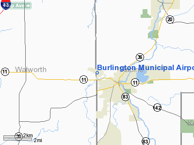
| Location |
Burlington, Wisconsin |
| Elevation AMSL |
779 ft / 237 m |
| Coordinates |
42°41′27″N 088°18′17″W / 42.69083°N 88.30472°W / 42.69083; -88.30472 |
| Runways |
| Direction |
Length |
Surface |
| ft |
m |
| 11/29 |
4,300 |
1,311 |
Asphalt |
| 1/19 |
2,477 |
755 |
Turf |
| Statistics (2006) |
| Aircraft operations |
55,300 |
| Based aircraft |
70 |
| Source: Federal Aviation Administration |
Burlington Municipal Airport (ICAO: KBUU, FAA LID: BUU) is a public airport located one mile (2 km) northwest of the central business district of Burlington, in Racine County, Wisconsin, United States. This airport is publicly owned by City of Burlington.
Although most U.S. airports use the same three-letter location identifier for the FAA and IATA, Burlington Municipal Airport is assigned BUU by the FAA and has no designation from the IATA (which assigned BUU to Buyo, Côte d'Ivoire).
Facilities and aircraft
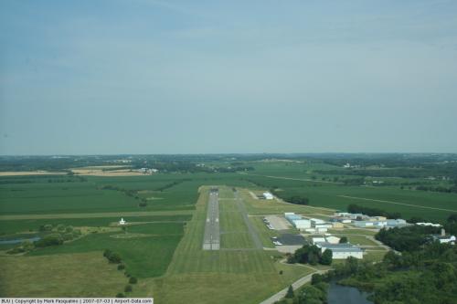
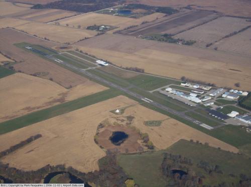
Burlington Municipal Airport covers an area of 240 acres (97 ha) and has two runways:
- Runway 11/29: 4,300 x 75 ft (1,311 x 23 m), Surface: Asphalt
- Runway 1/19: 2,477 x 130 ft (755 x 40 m), Surface: Turf
For 12-month period ending September 20, 2006, the airport had 55,300 aircraft operations, an average of 151 per day: 98% general aviation, 1% air taxi and 1% military. There are 70 aircraft based at this airport: 81% single engine and 19% multi-engine.
The above content comes from Wikipedia and is published under free licenses – click here to read more.
 |
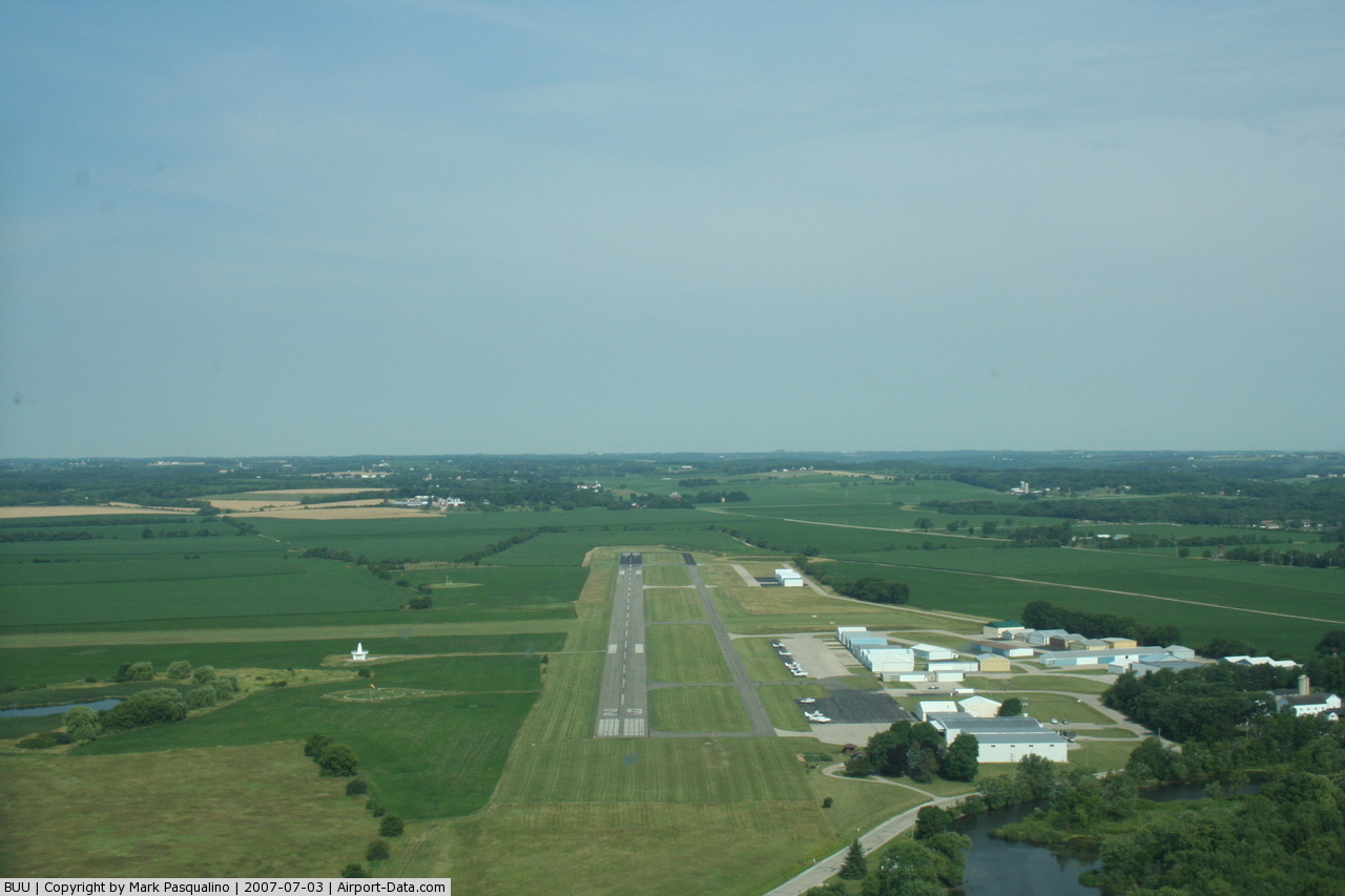
(Click on the photo to enlarge) |
 |
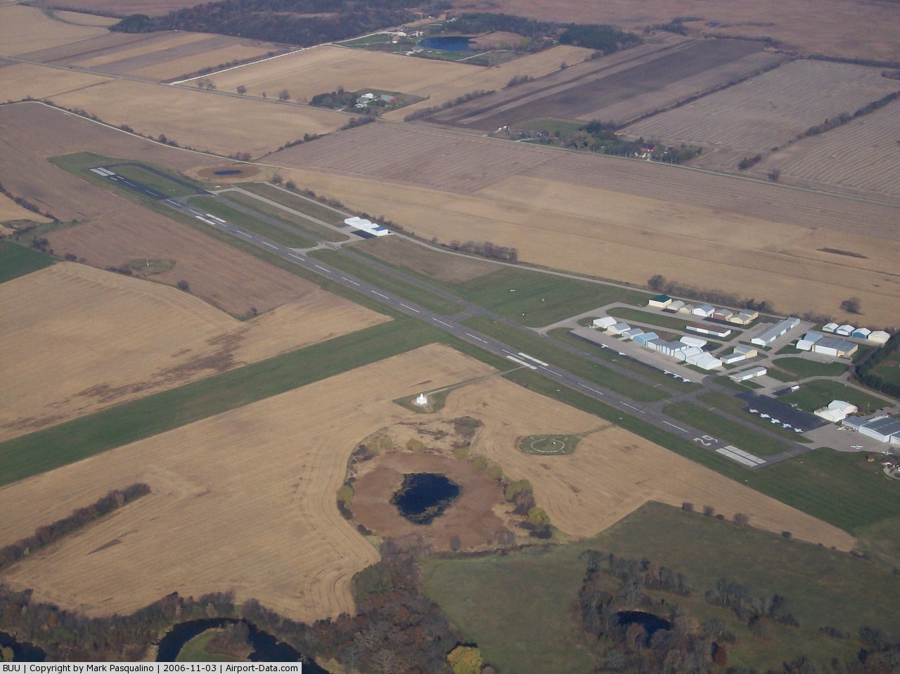
(Click on the photo to enlarge) |
 |
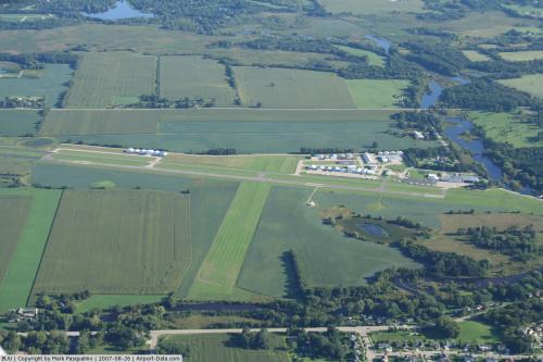
(Click on the photo to enlarge) |
Location & QuickFacts
| FAA Information Effective: | 2008-09-25 |
| Airport Identifier: | BUU |
| Airport Status: | Operational |
| Longitude/Latitude: | 088-18-16.7000W/42-41-26.6000N
-88.304639/42.690722 (Estimated) |
| Elevation: | 779 ft / 237.44 m (Surveyed) |
| Land: | 240 acres |
| From nearest city: | 1 nautical miles NW of Burlington, WI |
| Location: | Racine County, WI |
| Magnetic Variation: | 01W (1985) |
Owner & Manager
| Ownership: | Publicly owned |
| Owner: | City Of Burlington |
| Address: | City Hall 300 N Pine
Burlington, WI 53105 |
| Phone number: | 262-763-3717 |
| Manager: | Gary Meisner |
| Address: | 703 Airport Drive
Burlington, WI 53105 |
| Phone number: | 262-763-9509 |
Airport Operations and Facilities
| Airport Use: | Open to public |
| Wind indicator: | Yes |
| Segmented Circle: | Yes |
| Control Tower: | No |
| Lighting Schedule: | DUSK-DAWN
ACTVT MIRL RY 11/29; VASI RY 29 & PAPI RY 11 & REIL RYS 11 & 29 - CTAF. |
| Beacon Color: | Clear-Green (lighted land airport) |
| Landing fee charge: | No |
| Sectional chart: | Chicago |
| Region: | AGL - Great Lakes |
| Boundary ARTCC: | ZAU - Chicago |
| Tie-in FSS: | GRB - Green Bay |
| FSS on Airport: | No |
| FSS Toll Free: | 1-800-WX-BRIEF |
| NOTAMs Facility: | BUU (NOTAM-d service avaliable) |
| Federal Agreements: | NGY |
Airport Communications
| CTAF: | 123.050 |
| Unicom: | 123.050 |
Airport Services
| Fuel available: | 100LLA
24 HR SELF SERVICE |
| Airframe Repair: | MAJOR |
| Power Plant Repair: | MAJOR |
| Bottled Oxygen: | LOW |
| Bulk Oxygen: | NONE |
Runway Information
Runway 01/19
| Dimension: | 2477 x 130 ft / 755.0 x 39.6 m |
| Surface: | TURF, Good Condition |
| |
Runway 01 |
Runway 19 |
| Longitude: | 088-18-16.6919W | 088-18-09.7672W |
| Latitude: | 42-41-09.0452N | 42-41-32.9706N |
| Elevation: | 773.00 ft | 775.00 ft |
| Alignment: | 12 | 127 |
| Traffic Pattern: | Left | Right |
| Runway End Identifier: | No | No |
| Centerline Lights: | No | No |
| Touchdown Lights: | No | No |
| Obstruction: | 45 ft trees, 900.0 ft from runway, 150 ft right of centerline, 20:1 slope to clear | 53 ft pole, 1820.0 ft from runway, 185 ft right of centerline, 34:1 slope to clear |
|
Runway 11/29
| Dimension: | 4300 x 75 ft / 1310.6 x 22.9 m |
| Surface: | ASPH, Good Condition |
| Weight Limit: | Single wheel: 20000 lbs. |
| Edge Lights: | Medium |
| |
Runway 11 |
Runway 29 |
| Longitude: | 088-18-46.0150W | 088-17-51.5009W |
| Latitude: | 42-41-36.7127N | 42-41-23.0420N |
| Elevation: | 777.00 ft | 776.00 ft |
| Alignment: | 109 | 127 |
| Traffic Pattern: | Left | Right |
| Markings: | Non-precision instrument, Good Condition | Non-precision instrument, Good Condition |
| Crossing Height: | 33.00 ft | 36.00 ft |
| VASI: | 2-light PAPI on left side | 2-box on left side |
| Visual Glide Angle: | 3.15° | 3.00° |
| Runway End Identifier: | Yes | Yes |
| Centerline Lights: | No | No |
| Touchdown Lights: | No | No |
| Obstruction: | 144 ft tree, 3960.0 ft from runway, 470 ft right of centerline, 26:1 slope to clear | 35 ft tree, 900.0 ft from runway, 200 ft right of centerline, 20:1 slope to clear |
|
Radio Navigation Aids
| ID |
Type |
Name |
Ch |
Freq |
Var |
Dist |
| LVV | NDB | Lake Lawn | | 404.00 | 00W | 12.8 nm |
| GM | NDB | Teels | | 242.00 | 02W | 17.5 nm |
| RA | NDB | Paser | | 206.00 | 00E | 17.9 nm |
| UES | NDB | Waukesha | | 359.00 | 01W | 21.5 nm |
| BL | NDB | Yanks | | 260.00 | 02W | 29.1 nm |
| JVL | NDB | Janesville | | 375.00 | 03E | 32.9 nm |
| RYV | NDB | Rock River | | 371.00 | 01W | 34.4 nm |
| HXF | NDB | Hartford | | 200.00 | 00E | 39.7 nm |
| LLE | NDB | Kettle Moraine | | 329.00 | 01W | 44.8 nm |
| ME | NDB | Deana | | 350.00 | 00E | 45.2 nm |
| UNU | NDB | Juneau | | 344.00 | 01W | 47.7 nm |
| DKB | NDB | Dekalb | | 209.00 | 02W | 48.9 nm |
| BJB | VOR | West Bend | | 109.80 | 01W | 44.7 nm |
| BUU | VOR/DME | Burbun | 092X | 114.50 | 01W | 0.2 nm |
| ENW | VOR/DME | Kenosha | 029X | 109.20 | 02W | 17.4 nm |
| HRK | VOR/DME | Horlick | 124X | 117.70 | 02W | 22.1 nm |
| LJT | VOR/DME | Timmerman | 072X | 112.50 | 02W | 27.8 nm |
| OBK | VOR/DME | Northbrook | 077X | 113.00 | 02W | 32.3 nm |
| JVL | VOR/DME | Janesville | 090X | 114.30 | 03E | 36.3 nm |
| ORD | VOR/DME | Chicago O'hare | 086X | 113.90 | 02E | 45.8 nm |
| DPA | VOR/DME | Dupage | 021X | 108.40 | 02E | 48.2 nm |
| RFD | VOR/DME | Rockford | 045X | 110.80 | 01E | 48.5 nm |
| BAE | VORTAC | Badger | 111X | 116.40 | 02E | 25.6 nm |
| MKE | VOT | Milwaukee | | 109.00 | | 23.7 nm |
| ORD | VOT | Chicago O'hare Intl | | 112.00 | | 46.1 nm |
Remarks
- ASPH TWY 30 FT WIDE, EXCEPT W 700 FT 35 FT WIDE.
- DEPARTING TFC CLIMB TO 1000' AGL BEFORE TURNING SOUTH.
- WATERFOWL ON & INVOF ARPT.
- TFC DEPARTING RY 11 AVOID OVERFLIGHT OF CITY.
- GCO AVBL ON FREQ 121.725 THRU FLT SVCS.
- BE ALERT: CONSTRUCTION ON WEST END OF TWY.
Images and information placed above are from
http://www.airport-data.com/airport/BUU/
We thank them for the data!
| General Info
|
| Country |
United States
|
| State |
WISCONSIN
|
| FAA ID |
BUU
|
| Latitude |
42-41-26.600N
|
| Longitude |
088-18-16.700W
|
| Elevation |
779 feet
|
| Near City |
BURLINGTON
|
We don't guarantee the information is fresh and accurate. The data may
be wrong or outdated.
For more up-to-date information please refer to other sources.
|
|