 |
|
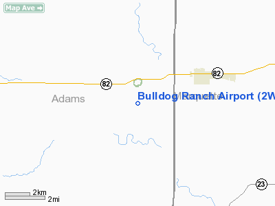
Location & QuickFacts
| FAA Information Effective: | 2008-09-25 |
| Airport Identifier: | 2WI9 |
| Airport Status: | Operational |
| Longitude/Latitude: | 089-38-05.4450W/43-45-35.9170N
-89.634846/43.759977 (Estimated) |
| Elevation: | 955 ft / 291.08 m (Estimated) |
| Land: | 80 acres |
| From nearest city: | 3 nautical miles SW of Oxford, WI |
| Location: | Adams County, WI |
| Magnetic Variation: | 00W (1990) |
Owner & Manager
| Ownership: | Privately owned |
| Owner: | Bulldog Ranch Inc |
| Address: | Po Box 233
Oxford, WI 53952 |
| Phone number: | 608-586-5997 |
| Manager: | G S Rynearson |
| Address: | Po Box 233
Oxford, WI 53952 |
| Phone number: | 312-987-2666 |
Airport Operations and Facilities
| Airport Use: | Private |
| Segmented Circle: | No |
| Control Tower: | No |
| Sectional chart: | Chicago |
| Region: | AGL - Great Lakes |
| Boundary ARTCC: | ZAU - Chicago |
| Tie-in FSS: | GRB - Green Bay |
| FSS Toll Free: | 1-800-WX-BRIEF |
Runway Information
Runway 01/19
| Dimension: | 2500 x 60 ft / 762.0 x 18.3 m |
| Surface: | TURF, |
| |
Runway 01 |
Runway 19 |
| Traffic Pattern: | Right | Left |
| Displaced threshold: | 0.00 ft | 700.00 ft |
| Obstruction: | | 50 ft pline, 300.0 ft from runway |
|
Radio Navigation Aids
| ID |
Type |
Name |
Ch |
Freq |
Var |
Dist |
| HBW | NDB | Kickapoo | | 251.00 | 03E | 31.0 nm |
| ISW | NDB | Wisconsin Rapids | | 215.00 | 01W | 37.4 nm |
| PCZ | NDB | Waupaca | | 382.00 | 01W | 43.6 nm |
| MS | NDB | Monah | | 400.00 | 00E | 43.8 nm |
| CMY | NDB | Mccoy | | 412.00 | 00E | 44.9 nm |
| UNU | NDB | Juneau | | 344.00 | 01W | 45.2 nm |
| VOK | TACAN | Volk | 041X | | 00E | 29.2 nm |
| LNR | VOR/DME | Lone Rock | 075X | 112.80 | 00E | 35.4 nm |
| DLL | VORTAC | Dells | 117X | 117.00 | 03E | 13.8 nm |
| MSN | VORTAC | Madison | 023X | 108.60 | 03E | 39.2 nm |
| STE | VORTAC | Stevens Point | 043X | 110.60 | 01W | 47.3 nm |
| OSH | VORTAC | Oshkosh | 055X | 111.80 | 02E | 48.8 nm |
Remarks
- PRVDD AREA 125' EITHER SIDE OF CNTRLN & 200' AT EITHER END BE CLEAR; OBS BE REMOVED OR LOWERED OR THR BE DSPLCD TO PRVD 20:1 SLOPE; OPERS ARE CONDUCTED IAW LETTER OF AGREEMENT.
Images and information placed above are from
http://www.airport-data.com/airport/2WI9/
We thank them for the data!
| General Info
|
| Country |
United States
|
| State |
WISCONSIN
|
| FAA ID |
2WI9
|
| Latitude |
43-45-35.917N
|
| Longitude |
089-38-05.445W
|
| Elevation |
955 feet
|
| Near City |
OXFORD
|
We don't guarantee the information is fresh and accurate. The data may
be wrong or outdated.
For more up-to-date information please refer to other sources.
|
|


