 |
|
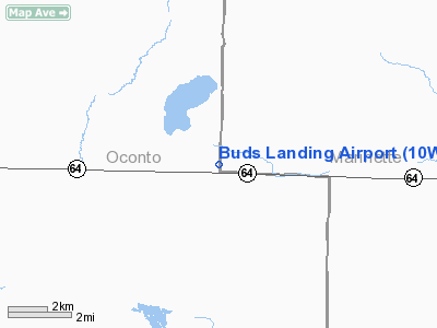
Location & QuickFacts
| FAA Information Effective: | 2008-09-25 |
| Airport Identifier: | 10WI |
| Airport Status: | Operational |
| Longitude/Latitude: | 088-11-22.3680W/45-06-56.9330N
-88.189547/45.115815 (Estimated) |
| Elevation: | 850 ft / 259.08 m (Estimated) |
| Land: | 0 acres |
| From nearest city: | 7 nautical miles WS of Pound, WI |
| Location: | Oconto County, WI |
| Magnetic Variation: | 02W (1985) |
Owner & Manager
| Ownership: | Privately owned |
| Owner: | Robert J. Wardecke |
| Address: | 8910 Hwy 64
Pound, WI 54161 |
| Phone number: | 414-897-3823 |
| Manager: | Robert J. Wardecke |
| Address: | 8910 Hwy 64
Pound, WI 54161 |
| Phone number: | 414-897-3823 |
Airport Operations and Facilities
| Airport Use: | Private |
| Wind indicator: | Yes |
| Segmented Circle: | No |
| Control Tower: | No |
| Sectional chart: | Green Bay |
| Region: | AGL - Great Lakes |
| Boundary ARTCC: | ZMP - Minneapolis |
| Tie-in FSS: | GRB - Green Bay |
| FSS Toll Free: | 1-800-WX-BRIEF |
Runway Information
Runway 18/36
| Dimension: | 2100 x 200 ft / 640.1 x 61.0 m |
| Surface: | TURF, |
| |
Runway 18 |
Runway 36 |
| Traffic Pattern: | Right | Left |
| Obstruction: | 50 ft trees, 500.0 ft from runway | |
|
Radio Navigation Aids
| ID |
Type |
Name |
Ch |
Freq |
Var |
Dist |
| OCQ | NDB | Oconto | | 388.00 | 03W | 18.6 nm |
| SUE | NDB | Sturgeon Bay | | 414.00 | 03W | 36.7 nm |
| CLI | NDB | Clintonville | | 209.00 | 02W | 37.8 nm |
| AIG | NDB | Antigo | | 347.00 | 02W | 39.3 nm |
| SG | NDB | Depre | | 332.00 | 02W | 43.2 nm |
| MNM | VOR/DME | Menominee | 033X | 109.60 | 00E | 23.3 nm |
| IMT | VOR/DME | Iron Mountain | 049X | 111.20 | 02W | 42.2 nm |
| GRB | VORTAC | Green Bay | 102X | 115.50 | 01E | 33.7 nm |
Remarks
- TREES NE OF ARPT MAY CAUSE SOME WIND SHEAR WHEN LANDING SOUTH.
- RY 18/36 & RAMP NOT ALWAYS PLOWED IN WINTER.
- ARPT NOT USEABLE DURG VERY WET PERIODS.
Images and information placed above are from
http://www.airport-data.com/airport/10WI/
We thank them for the data!
| General Info
|
| Country |
United States
|
| State |
WISCONSIN
|
| FAA ID |
10WI
|
| Latitude |
45-06-56.933N
|
| Longitude |
088-11-22.368W
|
| Elevation |
850 feet
|
| Near City |
POUND
|
We don't guarantee the information is fresh and accurate. The data may
be wrong or outdated.
For more up-to-date information please refer to other sources.
|
|


