 |
|
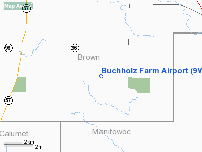
Location & QuickFacts
| FAA Information Effective: | 2008-09-25 |
| Airport Identifier: | 9WI3 |
| Airport Status: | Operational |
| Longitude/Latitude: | 087-59-12.3530W/44-17-07.9730N
-87.986765/44.285548 (Estimated) |
| Elevation: | 955 ft / 291.08 m (Estimated) |
| Land: | 0 acres |
| From nearest city: | 1 nautical miles S of Morrison, WI |
| Location: | Brown County, WI |
| Magnetic Variation: | 02W (1985) |
Owner & Manager
| Ownership: | Privately owned |
| Owner: | Melvin Buchholz |
| Address: | 7359 Morrison Rd
Greenleaf, WI 54126 |
| Phone number: | 414-864-2166 |
| Address: |
|
Airport Operations and Facilities
| Airport Use: | Private |
| Wind indicator: | Yes |
| Segmented Circle: | No |
| Control Tower: | No |
| Landing fee charge: | No |
| Sectional chart: | Green Bay |
| Region: | AGL - Great Lakes |
| Boundary ARTCC: | ZAU - Chicago |
| Tie-in FSS: | GRB - Green Bay |
| FSS on Airport: | No |
| FSS Toll Free: | 1-800-WX-BRIEF |
Runway Information
Runway N/S
| Dimension: | 1336 x 50 ft / 407.2 x 15.2 m |
| Surface: | TURF, |
| |
Runway N |
Runway S |
| Traffic Pattern: | Left | Left |
|
Radio Navigation Aids
| ID |
Type |
Name |
Ch |
Freq |
Var |
Dist |
| SG | NDB | Depre | | 332.00 | 02W | 9.2 nm |
| AQ | NDB | Kooky | | 407.00 | 02W | 18.2 nm |
| OCQ | NDB | Oconto | | 388.00 | 03W | 35.6 nm |
| CLI | NDB | Clintonville | | 209.00 | 02W | 37.8 nm |
| SUE | NDB | Sturgeon Bay | | 414.00 | 03W | 41.0 nm |
| PCZ | NDB | Waupaca | | 382.00 | 01W | 44.4 nm |
| MTW | VOR/DME | Manitowoc | 047X | 111.00 | 02W | 16.2 nm |
| FAH | VOR/DME | Falls | 37X | 110.00 | 02W | 31.6 nm |
| GRB | VORTAC | Green Bay | 102X | 115.50 | 01E | 18.5 nm |
| OSH | VORTAC | Oshkosh | 055X | 111.80 | 02E | 30.3 nm |
Remarks
- DUE TO OBSTNS WHICH SEVERLY REDUCE USBL RWY LENGTH.
Images and information placed above are from
http://www.airport-data.com/airport/9WI3/
We thank them for the data!
| General Info
|
| Country |
United States
|
| State |
WISCONSIN
|
| FAA ID |
9WI3
|
| Latitude |
44-17-07.973N
|
| Longitude |
087-59-12.353W
|
| Elevation |
955 feet
|
| Near City |
MORRISON
|
We don't guarantee the information is fresh and accurate. The data may
be wrong or outdated.
For more up-to-date information please refer to other sources.
|
|


