 |
|
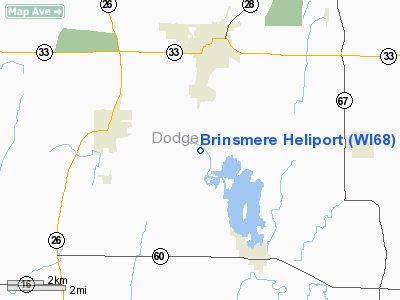
Location & QuickFacts
| FAA Information Effective: | 2008-09-25 |
| Airport Identifier: | WI68 |
| Airport Status: | Operational |
| Longitude/Latitude: | 088-38-27.3690W/43-23-43.9850N
-88.640936/43.395551 (Estimated) |
| Elevation: | 890 ft / 271.27 m (Estimated) |
| Land: | 17 acres |
| From nearest city: | 5 nautical miles E of Juneau, WI |
| Location: | Dodge County, WI |
| Magnetic Variation: | 00W (1985) |
Owner & Manager
| Ownership: | Privately owned |
| Owner: | Stanley Tesler |
| Address: | W4780 W4786 Club Grounds Rd.
Juneau, WI 53039 |
| Phone number: | 414-386-2147 |
| Manager: | Stanley Tesler |
| Address: | W4780 W4786 Club Grounds Rd.
Juneau, WI 53039 |
| Phone number: | 414-386-2147 |
Airport Operations and Facilities
| Airport Use: | Private
PERSONAL. |
| Wind indicator: | Yes |
| Segmented Circle: | No |
| Control Tower: | No |
| Lighting Schedule: | 24 HRS |
| Beacon Color: | Clear-Green-Yellow (heliport) |
| Sectional chart: | Chicago |
| Region: | AGL - Great Lakes |
| Boundary ARTCC: | ZAU - Chicago |
| Tie-in FSS: | GRB - Green Bay |
| FSS Toll Free: | 1-800-WX-BRIEF |
Runway Information
Helipad H1
| Dimension: | 12 x 12 ft / 3.7 x 3.7 m |
| Surface: | TURF, |
| |
Runway H1 |
Runway |
| Traffic Pattern: | Left | Left |
|
Radio Navigation Aids
| ID |
Type |
Name |
Ch |
Freq |
Var |
Dist |
| UNU | NDB | Juneau | | 344.00 | 01W | 3.3 nm |
| HXF | NDB | Hartford | | 200.00 | 00E | 11.1 nm |
| RYV | NDB | Rock River | | 371.00 | 01W | 13.8 nm |
| LLE | NDB | Kettle Moraine | | 329.00 | 01W | 22.5 nm |
| UES | NDB | Waukesha | | 359.00 | 01W | 27.6 nm |
| MS | NDB | Monah | | 400.00 | 00E | 36.8 nm |
| BL | NDB | Yanks | | 260.00 | 02W | 39.1 nm |
| GM | NDB | Teels | | 242.00 | 02W | 39.3 nm |
| LVV | NDB | Lake Lawn | | 404.00 | 00W | 41.9 nm |
| BJB | VOR | West Bend | | 109.80 | 01W | 22.6 nm |
| LJT | VOR/DME | Timmerman | 072X | 112.50 | 02W | 31.5 nm |
| FAH | VOR/DME | Falls | 37X | 110.00 | 02W | 41.2 nm |
| BUU | VOR/DME | Burbun | 092X | 114.50 | 01W | 45.0 nm |
| BAE | VORTAC | Badger | 111X | 116.40 | 02E | 22.9 nm |
| MSN | VORTAC | Madison | 023X | 108.60 | 03E | 34.1 nm |
| OSH | VORTAC | Oshkosh | 055X | 111.80 | 02E | 35.9 nm |
| DLL | VORTAC | Dells | 117X | 117.00 | 03E | 49.9 nm |
| MKE | VOT | Milwaukee | | 109.00 | | 42.3 nm |
Remarks
- FILED FOR RECORD PURPOSES ONLY.
Images and information placed above are from
http://www.airport-data.com/airport/WI68/
We thank them for the data!
| General Info
|
| Country |
United States
|
| State |
WISCONSIN
|
| FAA ID |
WI68
|
| Latitude |
43-23-43.985N
|
| Longitude |
088-38-27.369W
|
| Elevation |
890 feet
|
| Near City |
JUNEAU
|
We don't guarantee the information is fresh and accurate. The data may
be wrong or outdated.
For more up-to-date information please refer to other sources.
|
|


