 |
|
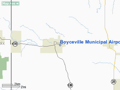
Location & QuickFacts
| FAA Information Effective: | 2008-09-25 |
| Airport Identifier: | 3T3 |
| Airport Status: | Operational |
| Longitude/Latitude: | 092-01-13.3300W/45-02-38.5100N
-92.020369/45.044031 (Estimated) |
| Elevation: | 967 ft / 294.74 m (Surveyed) |
| Land: | 75 acres |
| From nearest city: | 0 nautical miles SE of Boyceville, WI |
| Location: | Dunn County, WI |
| Magnetic Variation: | 00E (2000) |
Owner & Manager
| Ownership: | Publicly owned |
| Owner: | Village Of Boyceville |
| Address: | Village Hall
Boyceville, WI 54725 |
| Phone number: | 715-643-2351 |
| Manager: | Keith Sorensen |
| Address: | 1209 Main Street
Boyceville, WI 54725 |
| Phone number: | 715-643-5022 |
Airport Operations and Facilities
| Airport Use: | Open to public |
| Wind indicator: | Yes |
| Segmented Circle: | No |
| Control Tower: | No |
| Lighting Schedule: | DUSK-DAWN
ACTVT MIRL RY 08/26, PAPI RYS 08 & 26 & REIL RY 26 - 122.8 |
| Beacon Color: | Clear-Green (lighted land airport) |
| Landing fee charge: | No |
| Sectional chart: | Green Bay |
| Region: | AGL - Great Lakes |
| Traffic Pattern Alt: | 1000 ft |
| Boundary ARTCC: | ZMP - Minneapolis |
| Tie-in FSS: | GRB - Green Bay |
| FSS on Airport: | No |
| FSS Toll Free: | 1-800-WX-BRIEF |
| NOTAMs Facility: | GRB (NOTAM-d service avaliable) |
| Federal Agreements: | N |
Airport Communications
| CTAF: | 122.800 |
| Unicom: | 122.800 |
Airport Services
| Fuel available: | 100LL |
| Airframe Repair: | MAJOR |
| Power Plant Repair: | MINOR |
| Bottled Oxygen: | NONE |
| Bulk Oxygen: | NONE |
Runway Information
Runway 08/26
| Dimension: | 3300 x 60 ft / 1005.8 x 18.3 m |
| Surface: | ASPH, Good Condition |
| Edge Lights: | Medium |
| |
Runway 08 |
Runway 26 |
| Longitude: | 092-01-39.6200W | 092-00-53.9500W |
| Latitude: | 45-02-36.4100N | 45-02-40.0700N |
| Elevation: | 952.00 ft | 967.00 ft |
| Alignment: | 84 | 127 |
| Traffic Pattern: | Left | Left |
| Markings: | Non-precision instrument, Good Condition | Non-precision instrument, Good Condition |
| Crossing Height: | 28.00 ft | 23.00 ft |
| VASI: | 2-light PAPI on left side | 2-light PAPI on left side |
| Visual Glide Angle: | 3.00° | 3.00° |
| Runway End Identifier: | | Yes |
| Obstruction: | 60 ft tree, 1540.0 ft from runway, 150 ft left of centerline, 22:1 slope to clear | , 50:1 slope to clear |
|
Radio Navigation Aids
| ID |
Type |
Name |
Ch |
Freq |
Var |
Dist |
| AHH | NDB | Ameron | | 278.00 | 01E | 20.6 nm |
| RNH | NDB | New Richmond | | 257.00 | 02E | 22.6 nm |
| UBE | NDB | Cumberland | | 375.00 | 01E | 28.0 nm |
| OEO | NDB | Osceola | | 233.00 | 01E | 32.5 nm |
| PPI | NDB | Hopey | | 400.00 | 03E | 40.5 nm |
| SSQ | NDB | Shell Lake | | 212.00 | 01E | 41.3 nm |
| MS | NDB | Narco | | 266.00 | 02E | 47.4 nm |
| BXR | NDB | Big Doctor | | 203.00 | 02E | 48.9 nm |
| RPD | VOR/DME | Rice Lake | 037X | 110.00 | 01E | 24.6 nm |
| RZN | VOR/DME | Siren | 031X | 109.40 | 02E | 49.0 nm |
| EAU | VORTAC | Eau Claire | 076X | 112.90 | 04E | 24.7 nm |
| STP | VOT | St Paul | | 114.40 | | 44.6 nm |
Remarks
- DEER ON & INVOF ARPT, PRIMARILY AFTER DUSK.
- CRANE 160 FT 2.1 NM E 0700-1759 DAILY.
Images and information placed above are from
http://www.airport-data.com/airport/3T3/
We thank them for the data!
| General Info
|
| Country |
United States
|
| State |
WISCONSIN
|
| FAA ID |
3T3
|
| Latitude |
45-02-38.510N
|
| Longitude |
092-01-13.330W
|
| Elevation |
967 feet
|
| Near City |
BOYCEVILLE
|
We don't guarantee the information is fresh and accurate. The data may
be wrong or outdated.
For more up-to-date information please refer to other sources.
|
|


