 |
|
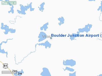
Location & QuickFacts
| FAA Information Effective: | 2008-09-25 |
| Airport Identifier: | BDJ |
| Airport Status: | Operational |
| Longitude/Latitude: | 089-38-45.5430W/46-08-14.8180N
-89.645984/46.137449 (Estimated) |
| Elevation: | 1666 ft / 507.80 m (Estimated) |
| Land: | 40 acres |
| From nearest city: | 2 nautical miles N of Boulder Junction, WI |
| Location: | Vilas County, WI |
| Magnetic Variation: | 01W (1985) |
Owner & Manager
| Ownership: | Publicly owned |
| Owner: | State Of Wi. |
| Address: | Po Box 616
Boulder Junction, WI 54512 |
| Phone number: | 715-385-2220 |
| Manager: | Jeff Long, Town Chairman |
| Address: | Po Box 616
Boulder Junction, WI 54512 |
| Phone number: | 715-385-2220
ADDNL PHONE NR 715-385-2481. |
Airport Operations and Facilities
| Airport Use: | Open to public |
| Wind indicator: | Yes |
| Segmented Circle: | No |
| Control Tower: | No |
| Landing fee charge: | No |
| Sectional chart: | Green Bay |
| Region: | AGL - Great Lakes |
| Traffic Pattern Alt: | 1000 ft |
| Boundary ARTCC: | ZMP - Minneapolis |
| Tie-in FSS: | GRB - Green Bay |
| FSS on Airport: | No |
| FSS Toll Free: | 1-800-WX-BRIEF |
| NOTAMs Facility: | GRB (NOTAM-d service avaliable) |
Airport Communications
Airport Services
| Airframe Repair: | NONE |
| Power Plant Repair: | NONE |
| Bottled Oxygen: | NONE |
| Bulk Oxygen: | NONE |
Runway Information
Runway 05/23
| Dimension: | 3170 x 165 ft / 966.2 x 50.3 m |
| Surface: | TURF, Fair Condition |
| |
Runway 05 |
Runway 23 |
| Longitude: | 089-39-17.5200W | 089-38-38.5700W |
| Latitude: | 46-07-55.8400N | 46-08-21.8000N |
| Elevation: | 1660.00 ft | 1665.00 ft |
| Traffic Pattern: | Left | Left |
| Markings: | None, | None, |
| Runway End Identifier: | No | No |
| Centerline Lights: | No | No |
| Touchdown Lights: | No | No |
| Obstruction: | 35 ft tree, 700.0 ft from runway, 100 ft right of centerline, 20:1 slope to clear | 30 ft trees, 240.0 ft from runway, 100 ft left of centerline, 8:1 slope to clear |
|
Runway 16/34
| Dimension: | 2540 x 160 ft / 774.2 x 48.8 m |
| Surface: | TURF, Fair Condition |
| |
Runway 16 |
Runway 34 |
| Longitude: | 089-38-50.0300W | 089-38-35.5400W |
| Latitude: | 46-08-29.7600N | 46-07-59.8100N |
| Elevation: | 1665.00 ft | 1660.00 ft |
| Traffic Pattern: | Left | Left |
| Markings: | None, | None, |
| Runway End Identifier: | No | No |
| Centerline Lights: | No | No |
| Touchdown Lights: | No | No |
| Obstruction: | 15 ft road, 100 ft right of centerline | 50 ft trees, 100.0 ft from runway, 100 ft left of centerline, 2:1 slope to clear |
|
Radio Navigation Aids
| ID |
Type |
Name |
Ch |
Freq |
Var |
Dist |
| BDJ | NDB | Boulder Junction | | 206.00 | 02E | 0.5 nm |
| MHA | NDB | Manitowish | | 364.00 | 01W | 9.9 nm |
| ARV | NDB | Arbor Vitae | | 221.00 | 01W | 13.2 nm |
| RXW | NDB | Watersmeet | | 407.00 | 01E | 17.8 nm |
| LNL | NDB | Land O Lakes | | 396.00 | 02W | 18.1 nm |
| DO | NDB | Dougy | | 236.00 | 01W | 18.5 nm |
| EGV | NDB | Eagle River | | 341.00 | 02W | 20.2 nm |
| PKF | NDB | Park Falls | | 371.00 | 01W | 34.4 nm |
| PBH | NDB | Phillips | | 263.00 | 00E | 41.3 nm |
| OGM | NDB | Ontonagon | | 375.00 | 00W | 44.4 nm |
| IWD | VORTAC | Ironwood | 025X | 108.80 | 01E | 31.0 nm |
| RHI | VORTAC | Rhinelander | 029X | 109.20 | 02E | 31.3 nm |
Remarks
- ARPT NOT PLOWED WINTER MONTHS.
- ESTBD PRIOR 1959.
Images and information placed above are from
http://www.airport-data.com/airport/BDJ/
We thank them for the data!
| General Info
|
| Country |
United States
|
| State |
WISCONSIN
|
| FAA ID |
BDJ
|
| Latitude |
46-08-14.818N
|
| Longitude |
089-38-45.543W
|
| Elevation |
1665 feet
|
| Near City |
BOULDER JUNCTION
|
We don't guarantee the information is fresh and accurate. The data may
be wrong or outdated.
For more up-to-date information please refer to other sources.
|
|


