|
|
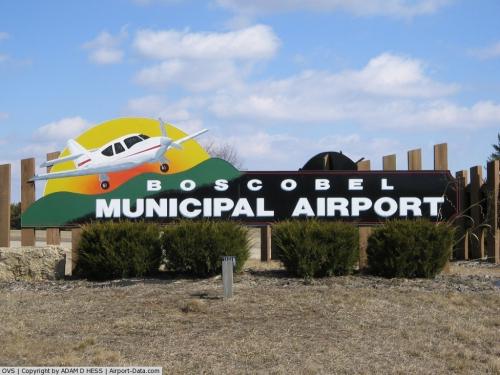
Boscobel Airport
Boscobel Municipal Airport |
| IATA: none – ICAO: KOVS – FAA LID: OVS |
| Summary |
| Airport type |
Public |
| Owner |
City of Boscobel |
| Serves |
Boscobel, Wisconsin |
| Elevation AMSL |
673 ft / 205 m |
| Coordinates |
43°09′39″N 090°40′26″W / 43.16083°N 90.67389°W / 43.16083; -90.67389 |
| Website |
BoscobelWisconsin.com/... |
| Runways |
| Direction |
Length |
Surface |
| ft |
m |
| 7/25 |
5,000 |
1,524 |
Asphalt |
| 2/20 |
3,658 |
1,115 |
Asphalt |
| Statistics (2005) |
| Aircraft operations |
16,800 |
| Based aircraft |
31 |
| Source: Federal Aviation Administration |
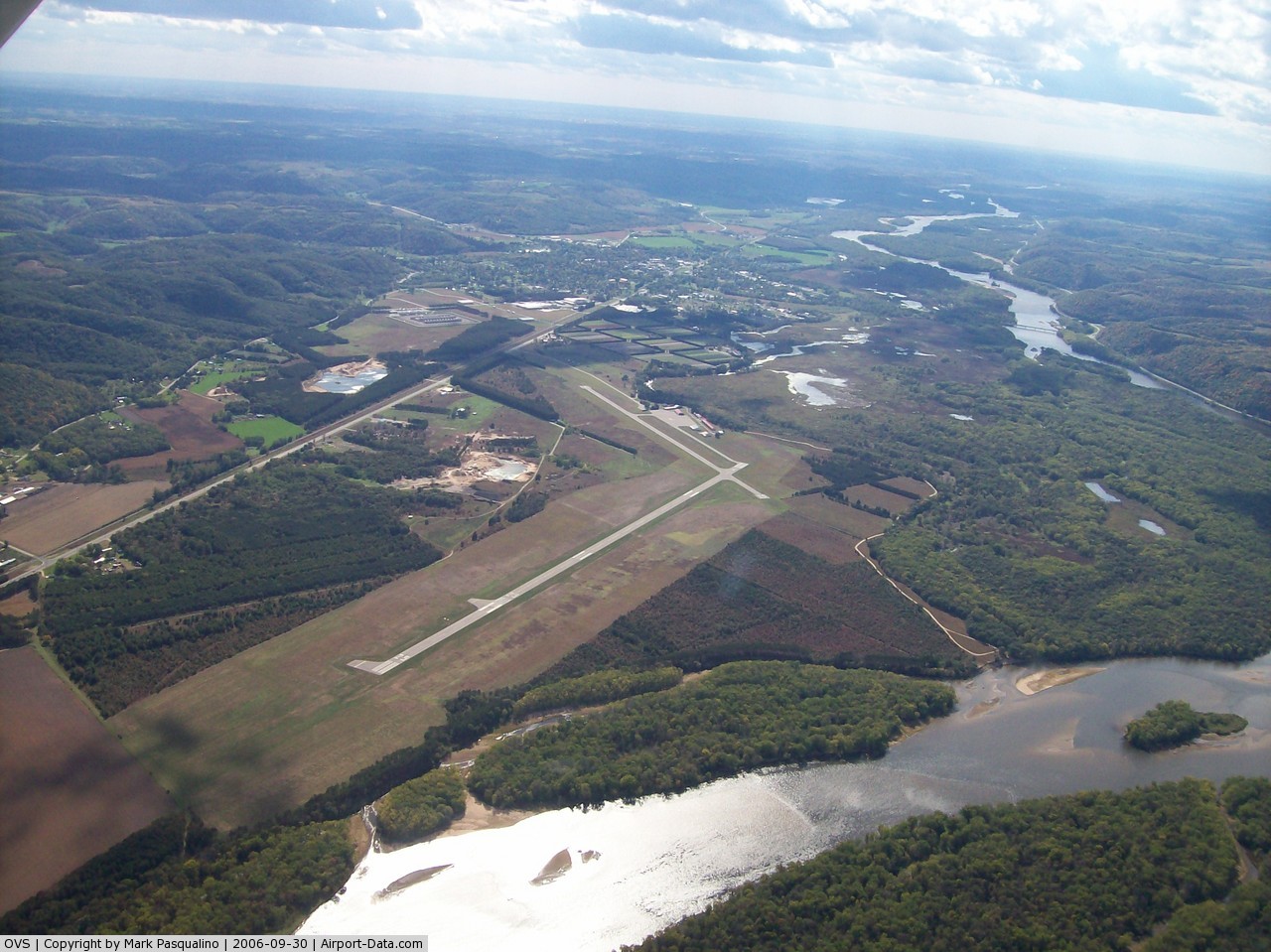
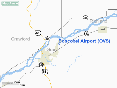
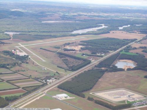
Boscobel Airport (ICAO: KOVS, FAA LID: OVS), also known as Boscobel Municipal Airport is a city-owned, public-use airport located two nautical miles (4 km) northeast of the central business district of Boscobel, a city in Grant County, Wisconsin, United States.
Although most U.S. airports use the same three-letter location identifier for the FAA and IATA, this airport is assigned OVS by the FAA but has no designation from the IATA.
Facilities and aircraft
Boscobel Airport covers an area of 382 acres (155 ha) at an elevation of 673 feet (205 m) above mean sea level. It has two asphalt paved runways: 7/25 measuring 5,000 by 75 feet (1,524 by 23 m) and 2/20 measuring 3,658 by 58 ft (1,115 by 18 m).
For the 12-month period ending June 7, 2005, the airport had 16,800 aircraft operations, an average of 46 per day: 95% general aviation, 3% military and 2% air taxi. At that time there were 31 aircraft based at this airport: 90% single-engine and 10% multi-engine.
The above content comes from Wikipedia and is published under free licenses – click here to read more.
 |
(Click on the photo to enlarge) |
 |
(Click on the photo to enlarge) |
 |
(Click on the photo to enlarge) |
Location & QuickFacts
| FAA Information Effective: | 2008-09-25 |
| Airport Identifier: | OVS |
| Airport Status: | Operational |
| Longitude/Latitude: | 090-40-26.3000W/43-09-38.9000N
-90.673972/43.160806 (Estimated) |
| Elevation: | 673 ft / 205.13 m (Surveyed) |
| Land: | 382 acres |
| From nearest city: | 2 nautical miles NE of Boscobel, WI |
| Location: | Grant County, WI |
| Magnetic Variation: | 01W (2010) |
Owner & Manager
| Ownership: | Publicly owned |
| Owner: | City Of Boscobel |
| Address: | 106 Wisconsin Ave
Boscobel, WI 53805 |
| Phone number: | 608-375-5001 |
| Manager: | Ronald Huls |
| Address: | 100 James Drive
Boscobel, WI 53805 |
| Phone number: | 608-375-5223 |
Airport Operations and Facilities
| Airport Use: | Open to public |
| Wind indicator: | Yes |
| Segmented Circle: | No |
| Control Tower: | No |
| Lighting Schedule: | DUSK-DAWN
MIRL RY 07/25 PRESET ON LOW INTST, TO INCR INTST & ACTVT MIRL RY 02/20 & REIL RYS 07 & 25 - CTAF. |
| Beacon Color: | Clear-Green (lighted land airport) |
| Landing fee charge: | No |
| Sectional chart: | Chicago |
| Region: | AGL - Great Lakes |
| Traffic Pattern Alt: | 830 ft |
| Boundary ARTCC: | ZAU - Chicago |
| Tie-in FSS: | GRB - Green Bay |
| FSS on Airport: | No |
| FSS Toll Free: | 1-800-WX-BRIEF |
| NOTAMs Facility: | OVS (NOTAM-d service avaliable) |
| Federal Agreements: | N |
Airport Communications
| CTAF: | 122.800 |
| Unicom: | 122.800 |
Airport Services
| Fuel available: | 100LL |
| Airframe Repair: | MAJOR |
| Power Plant Repair: | MAJOR |
| Bottled Oxygen: | NONE |
| Bulk Oxygen: | NONE |
Runway Information
Runway 02/20
| Dimension: | 3658 x 58 ft / 1115.0 x 17.7 m |
| Surface: | ASPH, Fair Condition |
| Weight Limit: | Single wheel: 12500 lbs. |
| Edge Lights: | Medium |
| |
Runway 02 |
Runway 20 |
| Longitude: | 090-40-51.1370W | 090-40-36.7970W |
| Latitude: | 43-09-10.4982N | 43-09-45.0771N |
| Elevation: | 672.00 ft | 668.00 ft |
| Alignment: | 17 | 127 |
| Traffic Pattern: | Left | Left |
| Markings: | Basic, Fair Condition | Basic, Fair Condition |
| Runway End Identifier: | No | No |
| Centerline Lights: | No | No |
| Touchdown Lights: | No | No |
| Obstruction: | 23 ft trees, 800.0 ft from runway, 120 ft right of centerline, 26:1 slope to clear | 57 ft trees, 1350.0 ft from runway, 170 ft right of centerline, 20:1 slope to clear |
|
Runway 07/25
| Dimension: | 5000 x 75 ft / 1524.0 x 22.9 m |
| Surface: | ASPH, Good Condition |
| Weight Limit: | Single wheel: 12500 lbs.
Dual wheel: 30000 lbs. |
| Edge Lights: | Medium |
| |
Runway 07 |
Runway 25 |
| Longitude: | 090-40-44.4718W | 090-39-42.3377W |
| Latitude: | 43-09-37.4275N | 43-09-56.6485N |
| Elevation: | 668.00 ft | 671.00 ft |
| Alignment: | 67 | 127 |
| Traffic Pattern: | Left | Left |
| Markings: | Non-precision instrument, Fair Condition | Non-precision instrument, Fair Condition |
| Crossing Height: | 38.00 ft | 40.00 ft |
| VASI: | 2-light PAPI on left side | 2-light PAPI on left side |
| Visual Glide Angle: | 3.00° | 3.00° |
| Runway End Identifier: | Yes | Yes |
| Obstruction: | 36 ft trees, 1160.0 ft from runway, 120 ft right of centerline, 26:1 slope to clear | 55 ft trees, 1650.0 ft from runway, 300 ft right of centerline, 26:1 slope to clear |
|
Radio Navigation Aids
| ID |
Type |
Name |
Ch |
Freq |
Var |
Dist |
| MRJ | NDB | Mineral Point | | 365.00 | 00W | 25.6 nm |
| PVB | NDB | Platteville | | 203.00 | 01E | 30.3 nm |
| HBW | NDB | Kickapoo | | 251.00 | 03E | 33.2 nm |
| CHU | NDB | Caledonia | | 209.00 | 03E | 43.9 nm |
| CMY | NDB | Mccoy | | 412.00 | 00E | 46.7 nm |
| DEH | NDB | Decorah | | 236.00 | 01E | 47.0 nm |
| LNR | VOR/DME | Lone Rock | 075X | 112.80 | 00E | 25.0 nm |
| LSE | VOR/DME | La Crosse | 021X | 108.40 | 02E | 49.9 nm |
| UKN | VORTAC | Waukon | 113X | 116.60 | 05E | 38.5 nm |
| DBQ | VORTAC | Dubuque | 105X | 115.80 | 04E | 45.7 nm |
| DLL | VORTAC | Dells | 117X | 117.00 | 03E | 46.2 nm |
Remarks
- GCO AVBL ON FREQ 121.725 THRU FLT SVCS.
- ESTABLISHED PRIOR TO 1959.
Images and information placed above are from
http://www.airport-data.com/airport/OVS/
We thank them for the data!
| General Info
|
| Country |
United States
|
| State |
WISCONSIN
|
| FAA ID |
OVS
|
| Latitude |
43-09-36.630N
|
| Longitude |
090-40-31.720W
|
| Elevation |
672 feet
|
| Near City |
BOSCOBEL
|
We don't guarantee the information is fresh and accurate. The data may
be wrong or outdated.
For more up-to-date information please refer to other sources.
|
|