 |
|
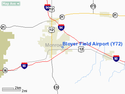
Location & QuickFacts
| FAA Information Effective: | 2008-09-25 |
| Airport Identifier: | Y72 |
| Airport Status: | Operational |
| Longitude/Latitude: | 090-28-50.2000W/43-58-34.4000N
-90.480611/43.976222 (Estimated) |
| Elevation: | 966 ft / 294.44 m (Surveyed) |
| Land: | 160 acres |
| From nearest city: | 1 nautical miles E of Tomah, WI |
| Location: | Monroe County, WI |
| Magnetic Variation: | 00E (2000) |
Owner & Manager
| Ownership: | Publicly owned |
| Owner: | City Of Tomah |
| Address: | 819 Superior Ave
Tomah, WI 54660 |
| Phone number: | 608-374-7440 |
| Manager: | Bill Phillips |
| Address: | 819 Superior Ave.
Tomah, WI 54660 |
| Phone number: | 608-374-7440 |
Airport Operations and Facilities
| Airport Use: | Open to public |
| Wind indicator: | Yes |
| Segmented Circle: | Yes |
| Control Tower: | No |
| Lighting Schedule: | DUSK-DAWN
MIRL RY 07/25 PRESET ON LOW INTST, TO INCR INTST & ACTVT REIL & PAPI RYS 07 & 25 - CTAF. |
| Beacon Color: | Clear-Green (lighted land airport) |
| Landing fee charge: | No |
| Sectional chart: | Chicago |
| Region: | AGL - Great Lakes |
| Boundary ARTCC: | ZAU - Chicago |
| Tie-in FSS: | GRB - Green Bay |
| FSS on Airport: | No |
| FSS Toll Free: | 1-800-WX-BRIEF |
| NOTAMs Facility: | GRB (NOTAM-d service avaliable) |
Airport Communications
Airport Services
| Fuel available: | 100LL
FOR FUEL CALL 608-372-3125. |
| Airframe Repair: | NONE |
| Power Plant Repair: | NONE |
| Bottled Oxygen: | NONE |
| Bulk Oxygen: | NONE |
Runway Information
Runway 07/25
| Dimension: | 3900 x 75 ft / 1188.7 x 22.9 m
E 300 FT HAS 1 IN DIPS. |
| Surface: | ASPH, Good Condition |
| Edge Lights: | Medium |
| |
Runway 07 |
Runway 25 |
| Longitude: | 090-29-14.9992W | 090-28-25.4770W |
| Latitude: | 43-58-27.2693N | 43-58-41.5608N |
| Elevation: | 966.00 ft | 962.00 ft |
| Traffic Pattern: | Left | Left |
| Markings: | Non-precision instrument, Good Condition | Non-precision instrument, Good Condition |
| Crossing Height: | 33.00 ft | 35.00 ft |
| VASI: | 2-light PAPI on left side | 2-light PAPI on left side |
| Visual Glide Angle: | 3.00° | 3.00° |
| Runway End Identifier: | Yes | Yes |
| Centerline Lights: | No | No |
| Touchdown Lights: | No | No |
| Obstruction: | 50 ft tree, 1200.0 ft from runway, 210 ft left of centerline, 20:1 slope to clear | 52 ft trees, 1400.0 ft from runway, 150 ft right of centerline, 23:1 slope to clear |
|
Radio Navigation Aids
| ID |
Type |
Name |
Ch |
Freq |
Var |
Dist |
| CMY | NDB | Mccoy | | 412.00 | 00E | 7.4 nm |
| HBW | NDB | Kickapoo | | 251.00 | 03E | 20.3 nm |
| BCK | NDB | Black River Falls | | 362.00 | 00E | 23.1 nm |
| VIQ | NDB | Neillsville | | 368.00 | 01W | 35.0 nm |
| ISW | NDB | Wisconsin Rapids | | 215.00 | 01W | 36.1 nm |
| MFI | NDB | Marshfield | | 391.00 | 00E | 41.9 nm |
| CHU | NDB | Caledonia | | 209.00 | 03E | 49.7 nm |
| VOK | TACAN | Volk | 041X | | 00E | 9.8 nm |
| LSE | VOR/DME | La Crosse | 021X | 108.40 | 02E | 34.1 nm |
| LNR | VOR/DME | Lone Rock | 075X | 112.80 | 00E | 43.7 nm |
| DLL | VORTAC | Dells | 117X | 117.00 | 03E | 40.3 nm |
| ODI | VORTAC | Nodine | 126X | 117.90 | 01E | 42.9 nm |
Images and information placed above are from
http://www.airport-data.com/airport/Y72/
We thank them for the data!
| General Info
|
| Country |
United States
|
| State |
WISCONSIN
|
| FAA ID |
Y72
|
| Latitude |
43-58-29.873N
|
| Longitude |
090-29-00.476W
|
| Elevation |
963 feet
|
| Near City |
TOMAH
|
We don't guarantee the information is fresh and accurate. The data may
be wrong or outdated.
For more up-to-date information please refer to other sources.
|
|


