 |
|
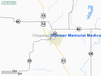
Bloomer Memorial Medical Center Heliport |
Location & QuickFacts
| FAA Information Effective: | 2008-09-25 |
| Airport Identifier: | WI15 |
| Airport Status: | Operational |
| Longitude/Latitude: | 091-30-05.0000W/45-06-09.0000N
-91.501389/45.102500 (Estimated) |
| Elevation: | 1055 ft / 321.56 m (Estimated) |
| Land: | 1 acres |
| From nearest city: | 0 nautical miles N of Bloomer, WI |
| Location: | Chippewa County, WI |
| Magnetic Variation: | 00E () |
Owner & Manager
| Ownership: | Privately owned |
| Owner: | Bloomer Memorial Medical Center |
| Address: | 1501 Thompson St
Bloomer, WI 54724 |
| Phone number: | 715-568-2000 |
| Manager: | Mary R. Kerg |
| Address: | 1501 Thompson St
Bloomer, WI 54724 |
| Phone number: | 715-568-2000 |
Airport Operations and Facilities
| Airport Use: | Private |
| Wind indicator: | Yes |
| Segmented Circle: | No |
| Control Tower: | No |
| Lighting Schedule: | PHONE REQ
FOR PERIMETER & FLOOD LGTS CALL 715-568-2000. |
| Sectional chart: | Green Bay |
| Region: | AGL - Great Lakes |
| Boundary ARTCC: | ZMP - Minneapolis |
| Tie-in FSS: | GRB - Green Bay |
| FSS Toll Free: | 1-800-WX-BRIEF |
Runway Information
Helipad H1
| Dimension: | 40 x 40 ft / 12.2 x 12.2 m |
| Surface: | CONC, |
| |
Runway H1 |
Runway |
| Traffic Pattern: | Left | Left |
|
Radio Navigation Aids
| ID |
Type |
Name |
Ch |
Freq |
Var |
Dist |
| UBE | NDB | Cumberland | | 375.00 | 01E | 31.6 nm |
| RCX | NDB | Rusk County | | 356.00 | 00W | 32.0 nm |
| AHH | NDB | Ameron | | 278.00 | 01E | 38.4 nm |
| SSQ | NDB | Shell Lake | | 212.00 | 01E | 41.5 nm |
| RNH | NDB | New Richmond | | 257.00 | 02E | 43.9 nm |
| RPD | VOR/DME | Rice Lake | 037X | 110.00 | 01E | 22.1 nm |
| EAU | VORTAC | Eau Claire | 076X | 112.90 | 04E | 12.4 nm |
Remarks
- PRVDD APCH/DEP FM 360-180 & 210-030 ,AREA IS MKD, WIND INDICATOR MAINTAINED.
Images and information placed above are from
http://www.airport-data.com/airport/WI15/
We thank them for the data!
| General Info
|
| Country |
United States
|
| State |
WISCONSIN
|
| FAA ID |
WI15
|
| Latitude |
45-06-09.000N
|
| Longitude |
091-30-05.000W
|
| Elevation |
1055 feet
|
| Near City |
BLOOMER
|
We don't guarantee the information is fresh and accurate. The data may
be wrong or outdated.
For more up-to-date information please refer to other sources.
|
|


