 |
|
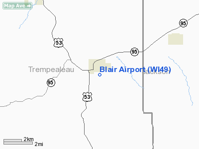
Location & QuickFacts
| FAA Information Effective: | 2008-09-25 |
| Airport Identifier: | WI49 |
| Airport Status: | Operational |
| Longitude/Latitude: | 091-13-35.5750W/44-17-09.8500N
-91.226549/44.286069 (Estimated) |
| Elevation: | 864 ft / 263.35 m (Surveyed) |
| Land: | 8 acres |
| From nearest city: | 1 nautical miles SE of Blair, WI |
| Location: | Trempealeau County, WI |
| Magnetic Variation: | 01E (1985) |
Owner & Manager
| Ownership: | Privately owned |
| Owner: | Darrell Ladsten |
| Address: | Po Box 85, Main St, 608-989-2545
Blair, WI 54616 |
| Manager: | Darrell Ladsten |
| Address: | Po Box 85, Main St, 122 S. Urberg Avenue
Blair, WI 54616 |
| Phone number: | 608-989-2545 |
Airport Operations and Facilities
| Airport Use: | Private |
| Wind indicator: | Yes |
| Segmented Circle: | No |
| Control Tower: | No |
| Lighting Schedule: | RDO-CTL
ACTVT LIRL RY 09/27 - CTAF. |
| Landing fee charge: | No |
| Sectional chart: | Green Bay |
| Region: | AGL - Great Lakes |
| Boundary ARTCC: | ZMP - Minneapolis |
| Tie-in FSS: | GRB - Green Bay |
| FSS on Airport: | No |
| FSS Toll Free: | 1-800-WX-BRIEF |
Airport Services
| Airframe Repair: | NONE |
| Power Plant Repair: | NONE |
| Bottled Oxygen: | NONE |
| Bulk Oxygen: | NONE |
Runway Information
Runway 09/27
| Dimension: | 1900 x 75 ft / 579.1 x 22.9 m |
| Surface: | TURF, Fair Condition |
| Edge Lights: | Non-standard lighting system
RWY 09/27 NSTD LIRL DUE TO SPACING & 1 THR LGHT EACH SIDE OF THRESHOLD. |
| |
Runway 09 |
Runway 27 |
| Traffic Pattern: | Left | Left |
| Runway End Identifier: | No | No |
| Centerline Lights: | No | No |
| Touchdown Lights: | No | No |
| Obstruction: | 20 ft bldg, 50 ft right of centerline | 38 ft trees, 500.0 ft from runway, 75 ft right of centerline, 13:1 slope to clear |
|
Radio Navigation Aids
| ID |
Type |
Name |
Ch |
Freq |
Var |
Dist |
| BCK | NDB | Black River Falls | | 362.00 | 00E | 16.4 nm |
| CMY | NDB | Mccoy | | 412.00 | 00E | 32.8 nm |
| VIQ | NDB | Neillsville | | 368.00 | 01W | 34.6 nm |
| CHU | NDB | Caledonia | | 209.00 | 03E | 43.5 nm |
| MFI | NDB | Marshfield | | 391.00 | 00E | 49.4 nm |
| VOK | TACAN | Volk | 041X | | 00E | 46.6 nm |
| ONA | VOR/DME | Winona | 051X | 111.40 | 01E | 24.2 nm |
| LSE | VOR/DME | La Crosse | 021X | 108.40 | 02E | 24.7 nm |
| ODI | VORTAC | Nodine | 126X | 117.90 | 01E | 24.8 nm |
| EAU | VORTAC | Eau Claire | 076X | 112.90 | 04E | 38.3 nm |
Remarks
- 65' PLINE 150' N AND PARALLEL TO RY CNTRLN.
- CONFIRM WINTER RY CONDITIONS WITH AMGR 608-989-2517.
Images and information placed above are from
http://www.airport-data.com/airport/WI49/
We thank them for the data!
| General Info
|
| Country |
United States
|
| State |
WISCONSIN
|
| FAA ID |
WI49
|
| Latitude |
44-56-31.879N
|
| Longitude |
090-15-29.489W
|
| Elevation |
1358 feet
|
| Near City |
ABBOTSFORD
|
We don't guarantee the information is fresh and accurate. The data may
be wrong or outdated.
For more up-to-date information please refer to other sources.
|
|


