 |
|
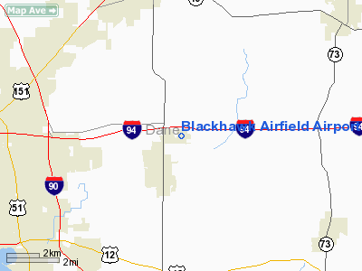
Blackhawk Airfield Airport |
Location & QuickFacts
| FAA Information Effective: | 2008-09-25 |
| Airport Identifier: | 87Y |
| Airport Status: | Operational |
| Longitude/Latitude: | 089-11-07.9380W/43-06-17.6920N
-89.185538/43.104914 (Estimated) |
| Elevation: | 920 ft / 280.42 m (Surveyed) |
| Land: | 27 acres |
| From nearest city: | 10 nautical miles E of Madison, WI |
| Location: | Dane County, WI |
| Magnetic Variation: | 00E (1985) |
Owner & Manager
| Ownership: | Privately owned |
| Owner: | Blackhawk Airfield Inc |
| Address: | 2534 S Fish Hatchery Road
Fitchburg, WI 53711 |
| Phone number: | 608-274-4932 |
| Manager: | Cheryl Strassman |
| Address: | 2534 S Fish Hatchery Road
Fitchburg, WI 53711 |
| Phone number: | 608-274-4932 |
Airport Operations and Facilities
| Airport Use: | Open to public |
| Wind indicator: | Yes |
| Segmented Circle: | Yes |
| Control Tower: | No |
| Lighting Schedule: | DUSK-DAWN |
| Beacon Color: | Clear-Green (lighted land airport) |
| Landing fee charge: | No |
| Sectional chart: | Chicago |
| Region: | AGL - Great Lakes |
| Traffic Pattern Alt: | 1000 ft |
| Boundary ARTCC: | ZAU - Chicago |
| Tie-in FSS: | GRB - Green Bay |
| FSS on Airport: | No |
| FSS Toll Free: | 1-800-WX-BRIEF |
| NOTAMs Facility: | GRB (NOTAM-d service avaliable) |
| Federal Agreements: | N |
Airport Communications
| CTAF: | 122.700 |
| Unicom: | 122.700 |
Airport Services
| Fuel available: | 100LL |
| Airframe Repair: | NONE |
| Power Plant Repair: | NONE |
| Bottled Oxygen: | NONE |
| Bulk Oxygen: | NONE |
Runway Information
Runway 04/22
| Dimension: | 2814 x 57 ft / 857.7 x 17.4 m
HAS 170 FT PAVED STWY WEST END & 289 FT PAVED STWY EAST END. |
| Surface: | ASPH, Poor Condition
RY 4/22 CRACKS WITH 1 FT VEGETATION GROWING ON RY. |
| |
Runway 04 |
Runway 22 |
| Longitude: | 089-11-22.5570W | 089-10-57.9170W |
| Latitude: | 43-06-07.2490N | 43-06-28.3800N |
| Elevation: | 914.00 ft | 0.00 ft |
| Alignment: | 41 | 127 |
| Traffic Pattern: | Right | Left |
| Markings: | Basic, Fair Condition | Basic, Fair Condition |
| Displaced threshold: | 0.00 ft | 260.00 ft |
| Obstruction: | 25 ft bldg, 1200.0 ft from runway, 150 ft left of centerline, 40:1 slope to clear
BRUSH SURROUNDS APCH EDGE IN EXCESS OF 20 FT. | 40 ft trees, 210.0 ft from runway, 25 ft left of centerline
RWY 22 APCH RATIO 15:1 TO DSPLCD THLD.
BRUSH SURROUNDS APCH EDGE IN EXCESS OF10 FT. |
|
Runway 09/27
| Dimension: | 2203 x 56 ft / 671.5 x 17.1 m
HAS 170 FT PAVED STWY WEST END & 289 FT PAVED STWY EAST END. |
| Surface: | ASPH, Fair Condition
RY 4/22 CRACKS WITH 1 FT VEGETATION GROWING ON RY. |
| Edge Lights: | Non-standard lighting system
RWY 09/27 NSTD LIRL; RY LGTS +2 TO 3 FT ABOVE RY & NSTD SPACING. RY 9/27 LGTD 1973'. |
| |
Runway 09 |
Runway 27 |
| Alignment: | 89 | 127 |
| Traffic Pattern: | Left | Right |
| Markings: | Basic, Fair Condition | Basic, Fair Condition |
| Displaced threshold: | 0.00 ft | 230.00 ft |
| Centerline Lights: | No | No |
| Touchdown Lights: | No | No |
| Obstruction: | 80 ft trees, 3400.0 ft from runway, 40:1 slope to clear | 16 ft road, 328.0 ft from runway, 3 ft right of centerline, 8:1 slope to clear
RY 27 APCH RATIO 30:1 TO DSPLCD THR. |
|
Radio Navigation Aids
| ID |
Type |
Name |
Ch |
Freq |
Var |
Dist |
| MS | NDB | Monah | | 400.00 | 00E | 7.5 nm |
| RYV | NDB | Rock River | | 371.00 | 01W | 20.6 nm |
| UNU | NDB | Juneau | | 344.00 | 01W | 28.8 nm |
| JVL | NDB | Janesville | | 375.00 | 03E | 30.1 nm |
| LVV | NDB | Lake Lawn | | 404.00 | 00W | 35.7 nm |
| HXF | NDB | Hartford | | 200.00 | 00E | 37.5 nm |
| UES | NDB | Waukesha | | 359.00 | 01W | 41.9 nm |
| MRJ | NDB | Mineral Point | | 365.00 | 00W | 47.6 nm |
| JVL | VOR/DME | Janesville | 090X | 114.30 | 03E | 33.1 nm |
| LNR | VOR/DME | Lone Rock | 075X | 112.80 | 00E | 43.1 nm |
| BUU | VOR/DME | Burbun | 092X | 114.50 | 01W | 46.2 nm |
| MSN | VORTAC | Madison | 023X | 108.60 | 03E | 7.2 nm |
| DLL | VORTAC | Dells | 117X | 117.00 | 03E | 36.8 nm |
| BAE | VORTAC | Badger | 111X | 116.40 | 02E | 39.6 nm |
Remarks
- RY 09 AVOID OVERFLIGHT OF FARM 3/4 MI EAST.
- DEER & TURKEYS ON & INVOF ARPT.
- RY ENDS OBSTRUCTED VISUALLY FM OTHERS BY WEEDS & TREES APPROX 10 FT TALL.
Images and information placed above are from
http://www.airport-data.com/airport/87Y/
We thank them for the data!
| General Info
|
| Country |
United States
|
| State |
WISCONSIN
|
| FAA ID |
87Y
|
| Latitude |
43-06-17.692N
|
| Longitude |
089-11-07.938W
|
| Elevation |
920 feet
|
| Near City |
MADISON
|
We don't guarantee the information is fresh and accurate. The data may
be wrong or outdated.
For more up-to-date information please refer to other sources.
|
|


