 |
|
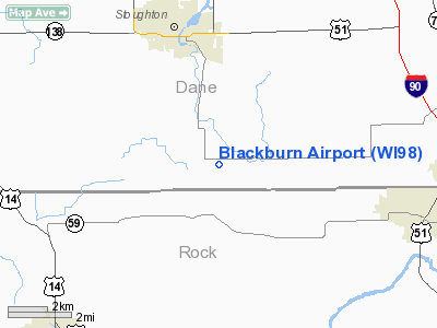
Location & QuickFacts
| FAA Information Effective: | 2008-09-25 |
| Airport Identifier: | WI98 |
| Airport Status: | Operational |
| Longitude/Latitude: | 089-11-50.4150W/42-51-30.0130N
-89.197337/42.858337 (Estimated) |
| Elevation: | 888 ft / 270.66 m (Estimated) |
| Land: | 10 acres |
| From nearest city: | 3 nautical miles NE of Cooksville, WI |
| Location: | Dane County, WI |
| Magnetic Variation: | 00W (1990) |
Owner & Manager
| Ownership: | Privately owned |
| Owner: | Ernie Blackburn |
| Address: | 200 Mcginnis Rd
Stoughton, WI 53589 |
| Phone number: | 608-873-6267 |
| Manager: | Ernie Blackburn |
| Address: | 200 Mcginnis Rd
Stoughton, WI 53589 |
| Phone number: | 608-873-6267 |
Airport Operations and Facilities
| Airport Use: | Private |
| Wind indicator: | Yes |
| Segmented Circle: | No |
| Control Tower: | No |
| Sectional chart: | Chicago |
| Region: | AGL - Great Lakes |
| Boundary ARTCC: | ZAU - Chicago |
| Tie-in FSS: | GRB - Green Bay |
| FSS Toll Free: | 1-800-WX-BRIEF |
Runway Information
Runway 18/36
| Dimension: | 1350 x 85 ft / 411.5 x 25.9 m |
| Surface: | TURF, |
| |
Runway 18 |
Runway 36 |
| Traffic Pattern: | Left | Left |
| Obstruction: | 6 ft crops, 500.0 ft from runway | 15 ft road, 300.0 ft from runway |
|
Radio Navigation Aids
| ID |
Type |
Name |
Ch |
Freq |
Var |
Dist |
| MS | NDB | Monah | | 400.00 | 00E | 13.9 nm |
| JVL | NDB | Janesville | | 375.00 | 03E | 16.2 nm |
| RYV | NDB | Rock River | | 371.00 | 01W | 28.1 nm |
| LVV | NDB | Lake Lawn | | 404.00 | 00W | 28.3 nm |
| UNU | NDB | Juneau | | 344.00 | 01W | 40.6 nm |
| FEP | NDB | Freeport | | 335.00 | 00E | 40.7 nm |
| UES | NDB | Waukesha | | 359.00 | 01W | 43.8 nm |
| MRJ | NDB | Mineral Point | | 365.00 | 00W | 45.4 nm |
| HXF | NDB | Hartford | | 200.00 | 00E | 45.8 nm |
| JVL | VOR/DME | Janesville | 090X | 114.30 | 03E | 18.5 nm |
| RFD | VOR/DME | Rockford | 045X | 110.80 | 01E | 38.0 nm |
| BUU | VOR/DME | Burbun | 092X | 114.50 | 01W | 40.8 nm |
| LNR | VOR/DME | Lone Rock | 075X | 112.80 | 00E | 48.7 nm |
| MSN | VORTAC | Madison | 023X | 108.60 | 03E | 18.3 nm |
| BAE | VORTAC | Badger | 111X | 116.40 | 02E | 43.0 nm |
| DLL | VORTAC | Dells | 117X | 117.00 | 03E | 48.5 nm |
Remarks
- OBS REMOVED/LOWERED OR THRS DSPLCD TO PRVD 20:1 SLOPES; 125' EITHER SIDE OF CNTRLN & 200' EITHER END BE CLEAR OF OBS.
Images and information placed above are from
http://www.airport-data.com/airport/WI98/
We thank them for the data!
| General Info
|
| Country |
United States
|
| State |
WISCONSIN
|
| FAA ID |
WI98
|
| Latitude |
42-51-30.013N
|
| Longitude |
089-11-50.415W
|
| Elevation |
888 feet
|
| Near City |
COOKSVILLE
|
We don't guarantee the information is fresh and accurate. The data may
be wrong or outdated.
For more up-to-date information please refer to other sources.
|
|


