 |
|
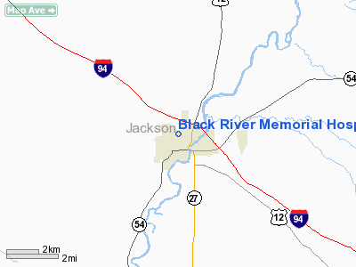
Black River Memorial Hospital Heliport |
Location & QuickFacts
| FAA Information Effective: | 2008-09-25 |
| Airport Identifier: | 23WI |
| Airport Status: | Operational |
| Longitude/Latitude: | 090-51-16.7130W/44-18-14.3600N
-90.854642/44.303989 (Estimated) |
| Elevation: | 850 ft / 259.08 m (Estimated) |
| Land: | 0 acres |
| From nearest city: | 5 nautical miles N of Black River Falls, WI |
| Location: | Jackson County, WI |
| Magnetic Variation: | 00E (1995) |
Owner & Manager
| Ownership: | Privately owned |
| Owner: | Black River Memorial Hospital |
| Address: | 711 West Adams Street
Black River Falls, WI 54615 |
| Phone number: | 715-284-5361 |
| Manager: | Richard Shaw |
| Address: | 711 West Adams Street
Black River Falls, WI 54615 |
| Phone number: | 715-284-5361 |
Airport Operations and Facilities
| Airport Use: | Private
MEDICAL USE. |
| Segmented Circle: | No |
| Control Tower: | No |
| Lighting Schedule: | PHONE REQ
FOR PERIMETER LGTS CALL (715) 284-5361. |
| Sectional chart: | Green Bay |
| Region: | AGL - Great Lakes |
| Boundary ARTCC: | ZMP - Minneapolis |
| Tie-in FSS: | GRB - Green Bay |
| FSS on Airport: | No |
| FSS Toll Free: | 1-800-WX-BRIEF |
Runway Information
Helipad H1
| Dimension: | 45 x 45 ft / 13.7 x 13.7 m |
| Surface: | CONC, |
| |
Runway H1 |
Runway |
| Traffic Pattern: | Left | Left |
|
Radio Navigation Aids
| ID |
Type |
Name |
Ch |
Freq |
Var |
Dist |
| BCK | NDB | Black River Falls | | 362.00 | 00E | 3.0 nm |
| VIQ | NDB | Neillsville | | 368.00 | 01W | 21.1 nm |
| CMY | NDB | Mccoy | | 412.00 | 00E | 23.9 nm |
| MFI | NDB | Marshfield | | 391.00 | 00E | 35.0 nm |
| ISW | NDB | Wisconsin Rapids | | 215.00 | 01W | 43.8 nm |
| HBW | NDB | Kickapoo | | 251.00 | 03E | 45.1 nm |
| VOK | TACAN | Volk | 041X | | 00E | 33.6 nm |
| LSE | VOR/DME | La Crosse | 021X | 108.40 | 02E | 31.0 nm |
| ONA | VOR/DME | Winona | 051X | 111.40 | 01E | 39.2 nm |
| ODI | VORTAC | Nodine | 126X | 117.90 | 01E | 35.4 nm |
| EAU | VORTAC | Eau Claire | 076X | 112.90 | 04E | 44.6 nm |
Remarks
- PRVDD APCH/DEP 270-090 CLKWS; AREA IS MKD; NON-OBSTRUCTIVE WIND INDICATOR IS MAINTAINED.
Images and information placed above are from
http://www.airport-data.com/airport/23WI/
We thank them for the data!
| General Info
|
| Country |
United States
|
| State |
WISCONSIN
|
| FAA ID |
23WI
|
| Latitude |
44-18-14.360N
|
| Longitude |
090-51-16.713W
|
| Elevation |
850 feet
|
| Near City |
BLACK RIVER FALLS
|
We don't guarantee the information is fresh and accurate. The data may
be wrong or outdated.
For more up-to-date information please refer to other sources.
|
|


