 |
|
Black River Falls Area Airport |
| Black River Falls Area Airport |
| IATA: none – ICAO: KBCK – FAA LID: BCK |
| Summary |
| Airport type |
Public |
| Owner |
Black River Falls, Wisconsin |
| Serves |
Black River Falls, Wisconsin |
| Elevation AMSL |
836 ft / 255 m |
| Coordinates |
44°15′03″N 090°51′19″W / 44.25083°N 90.85528°W / 44.25083; -90.85528 |
| Runways |
| Direction |
Length |
Surface |
| ft |
m |
| 8/26 |
4,600 |
1,402 |
Asphalt |
| Statistics (2005) |
| Aircraft operations |
12,320 |
| Source: Federal Aviation Administration |
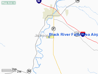
Black River Falls Area Airport (ICAO: KBCK, FAA LID: BCK) is a public-use airport located three nautical miles (6 km) south of the central business district of Black River Falls, a city in Jackson County, Wisconsin, United States. It is owned by the city of Black River Falls and Jackson County.
Although most U.S. airports use the same three-letter location identifier for the FAA and IATA, this airport is assigned BCK by the FAA but has no designation from the IATA (which assigned BCK to Bolwarra, Queensland, Australia). Facilities and aircraft
Black River Falls Area Airport covers an area of 353 acres (143 ha) at an elevation of 836 feet (255 m) above mean sea level. It has one asphalt paved runway designated 8/26 which measures 4,600 by 75 feet (1,402 x 23 m). For the 12-month period ending July 13, 2005, the airport had 12,320 aircraft operations, an average of 33 per day: 98% general aviation and 2% air taxi.
A Non-directional beacon, 362 kHz, ident: BCK is on field.
The above content comes from Wikipedia and is published under free licenses – click here to read more.
Location & QuickFacts
| FAA Information Effective: | 2008-09-25 |
| Airport Identifier: | BCK |
| Airport Status: | Operational |
| Longitude/Latitude: | 090-51-19.0090W/44-15-02.6590N
-90.855280/44.250739 (Estimated) |
| Elevation: | 836 ft / 254.81 m (Estimated) |
| Land: | 353 acres |
| From nearest city: | 3 nautical miles S of Black River Falls, WI |
| Location: | Jackson County, WI |
| Magnetic Variation: | 00E (1995) |
Owner & Manager
| Ownership: | Publicly owned |
| Owner: | Black River Falls%jackson Co |
| Address: | 101 S. Second St
Black River Falls, WI 54615 |
| Phone number: | 715-284-5514 |
| Manager: | Lois Ferris
CHMN ARPT AUTH. |
| Address: | 101 S. Second St
Black River Falls, WI 54615 |
| Phone number: | 715-284-9491 |
Airport Operations and Facilities
| Airport Use: | Open to public |
| Wind indicator: | Yes |
| Segmented Circle: | No |
| Control Tower: | No |
| Lighting Schedule: | DUSK-DAWN
MIRL RY 08/26 ARE PRESET ON LOW INTST; TO ACTVT HIGHER INTST & PAPI RYS 08 & 26 & REIL RY 08 - CTAF. |
| Beacon Color: | Clear-Green (lighted land airport) |
| Landing fee charge: | No |
| Sectional chart: | Green Bay |
| Region: | AGL - Great Lakes |
| Boundary ARTCC: | ZMP - Minneapolis |
| Tie-in FSS: | GRB - Green Bay |
| FSS on Airport: | No |
| FSS Toll Free: | 1-800-WX-BRIEF |
| NOTAMs Facility: | GRB (NOTAM-d service avaliable) |
| Federal Agreements: | NY1 |
Airport Communications
Airport Services
| Fuel available: | 100LLA |
| Airframe Repair: | NONE |
| Power Plant Repair: | NONE |
| Bottled Oxygen: | NONE |
| Bulk Oxygen: | NONE |
Runway Information
Runway 08/26
| Dimension: | 4600 x 75 ft / 1402.1 x 22.9 m |
| Surface: | ASPH, Good Condition |
| Weight Limit: | Single wheel: 12000 lbs. |
| Edge Lights: | Medium |
| |
Runway 08 |
Runway 26 |
| Longitude: | 090-51-50.1880W | 090-50-47.8400W |
| Latitude: | 44-14-58.8920N | 44-15-06.4340N |
| Elevation: | 823.00 ft | 836.00 ft |
| Alignment: | 80 | 127 |
| Traffic Pattern: | Left | Left |
| Markings: | Non-precision instrument, Good Condition | Non-precision instrument, Good Condition |
| Crossing Height: | 27.00 ft | 27.00 ft |
| VASI: | 2-light PAPI on left side | 2-light PAPI on left side |
| Visual Glide Angle: | 3.00° | 3.30° |
| Runway End Identifier: | Yes | No |
| Obstruction: | 19 ft trees, 850.0 ft from runway, 100 ft right of centerline, 34:1 slope to clear | 54 ft trees, 1350.0 ft from runway, 70 ft left of centerline, 21:1 slope to clear |
|
Radio Navigation Aids
| ID |
Type |
Name |
Ch |
Freq |
Var |
Dist |
| BCK | NDB | Black River Falls | | 362.00 | 00E | 0.4 nm |
| CMY | NDB | Mccoy | | 412.00 | 00E | 20.9 nm |
| VIQ | NDB | Neillsville | | 368.00 | 01W | 23.5 nm |
| MFI | NDB | Marshfield | | 391.00 | 00E | 37.0 nm |
| HBW | NDB | Kickapoo | | 251.00 | 03E | 42.3 nm |
| ISW | NDB | Wisconsin Rapids | | 215.00 | 01W | 44.2 nm |
| CHU | NDB | Caledonia | | 209.00 | 03E | 48.5 nm |
| VOK | TACAN | Volk | 041X | | 00E | 31.7 nm |
| LSE | VOR/DME | La Crosse | 021X | 108.40 | 02E | 28.4 nm |
| ONA | VOR/DME | Winona | 051X | 111.40 | 01E | 38.1 nm |
| ODI | VORTAC | Nodine | 126X | 117.90 | 01E | 33.4 nm |
| EAU | VORTAC | Eau Claire | 076X | 112.90 | 04E | 47.2 nm |
Remarks
- DEER & TURKEY ON & INVOF ARPT.
- ULTRALIGHT ACTVTY ON & IN VCNTY OF ARPT.
Images and information placed above are from
http://www.airport-data.com/airport/BCK/
We thank them for the data!
| General Info
|
| Country |
United States
|
| State |
WISCONSIN
|
| FAA ID |
BCK
|
| Latitude |
44-15-02.659N
|
| Longitude |
090-51-19.009W
|
| Elevation |
836 feet
|
| Near City |
BLACK RIVER FALLS
|
We don't guarantee the information is fresh and accurate. The data may
be wrong or outdated.
For more up-to-date information please refer to other sources.
|
|


